Sunday, June 30, 2024

Proposed fee changes Black Canyon of the Gunnison National Park and Curecanti National Recreation Area

The National Park Service (NPS) is proposing to charge fees for wilderness permits on the South Rim of Black Canyon of the Gunnison National Park and increase group campsite fees for Curecanti National Recreation Area. Park managers are seeking public comment on the fee changes. The proposed fee changes would take effect in January 2025.

NPS fee staff recently completed fee compatibility studies for wilderness permits and group campsites. The study demonstrated that comparable wilderness permit costs vary widely but are typically uniformly higher than current Black Canyon permits. Additionally, significant price increases have occurred at most comparable group campgrounds in recent years. The proposed fees would bring both parks into closer alignment with comparable wilderness permits and group campgrounds.

The 2004 Federal Lands Recreation Enhancement Act (FLREA) authorizes the National Park Service to charge fees for recreation amenities at national parks. The law requires that recreational fees are appropriate to the benefits and services provided, and comparable to fees charged by others in the local area for similar benefits and services. Eighty percent (80%) of the fees collected at Black Canyon and Curecanti will remain at the parks to fund projects such as the rehabilitation of trails, upgrades to campgrounds, and improvements to water, sewer, and solid waste systems. The remaining twenty percent (20%) will be utilized agency wide.

Black Canyon of the Gunnison National Park changes: The wilderness permit fee will be $6 plus an additional $4 per person per permit. To minimize resource impacts and maintain wilderness character, wilderness use permits will be issued for no more than three nights and for a group of up to four people per night. Wilderness permits will be available online only, and not in-person at the Black Canyon visitor center. Advanced planning is needed. All permit holders will still be responsible for paying the park entrance fee.

Additionally, Black Canyon will be transitioning all wilderness use permit reservations to www.recreation.gov . All day and overnight use of Black Canyon’s South Rim wilderness routes, including Warner, Gunnison, and Tomichi, will be available for reservation on www.recreation.gov beginning in January 2025.

Curecanti National Recreation Area changes: Under this proposal, the Curecanti group campsite at East Elk Creek, which can accommodate up to 50 individuals, would have a nightly fee of $120. The smaller group campsite at Red Creek would have a nightly fee of $60.

Comments on the proposed fee changes are being accepted at the parks’ planning website, https://parkplanning.nps.gov/BLCACUREFEES2024, from June 28, 2024, through July 29, 2024. Mailed comments can be sent to: Superintendent, RE: Fee Proposal 2024, Curecanti National Recreation Area, 102 Elk Creek, Gunnison, CO 81230.

Learn more about Black Canyon of the Gunnison National Park and wilderness routes by visiting the park website, www.nps.gov/blca and learn more about Curecanti National Recreation Area at www.nps.gov/cure.


              ************************************************************************************

Check out our online trail guides:


Wednesday, June 26, 2024

Old Fall River Road Closed To All Uses June 27 through June 29, Will Open To Vehicles For The Season on Sunday, June 30

Spring opening operations for Old Fall River Road continue and beginning at 6 a.m. on Thursday, June 27, the road will be closed to all uses, including bicycles and pedestrians, for dust abatement through Saturday, June 29. Old Fall River Road will open for the season to vehicles on Sunday, June 30. This historic road normally opens to vehicles in early July.

Old Fall River Road was built between 1913 and 1920. It is an unpaved road which starts next to Endovalley Picnic Area and ends at the top of Fall River Pass and merges with Trail Ridge Road at Alpine Visitor Center. This road follows the steep slope of Mount Chapin’s south face. Due to the narrow and winding nature of the road, the scenic 9.4-mile route is one-way uphill only.

The road offers access to the "CCY Route".

Vehicles over 25 feet and vehicles pulling trailers are prohibited from traveling on Old Fall River Road.

During certain hours of the day, visitors to Rocky Mountain National Park will need a timed entry reservation. There are two reservation options available: Timed Entry or Timed Entry + Bear Lake Road. Timed Entry Reservations are required to enter the park between the hours of 9 a.m. to 2 p.m. These reservations provide access to areas of Rocky Mountain National Park located outside of the Bear Lake Road corridor, including access to Old Fall River Road. To learn more visit https://go.nps.gov/romo/timedentry.


              ************************************************************************************

Check out our online trail guides:


Tuesday, June 25, 2024

The Colorado Trail Foundation still seeks trail crew volunteers

Online registration for 2023 trail crews opened this week, and the Colorado Trail Foundation needs your help to preserve The Colorado Trail! According to their website:
Volunteer Trail Crews vary in length from one to seven days. We provide training, tools, hardhats, group camp equipment, and leadership. Volunteers are responsible for their own transportation to the crew location and for their personal equipment, including tent or camper, sleeping bag, sleeping pad, dishes and eating utensils, work clothes, and other personal items. Some crews have meals provided, and those are noted below. Crews typically involve a hike to the project site each day, and basecamp crews may require a drive and a hike each day if the campsite is not within reasonable hiking distance of the project site. Crews can be accessed by a 2WD vehicle unless otherwise noted.
The Colorado Trail Foundation crews are already 98% full for 2024. However, there are still several spots open between July and September.

* Volunteer for this essential work
* Camp Out in the Colorado Rockies
* Build the Trail
* Improve it, make it last
* Create drainage to prevent Trail erosion Team Up
* Sustain and preserve The Colorado Trail

Click here for the full schedule and to register!


                *******************************************************************************

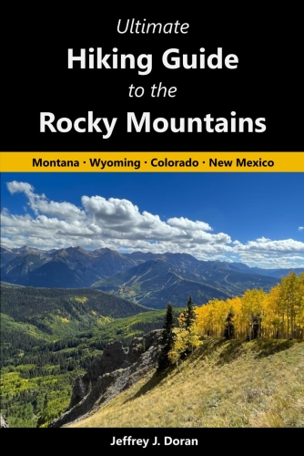
From Montana to New Mexico, the American Rockies stretch for more than a thousand miles. Within this spectacular mountain range are thousands of miles of hiking trails. With such an overwhelming number of options, how will you find and choose the most scenic and rewarding hikes?

Ultimate Hiking Guide to the Rocky Mountains takes all the guesswork out by focusing on some of the most amazing hikes across this range, and provides you with a handpicked list of options that will allow you to make the most of your trips in the Rockies:


Saturday, June 22, 2024

Colorado Parks and Wildlife confirms first reproduction of gray wolves in Grand County

Colorado Parks and Wildlife has confirmed successful reproduction in its gray wolf reintroduction efforts in the state.

CPW biologists have been gathering evidence suggesting a male and female gray wolf pair have been denning, indicating reproduction. Some of this evidence includes GPS collar data.

The collared female’s GPS points stopped uploading in early April, and resumed uploading later in April. The points for the female's collar showed a very localized position. CPW biologists interpreted this to mean that she was likely in a den, and therefore not in communication with the satellites, during the time when connectivity with the collar was interrupted, which aligned with the expected timing of wolf reproduction.

At that point, CPW staff began diligently working to confirm the den and whether pups are present.

On June 18, CPW biologists confirmed one wolf pup in Grand County. The confirmation occurred during routine wolf monitoring efforts, which included attempted observations from the air and ground, remote cameras, public sightings, etc. There are no photos or videos at this time. Although biologists were only able to confirm one pup at this time, it is possible that other pups may be present, as wolf litters commonly consist of four to six pups. CPW staff will continue to monitor the animals to determine how many pups have been born to the litter.

Because these wolves have successfully reproduced, they are officially considered a pack. The pack name is the Copper Creek Pack. This is the first confirmed Colorado-born wolf pup since the voter-approved wolf reintroduction in December.

“We are continuing to actively monitor this area while exercising extreme caution to avoid inadvertently disturbing the adult wolves, this pup, or other pups,” said CPW Wildlife Biologist Brenna Cassidy.

CPW biologists and area staff will continue to monitor this pack. Staff will continue to work with landowners in the area to implement practices to minimize the potential for conflict.


              ************************************************************************************

Check out our online trail guides:


Tuesday, June 18, 2024

Would you be a hiker if hiking clubs never existed?

The following was adapted from my book, Ramble On:


How the First Hiking Clubs Brought Hiking into the Mainstream:

The significance of the first hiking clubs cannot be understated. Not only were they responsible for the construction of thousands of miles of hiking trails, but they also played leading roles in the establishment of several national parks. Perhaps most importantly, they helped to expose countless numbers of people to the fledgling sport of hiking, and in the process, made it one of America‘s most popular outdoor activities.

Hiking clubs came in all shapes and sizes, each having their own sets of goals and reasons for organizing. Most formed to hike as groups in local forests and nearby mountains, thus allowing their members to socialize with other like-minded individuals. A majority of the clubs that were established between the Civil War and World War II focused at least some of their time on building trails, many of which are still in existence today. Both large and small clubs were responsible for the construction and/or maintenance of several iconic trails across America; including the Appalachian Trail, Long Trail, John Muir Trail, Colorado Trail and the Mountains-to-Sea Trail, among many other shorter and lesser-known footpaths. Still others formed to advocate for the creation and preservation of parks, mountains and forests. To state the obvious, hikers needed places to hike. Thus, hiking provided another reason for preserving wilderness areas. An array of clubs across the country would play extremely important roles in the establishment of Mt. Rainier, Yosemite, Kings Canyon, Crater Lake, Olympic, Rocky Mountain and the Great Smoky Mountains as national parks. Many of these same organizations also helped to secure federal protection for other wilderness areas, such as the Indiana Dunes National Lakeshore (now a national park), Cascade Range Forest Reserve, Oregon Caves National Monument, Muir Woods National Monument, Linville Gorge Wilderness and the Shining Rock Wilderness.

Arguably the most far-reaching impact of hiking clubs was their effectiveness at introducing the new pastime to novices, especially through various forms of media. Almost from the start, clubs used a wide array of communication tools to promote themselves, and in turn, the sport of hiking itself. Most clubs published periodic newsletters, many of which were shared with other organizations throughout the country. Some clubs announced their outings and events to the general public in local newspapers. Many also published magazines, trail guides and maps, all of which were easily disseminated to the general public.

It was specifically the use of newsletters that would help to promote the sport to expanding audiences of hikers. Hiking organizations typically used newsletters to announce outings, events, upcoming meetings, past meeting minutes, news items, hiking tips and advice, and of course trip reports, some of which were extensively detailed. Some included poems, book reviews, information on pertinent legislation, progress on trail building efforts, reports on the geography and natural history of the local mountains and forests, while others published detailed scientific data, such as barometric observations to measure the elevations of nearby mountains. Many clubs also published news and articles from other club newsletters.
Although it may not be widely known or recognized, hiking clubs were not exclusively comprised of anonymous individuals who have been lost to history. In fact, there were countless individuals who already were, or would become nationally famous. There were highly accomplished mountaineers, such as Fay Fuller, Fanny Bullock Workman, Bradford Washburn, Jim Whittaker and Annie Peck. There were several future politicians, such as Franklin Delano Roosevelt, William O. Douglas, Nelson Rockefeller and Dick Lamm. Hiking clubs across America also counted among its membership individuals who were instrumental in the creation of national parks, or were leaders in the conservation movement. This included John Muir, Stephen Mather, Enos Mills, Roger Toll, William Henry Jackson, Ansel Adams, Bob Marshall, Gifford Pinchot, Harvey Broome, George Masa and Horace Kephart.

Below are brief profiles of the first hiking clubs:

The Exploring Circle (1850): Most writers and historians point to the Alpine Club of London as being the first mountaineering club in the world, and the Alpine Club of Williamstown as being the first hiking club in America. However, it should be noted that the U.S. National Park Service recognizes the Exploring Circle as preceding both of those clubs by several years. The Exploring Circle was founded in 1850 by Cyrus M. Tracy and three other men from Lynn, Massachusetts. The four men, all mechanics, formed the club to advance their knowledge of the natural sciences as they pertained to the wooded areas adjacent to their town. This included zoology, topography, mapping, mineralogy, meteorology, as well as documenting botanical specimens and unusual geological formations. They also took part in other educational pursuits that would help to enhance their understanding of the natural sciences, such as the study of language. Although not a true hiking club in the same sense as the clubs that would emerge several years later, the National Park Service does recognize the Exploring Circle as “the first hiking club in New England.” In addition to their pursuit of knowledge, the club held periodic outings, and built trails and camps in Lynn Woods, some of which still survive today. Throughout the years the group added new members, and is documented as having existed until at least 1881. Tracy’s greatest legacy was securing funds to save the wooded areas around Lynn, which became known as the “Free Public Forest,” and is now the second largest municipal park in America. The forest is now part of the Lynn Woods Historic District, which was added to the National Register of Historic Places in 1996.

The Alpine Club of London (1857): A few years after the founding of the Exploring Circle the Golden Age of Alpinism was commenced with the ascent of the Wetterhorn in Switzerland. Over the next eleven years several major peaks in the Alps would be climbed for the first time, including the Matterhorn in 1865, which marked the end of this historical era in mountaineering. Most of these first ascents were made by British climbers. It was against this backdrop that eleven prominent mountaineers met at Ashley's Hotel in London in 1857 to discuss the formation of a club for accomplished mountaineers. Within a few years the Austrian, Italian and Swiss Alpine Clubs would also be organized, and by 1900 several dozen alpine clubs had been established across the globe, most of them in Europe.

The Alpine Club of Williamstown (1863): The Alpine Club of Williamstown appears to be the first hiking club of any type to include women. In addition to Professor Albert Hopkins, Professor Paul Chadbourne and Reverend Harry Hopkins of Williams College, there were nine unmarried ladies from Williamstown who formed the nucleus of the original club. Over the course of its first full year, four more women and nine men were added to its membership rolls. Most of the new male members were students from Williams College. During its brief existence, Professor Hopkins led students and town citizens on several hiking and camping excursions across the region. The inclusion of women in this club likely set a precedent for the clubs that would follow. Among the second wave of individuals to join the club was Samuel H. Scudder, who would become one of the co-founders of the Appalachian Mountain Club. It seems likely that he saw the inclusion of females as a positive, and advocated for their involvement while helping to establish the Appalachian Mountain Club more than a decade later.

White Mountain Club (1873): A few years after the demise of the short-lived Williamstown club, six leading citizens from Portland, Maine established the White Mountain Club. The idea for the club was hatched during an extended weekend climbing trip on Mount Carrigain in New Hampshire. Although they didn’t reach the summit during that fateful August trip, the six men decided to form a hiking club. Like the Alpine Club of Williamstown, the White Mountain Club was also short-lived, lasting only until 1884. Despite its brevity, the club left a more physical legacy than its predecessor. The White Mountain Club built trails, took barometric pressure readings to calculate the heights of mountains, and created maps that accurately identified trails, mountains and other significant landmarks in the Mt. Carrigain area, and in the Mahoosuc Range of western Maine. Additionally, one of its members, John M. Gould, published Hints for Camping and Walking: How to Camp Out in 1877, which was likely the first true camping guide to be published in America.

Rocky Mountain Club (1875): In 1875, the first “Rocky Mountain Club” was formed in Denver, Colorado. Little is known about this club, other than its famous members, which included Frederick Hayden, Albert Bierstadt and Cyrus West Field. Charles Fay, one of the charter members of the Appalachian Mountain Club, speculated that the club didn’t last long because that area of the country was still unsettled, and as a result, the pioneers who lived there simply didn’t have time for recreational activities. Another club bearing the same name was established in 1896.

Appalachian Mountain Club (1876): In 1876 the Appalachian Mountain Club was formed in Boston “for the advancement of the interests of those who visit the mountains of New England and adjacent regions, whether for the pursuit of scientific research or summer recreation.” Among the founding members were Edward Pickering, Samuel Scudder, Charles Fay and several other natural science and mountain enthusiasts, many of whom were academics from MIT, Harvard and Tufts University. Over the course of its first few decades the AMC built trails, constructed overnight shelters, published maps, played a critical role in the construction of the Appalachian Trail, and acted as an organizational model for future hiking clubs. The Appalachian Mountain Club is now the oldest hiking club in America. It has 12 chapters located throughout the Northeast, and boasts more than 150,000 members, advocates and supporters, including more than 16,000 volunteers who lead roughly 8000 trips each year. In 2015, the club employed 735 full time and seasonal staff, and in 2021, had an endowment exceeding $96 million. The club also maintains more than 1800 miles of trails, including nearly 350 miles of the Appalachian Trail.


                *******************************************************************************

Virtually no one went hiking before the 19th century. What occurred that inspired ordinary people to take a walk through the woods for pleasure? Ramble On explores the rich history of hiking, and how it evolved into one of the most popular pastimes in the world:

Sunday, June 16, 2024

West Elkhorn Avenue paving in Estes Park delayed to October

In response to feedback provided by West Elkhorn Avenue business owners, the milling and overlay work scheduled on West Elkhorn Avenue for June has been delayed until after Oct. 20, 2024, pending suitable weather and availability of personnel, equipment, and materials. More information on timing will be provided when it is available.

This work is part of the 2024 Street Improvement Program (STIP), which aims to maintain the street system Pavement Condition Index (PCI) at 80 (good condition). The plan, which receives its funding from the voter-approved 2024 Ballot Issue 1% sales tax, includes extensive preventative maintenance that will preserve good road conditions throughout the Town.

For more information, or to view project maps, please visit www.estes.org/stip


              ************************************************************************************

Check out our online trail guides:


Friday, June 14, 2024

Rocky Mountain National Park issues warning about high water

Rocky Mountain National Park posted this on their social media last evening:
Summertime temperatures are here and snow is melting in the Rocky Mountains. This has led a rise in water flowing in many mountain streams, rivers and waterfalls.

Several sections of trails in RMNP are currently impacted by water flowing across trails. On the west side of Rocky, the Bowen Gulch Trail/Continental Divide Trail has been rerouted due to fast moving water and flooding, which has caused a bridge to washout.

When hiking, if you see water flowing across a trail, stop. Don't try to cross. Turn back and complete your hike another day. Even a few inches of swift-moving water can knock an adult off their feet.

This is also the time of year when many trails are wet and muddy. Be a trail steward and help protect trails by walking through the mud. When you walk around wet spots and mud, this causes trails to widen, damages plants growing along the trail, and causes trail erosion.


                *******************************************************************************

From Montana to New Mexico, the American Rockies stretch for more than a thousand miles. Within this spectacular mountain range are thousands of miles of hiking trails. With such an overwhelming number of options, how will you find and choose the most scenic and rewarding hikes?

Ultimate Hiking Guide to the Rocky Mountains takes all the guesswork out by focusing on some of the most amazing hikes across this range, and provides you with a handpicked list of options that will allow you to make the most of your trips in the Rockies:


Wednesday, June 12, 2024

Hiker Fatality in Colorado National Monument

On June 10th, at approximately 2:27 p.m., Colorado National Monument staff received a report that a female hiker collapsed and lost consciousness two miles up the Lower Monument Canyon Trail. National Park Service rangers, Lower Valley Fire crew members, Colorado Parks and Wildlife staff, and Mesa County Search and Rescue team members immediately responded to the location to assess the visitor and provide care. Family and first responders initiated CPR, but life-saving efforts were unsuccessful. The hiker was pronounced dead at the scene.

The hiker has been identified as Marsha Cook, 54, of Cedar Rapids, Iowa. Colorado National Monument staff would like to extend their condolences to the hiker’s family and friends. Staff also would like to express gratitude to partners at Lower Valley Fire, Colorado Parks and Wildlife, Classic Air, the Mesa County Coroner’s Office, and the Mesa County Sheriff’s Office Victim Assistance Program.

Hiking in hot weather can lead to serious health risks including heat exhaustion and heat stroke. Daytime temperatures in Colorado National Monument have exceeded 90 degrees in the past week, and hot weather is expected throughout the summer. Hikers should plan to hike in early morning or late afternoon, before 10 a.m. or after 4 p.m., to reduce exposure to heat.

The Mesa County Coroner’s Office will investigate the fatality and determine the cause and manner of death. No additional information is available at this time.


              ************************************************************************************

Check out our online trail guides:


Tuesday, June 11, 2024

Old Fall River Road Inside Rocky Mountain National Park is Closed to All Uses Tuesdays Through Fridays During Daytime for Spring Opening Road Maintenance

Spring snowplowing operations and road maintenance is now underway on Old Fall River Road, located on the east side of Rocky Mountain National Park. The road is closed to all uses (including pedestrians and cyclists) Tuesdays through Fridays between the hours of 6 a.m. to 4:30 p.m.

This closure is expected to remain in place through the month of June. The road normally opens to vehicles in late June/early July.

While spring opening operations are underway, Old Fall River Road is open to pedestrians and cyclists on Saturdays, Sundays, and Mondays; the road is also open to these users Tuesdays through Fridays after 4:30 p.m.

All users must adhere to posted road closure signs. Violators will be cited. Parking in front of the access gate to Old Fall River Road is prohibited. Park vehicles will be entering and exiting Old Fall River Road throughout the day. Any vehicles that block road access will be towed and cited.


              ************************************************************************************

Check out our online trail guides:


Monday, June 10, 2024

RMNP Trail News

Below are a couple of recent social media posts from Rocky Mountain National Park that may be of interest to hikers. The first was posted about an hour ago:
The Bowen Gulch Trail/Continental Divide Trail on the west side of #RMNP is rerouted due to high, fast water and flooding, including a bridge washout. Rangers have signed and flagged a reroute around the washed-out bridge.
This was posted on Saturday:
Lily Lake Trail has reopened!

Thank you to Rocky's Trail Crew for their hard work to repair the Lily Lake Trail. Strong winds created high waves on Lily Lake during the winter and spring, which caused a section of the Lily Lake Trail to be damaged.
This one is from five days ago:
Conditions are changing on many higher elevation trails in Rocky. Be prepared for varying conditions on most park trails. Sections of trails may be dry. Some sections of trails may be wet or muddy. Other areas are still covered with snow. Waterproof hiking boots, traction devices, and hiking poles are helpful when hiking on trails above 9,000 feet.


              ************************************************************************************

Check out our online trail guides:


Friday, June 7, 2024

CPW responding to unprecedented third cow elk attack in Estes Park

Colorado Parks and Wildlife is investigating an unprecedented third cow elk attack in Estes Park early Friday morning. The victim, an adult woman, was walking a dog on-leash near South St Vrain Avenue and Stanley Avenue when she startled a cow elk from about 20 yards away. The woman tried to run behind a tree for safety, but the elk knocked her to the ground, stomping and kicking her several times. She is seeking medical treatment. The cow’s calf was later spotted nearby.

“Cow elk with young calves are known to be aggressive, however we’ve never seen a year like this,” said Jason Duetsch, CPW Area Wildlife Manager. “All three attacks have been unprovoked and unfortunate accidents. We have no clear evidence to suggest these attacks were from the same animal, which underscores how uncommon the elk behavior has been.”

CPW is warning Estes Park residents and visitors to be extra cautious while outdoors until elk calving season ends. Late spring through early summer is considered calving season for elk and moose. Cow elk will commonly charge and chase any perceived threats to their newborns. Please give elk a wide berth to avoid conflicts. Pets should be kept on-leash at all times as cow elk can be especially aggressive towards dogs.

Cow elk and cow moose have heightened protective instincts while their newborns are unable to move on their own. Always leave young wildlife alone. While a calf may be unattended, the cow is most likely nearby gathering food.


              ************************************************************************************

Check out our online trail guides:


Wednesday, June 5, 2024

CPW is urging awareness of aggressive cow elk in Estes Park following second attack

Colorado Parks and Wildlife is urging Estes Park residents and visitors to be aware of aggressive cow elk after a 4-year-old boy was attacked Monday. This is the second cow elk attack in less than a week in Estes Park.

Witnesses reported to CPW the boy was at a playground near Stanley Park around 1:30 p.m. Two elk calves were hidden nearby in a rock area, unbeknownst to families using the playground. As the boy was playing, a cow elk suddenly charged and stomped on him multiple times. A family member told CPW they scared the cow elk off the boy and took him to a hospital, where he was treated and released Monday evening.

When a CPW officer responded to the scene, they found multiple cow elk in the area. The officer hazed the elk using non-lethal bean bag rounds to encourage the elk to leave the park. The elk have moved to another location. The playground is closed indefinitely. Parts of the Lake Estes Loop trail are also closed. CPW has placed signs warning of aggressive cow elk in the area.

On the afternoon of May 30th, an 8-year-old girl was attacked by cow elk in Estes Park. Family members reported the girl was riding her bike in a neighborhood around 1 p.m. when the female elk started charging the girl from approximately 60 yards away. The elk caught up to the victim and stomped on her multiple times. The girl was taken to a nearby hospital for treatment and released later that day.

While newborn calves are immobile, cow elk can become aggressive towards perceived threats. People are encouraged to be aware while recreating outdoors that calves could be hidden nearby. Cow elk can charge from many yards away. Please respect trail closures and signs warning of aggressive elk. Never disturb young wildlife, even if they appear to be alone, as the mother is most likely nearby searching for food.


              ************************************************************************************

Check out our online trail guides:


Four New National Recreation Trails Designated

In celebration of Great Outdoors Month and National Trails Day, Secretary of the Interior Deb Haaland has announced the designation of four new national recreation trails in four states, adding 33.5 miles to the National Trails System. The newly designated trails join a network of more than 1,300 existing national recreation trails, which can be found in every U.S. state, the District of Columbia and Puerto Rico. 

“These four new national trails will build connections in communities, ensuring bikers, hikers and all who love our public lands have increased access to outdoor recreation opportunities close to home,” said National Park Service Director Chuck Sams. “This National Trails Day and Great Outdoors Month, I encourage everyone to visit these trails and enjoy the view.” 

National recreation trails are jointly coordinated and administered by the National Park Service and the U.S. Forest Service, in conjunction with a number of federal and nonprofit partners. A national recreation trail can be designated by either the Secretary of the Interior or the Secretary of Agriculture on an existing local or regional trail with the consent of the federal, state, Tribal, local, nonprofit or private entity that has jurisdiction over the trail. The trail's managing agency or organization must apply for the distinction. The application period for new national recreational trails is currently open until November 1, 2024.

Secretary Haaland has designated the following as national recreation trails. Each will retain their existing ownership and receive a certificate of designation, a set of trail markers and a letter of recognition.     

OREGON: Banks-Vernonia State Trail 

The Banks-Vernonia State Trail is a 21-mile paved rail-to-trail route connecting the towns of Banks and Vernonia through the foothills of Oregon’s lush coastal mountain range. The gentle grade allows hikers, bicyclists, equestrians and people of all ages and abilities to enjoy the scenic mountains, fields and forests of Washington and Columbia Counties. 

TEXAS: Comal River Water Trail 

Flowing through the heart of New Braunfels, the Comal River Water Trail is 1.5 miles is recognized for being one of the best tubing rivers in Texas. The cool and clear spring-fed waters hail from the Edwards Aquifer and provides important habitat for rare aquatic flora and fauna. You can find locals and visitors at the river trail year-round, taking advantage of the wide range of recreational opportunities. From tubing, to kayaking, to fishing and scuba diving, the Comal River Water Trail is a special place and leaves a lasting impression on visitors. 

UTAH: Hell’s Revenge Trail 

The most popular off-highway vehicle trail near Moab is the 9.7-mile Hell’s Revenge Trail, located just outside of town and within the BLM Sand Flats Recreation area. The trail consists of long stretches of slickrock with outstanding views, including Arches and Canyonlands National Parks, the Colorado Rover Gorge, several Wilderness Study Areas surrounding Moab, and the outstanding landscape of the Sand Flats Recreation Area.

WEST VIRGINIA: Sweet Spring Turnpike Trail 

At just over one mile, the Sweet Springs Turnpike Trail is a multiuse gentle grade scenic trail that transitions from open pastures to dense forest. It boasts magnificent views of Sweet Springs Valley and the Andrew S. Rowan Memorial Farm, and beautiful seasonal foliage with a wide variety of tree species, raptors, and wildlife. Trail runs along a remarkably intact section of the historic 19th century stage road known as The Price's Mountain-Sweet Springs Turnpike and is associated with the nearby Old Sweet Springs Historic District. 


                *******************************************************************************

From Montana to New Mexico, the American Rockies stretch for more than a thousand miles. Within this spectacular mountain range are thousands of miles of hiking trails. With such an overwhelming number of options, how will you find and choose the most scenic and rewarding hikes?

Ultimate Hiking Guide to the Rocky Mountains takes all the guesswork out by focusing on some of the most amazing hikes across this range, and provides you with a handpicked list of options that will allow you to make the most of your trips in the Rockies:


Monday, June 3, 2024

Deaths in National Parks

I'm not sure if the "Deaths in National Parks" is a brand new page on the National Park Service website, or if the NPS simply updated the page in recent weeks. Either way, I just discovered it. The page includes an interactive "mortality dashboard", which allows the public to dig through mortality statistics in national parks. Being someone who loves data and statistics, I thought it might be interesting to dig through the numbers to see what kind of trends or revelations might come to light. A few years ago I did a deep dive on fatalities on Longs Peak in Rocky Mountain National Park that revealed some rather interesting trends and statistics.

The data on the mortality dashboard covers fatality statistics in national parks from 2014 through 2019. According to the NPS, the dashboard helps them identify key trends, such as leading causes of deaths, activities that resulted in a death, and populations that are at greater risk of dying. National parks and programs use the data to prioritize safety projects and prevent injuries. Park managers also rely on this information to plan operations and target resources to save lives. Examples of visitor safety projects include:

* High visibility traffic safety enforcement campaigns

* Preventive search and rescue (PSAR) programs

* Injury prevention campaigns such as drowning prevention, heat safety, safe distance from wildlife, etc.

* Life jacket loaner stations
Since the primary topic of this blog is hiking, I wanted to take a closer look at hiking related deaths. Here are several key takeaways:

* A total of 2149 people died in national parks during the six-year time period reported on the dashboard.

* 255 individuals died while hiking (representing 11.9% of all deaths in national parks). Another 75 people died while walking.

* Among those that died while hiking, 73 were the result of a fall, which was the most common cause of death for hikers.

* 50 hikers died as a result of an environmental cause, such as lightning, thermal burns, or exposure to heat or cold.

* Only one person died as a result of a wildlife encounter. The dashboard didn't indicate what type of wildlife was involved, however, this is great news for those with an intense fear of bears. You could argue that this extremely low figure is due to on-going education; meaning, national parks (and others) are doing a great job of promoting ways to avoid surprise encounters and injuries, such as walking in groups, making plenty of noise, and carrying bear spray.

* The overwhelming number of individuals that died while hiking were males (84%). The question that comes to mind, which can't be answered from the dashboard, is what's the ratio between male and female hikers. According to the most recent data I found while researching this topic for my book on the history of hiking, the percent of males (39%) who participate in hiking was significantly higher than females (29.2%). My guess is that this gap has narrowed considerably in recent years. Therefore, the data from the mortality dashboard would seem to suggest that males are significantly more prone to dying while hiking than females. While researching Search and Rescue (SAR) statistics for my book, I found:
The typical victim needing a SAR is primarily a male in his 20s. According to national park data the most common factors that contribute to SAR incidents are fatigue, poor physical condition, insufficient information, error in judgment, and insufficient equipment, clothing or experience. All of these factors would seem to indicate that the majority of individuals needing a SAR are novices. Search and rescue personnel from across the country have noted that many inexperienced hikers are hitting the trail unprepared, and aren’t carrying the ten essentials.
* 121 people who died while hiking were older than 55 (47.5% of all hiking deaths). In a likely related statistic, 106 deaths were due to a medical issue.

* In other related outdoor activities, 62 people died while climbing, 11 while canyoneering, 4 while rock scrambling, and 2 while snowshoeing. Another 13 died while camping.


The following are some of the key findings noted by the NPS:

* Out of 420+ national parks, 177 reported one or more deaths in this six-year period.

* An average of 358 deaths a year were reported in this six-year period, or 7 deaths a week. * In 2019, the NPS mortality rate was 0.11 death per 100,000 recreational visits, which is very low when compared to the 715 deaths per 100,000 people rate of the overall U.S. population.

* Most deaths (79%) occurred among males.

* More than half of all deaths (52%) occurred among people ages 45 and older.

* Half of all reported deaths (50%) are due to unintentional causes.

* Motor vehicle crashes, drownings, and falls are the top three leading causes of unintentional deaths in parks, in that order.

* Half of medical deaths (50%) occurred while the individual was engaged in a physical activity (e.g., hiking, biking, swimming).

* Suicides account for 93% of all reported intentional deaths. Suicides are a national public health concern. The objective of collecting and analyzing suicide data is to support an informed discussion about suicides in national parks.


Finally, the NPS noted several common hazards that park visitors should be aware of:

* Severe weather like lightning, blizzards, extreme heat, or cold temperatures

* Wildland fires

* Geologic activities like volcanoes, hot springs, rockfalls, geysers

* Water hazards like rip currents, flooding, rapids, cold water temperatures

* Terrain features like steep slopes, sheer cliffs, waterfalls, sinkholes, high elevations

* Condition of walking surface like gravelly, rocky, wet trails or uneven steps in historic structures

To view the dashboard, please click here.


              ************************************************************************************

Check out our online trail guides:


Saturday, June 1, 2024

Trail Ridge Road Opens For The Season Timed Entry Permit Reservations Required For Trail Ridge Road 9 am to 2 pm

Trail Ridge Road in Rocky Mountain National Park is open for the season. Due to melting snow on the road and the potential for freezing temperatures visitors should be prepared for icy conditions. At this time, nightly closures will not be implemented. However, because weather conditions may change rapidly at higher elevations, park visitors should be prepared to adjust travel plans accordingly at any time and are encouraged to call the park’s Trail Ridge Road recorded status phone line at (970) 586-1222. Park staff will update the recorded line when/if the road status changes.

Alpine Visitor Center, Trail Ridge Store and the large adjacent parking area are closed to all uses. Visitors must adhere to the barricades. Visitors entering the closure area will be cited.

Timed Entry Permit Reservations In Place:

Rocky Mountain National Park has a timed entry permit reservation system in place during certain times of day.

There are two types of reservations available. One option is for the Bear Lake Road Corridor, which includes the entire corridor and rest of the park. This reservation period is from 5 a.m. to 6 p.m. Another timed-entry option is for the rest of Rocky Mountain National Park, excluding the Bear Lake Road corridor, and includes Trail Ridge Road. This reservation period is from 9 a.m. to 2 p.m. Permits issued using the reservation system will allow park visitors to enter the park within two-hour windows of availability. The reservation system will apply to all areas of the park. To learn more visit http://go.nps.gov/romo/timedentry


                *******************************************************************************

From Montana to New Mexico, the American Rockies stretch for more than a thousand miles. Within this spectacular mountain range are thousands of miles of hiking trails. With such an overwhelming number of options, how will you find and choose the most scenic and rewarding hikes?

Ultimate Hiking Guide to the Rocky Mountains takes all the guesswork out by focusing on some of the most amazing hikes across this range, and provides you with a handpicked list of options that will allow you to make the most of your trips in the Rockies: