Colorado Parks and Wildlife is pleased to welcome in the new year by once again participating in First Day Hikes. Over 30 events are scheduled in state parks across Colorado on New Year’s Day as part of America's State Parks First Day Hikes initiative.
“Each year, we’ve had a growing number of our parks offering First Day Hike events as part of this national effort to get people outdoors and into state parks,” said CPW Director Bob Broscheid. “First Day Hikes are a great way to cure cabin fever and celebrate the New Year in our amazing state with a walk or hike in one of our beautiful state parks.”
Coloradans can find a nearby First Day Hike by visiting the Colorado Parks and Wildlife First Day Hikes web page, or by locating an event on the stateparks.org website. First Day Hikes was created to offer everyone an opportunity to begin the new year rejuvenating and connecting with the outdoors at a state park close to home.
Visitors to Colorado State Parks can expect to be surrounded by the quiet beauty of nature in winter, experience spectacular views and vistas and, in many parks, benefit from the company of a knowledgeable state park guide on hikes ranging from half-mile fun walks to challenging five-mile hikes. In addition, most parks offer refreshments as well as giveaways provided by a Colorado Parks Foundation grant.
According to the National Association of State Park Directors, 1,300 First Day Hikes were offered across all 50 states in 2017, with 61,800 participants covering more than 111,850 miles.
First Day Hikes originated more than 25 years ago with the goal of promoting both healthy lifestyles throughout the year and year-round recreation at state parks. Getting outside and unplugging from daily technology creates a unique connection with nature that promotes physical and mental well-being and encourages creativity and stewardship of our shared resources in kids and adults alike.
Whether planning to participate in a First Day Hike, reserving a spring campsite or scheduling hunter education courses, you can start your 2018 outdoor adventures by visiting cpw.state.co.us.
Jeff
RockyMountainHikingTrails.com
HikinginGlacier.com
TetonHikingTrails.com
HikingintheSmokys.com

Thursday, December 14, 2017
Tuesday, December 12, 2017
Small Fire Reported Near Bierstadt Lake In Rocky Mountain National Park
On Saturday, December 9, rangers and firefighters from Rocky Mountain National Park responded to a fire near Bierstadt Lake. The fire was reported by a park visitor. The fire was contained to a 15 by 50 feet area. When firefighters arrived the fire was smoldering, a few snags were burning with potential to spread to the canopy. Firefighters successfully prevented spread of the fire to the crowns of the trees. Fortunately, winds were low at 10 mph with gusts to 15 mph.
The fire was contained by Saturday afternoon and firefighters hiked to the trailhead at 5 p.m. The cause of the fire was from an illegal campfire and is under investigation. On Thursday, a park visitor reported smelling smoke in the Bierstadt Lake/Bierstadt Trail area. Rangers investigated and did not smell or see smoke. Park rangers are asking for anyone who has information or was in the Bierstadt Lake area on Thursday, December 7, to notify them at (970) 586-1204.
There are always fire restrictions in place at Rocky Mountain National Park. Campfires are only allowed within designated campfire rings at select locations in the park, including picnic areas and campgrounds. Unfortunately, over the past four years park staff have seen a significant increase of illegal campfires.
Due to unseasonably warm and dry conditions as well as lack of snowpack, fire danger is high in Rocky Mountain National Park. These conditions are forecast to continue through this week.
Jeff
RockyMountainHikingTrails.com
HikinginGlacier.com
TetonHikingTrails.com
HikingintheSmokys.com
Tuesday, November 21, 2017
National Park Service Extends Public Comment Period for Proposed Peak-Season Entrance Fees at 17 Parks
The National Park Service has extended the public comment periods for the proposed peak-season entrance fees at 17 national parks and revised fees for road-based commercial tours and will accept comments until December 22, 2017. If implemented, the increased fees would generate needed revenue for improvements to the aging infrastructure of national parks.
The deadlines, originally scheduled for November 23, have been extended to accommodate interest in this issue from members of Congress and the public. Already, more than 65,000 comments have been received on the proposals.
 Under the proposal, peak-season entrance fees would be established at 17 highly visited national parks. The peak season for each park would include its busiest contiguous five-month period of visitation. The peak season entrance fee for a seven-day pass to each park would be $70 per private, non-commercial vehicle, $50 per motorcycle, and $30 per person on bike or foot. A park-specific annual pass for any of the 17 parks would be available for $75.
The cost of the annual America the Beautiful- The National Parks and Federal Recreational Lands Pass, which provides entrance to all federal lands, including all national parks for a one-year period, would remain $80. Entrance fees are not charged to visitors under 16 years of age or holders of Senior, Military, Access, Volunteer, or Every Kid in a Park (EKIP) passes. The majority of national parks will remain free to enter; only 118 of 417 parks have an entrance fee.
The proposed new fee structure would be implemented at Arches, Bryce Canyon, Canyonlands, Denali, Glacier, Grand Canyon, Grand Teton, Olympic, Sequoia and Kings Canyon, Yellowstone, Yosemite, and Zion National Parks with peak season starting on May 1, 2018; in Acadia, Mount Rainier, Rocky Mountain, and Shenandoah National Parks with peak season starting on June 1, 2018; and in Joshua Tree National Park as soon as practicable in 2018.
Fees have long been an important source of revenue used to improve the visitor experience and recreation opportunities in national parks and on other federal lands. Estimates suggest that the peak season price structure could increase national park revenue by $70 million per year. The funds would be used to improve roads, bridges, campgrounds, waterlines, bathrooms, and other amenities which enhance the visitor experience. Under the Federal Lands Recreation Enhancement Act, 80% of entrance fees remain in the park where they are collected. The other 20% of the revenue is distributed to other national parks.
Access to the vast majority of National Park Service sites remains free; only 118 of 417 National Park Service units charge an entrance fee.
The public can comment period on the peak-season entrance fee proposal until December 22, 2017, on the NPS Planning, Environment and Public Comment (PEPC) website https://parkplanning.nps.gov/proposedpeakseasonfeerates. Written comments can be sent to 1849 C Street, NW, Mail Stop: 2346 Washington, DC 20240.
The public comment period for proposed entry and permit fee adjustments for commercial tour operators has also been extended until December 22. The proposal would increase entry fees for commercial operators and standardize commercial use authorization (CUA) requirements for road-based commercial tours, including application and management fees. All CUA fees stay within the collecting park and would fund rehabilitation projects for buildings, facilities, parking lots, roads, and wayside exhibits that would enhance the visitor experience. The fees will also cover the administrative costs of receiving, reviewing, and processing CUA applications and required reports.
The proposal also includes a peak-season commercial entry fee structure for the 17 national parks referenced above. All proposed fee adjustments for commercial operators would go into effect following an implementation window.
Information and a forum for public comments regarding commercial permit requirements and fees is available until December 22, 2017 on the NPS Planning, Environment and Public Comment (PEPC) website at http://parkplanning.nps.gov/commercialtourrequirements. Written comments can be sent to National Park Service, Recreation Fee Program, 1849 C Street, NW, Mail Stop: 2346 Washington, DC 20240.
Jeff
RockyMountainHikingTrails.com
HikinginGlacier.com
TetonHikingTrails.com
HikingintheSmokys.com
The deadlines, originally scheduled for November 23, have been extended to accommodate interest in this issue from members of Congress and the public. Already, more than 65,000 comments have been received on the proposals.
The cost of the annual America the Beautiful- The National Parks and Federal Recreational Lands Pass, which provides entrance to all federal lands, including all national parks for a one-year period, would remain $80. Entrance fees are not charged to visitors under 16 years of age or holders of Senior, Military, Access, Volunteer, or Every Kid in a Park (EKIP) passes. The majority of national parks will remain free to enter; only 118 of 417 parks have an entrance fee.
The proposed new fee structure would be implemented at Arches, Bryce Canyon, Canyonlands, Denali, Glacier, Grand Canyon, Grand Teton, Olympic, Sequoia and Kings Canyon, Yellowstone, Yosemite, and Zion National Parks with peak season starting on May 1, 2018; in Acadia, Mount Rainier, Rocky Mountain, and Shenandoah National Parks with peak season starting on June 1, 2018; and in Joshua Tree National Park as soon as practicable in 2018.
Fees have long been an important source of revenue used to improve the visitor experience and recreation opportunities in national parks and on other federal lands. Estimates suggest that the peak season price structure could increase national park revenue by $70 million per year. The funds would be used to improve roads, bridges, campgrounds, waterlines, bathrooms, and other amenities which enhance the visitor experience. Under the Federal Lands Recreation Enhancement Act, 80% of entrance fees remain in the park where they are collected. The other 20% of the revenue is distributed to other national parks.
Access to the vast majority of National Park Service sites remains free; only 118 of 417 National Park Service units charge an entrance fee.
The public can comment period on the peak-season entrance fee proposal until December 22, 2017, on the NPS Planning, Environment and Public Comment (PEPC) website https://parkplanning.nps.gov/proposedpeakseasonfeerates. Written comments can be sent to 1849 C Street, NW, Mail Stop: 2346 Washington, DC 20240.
The public comment period for proposed entry and permit fee adjustments for commercial tour operators has also been extended until December 22. The proposal would increase entry fees for commercial operators and standardize commercial use authorization (CUA) requirements for road-based commercial tours, including application and management fees. All CUA fees stay within the collecting park and would fund rehabilitation projects for buildings, facilities, parking lots, roads, and wayside exhibits that would enhance the visitor experience. The fees will also cover the administrative costs of receiving, reviewing, and processing CUA applications and required reports.
The proposal also includes a peak-season commercial entry fee structure for the 17 national parks referenced above. All proposed fee adjustments for commercial operators would go into effect following an implementation window.
Information and a forum for public comments regarding commercial permit requirements and fees is available until December 22, 2017 on the NPS Planning, Environment and Public Comment (PEPC) website at http://parkplanning.nps.gov/commercialtourrequirements. Written comments can be sent to National Park Service, Recreation Fee Program, 1849 C Street, NW, Mail Stop: 2346 Washington, DC 20240.
Jeff
RockyMountainHikingTrails.com
HikinginGlacier.com
TetonHikingTrails.com
HikingintheSmokys.com
Tuesday, November 14, 2017
Brainard Lake Road Closures Thru July 2018
The Brainard Lake Road between the Peak-to-Peak Highway (SH 72) and the Brainard Gateway Trailhead parking area will be closed on certain days to all public uses during reconstruction from November 2017 through July 2018. Closure dates will be updated on www.brainardroad.com along with re-openings, whenever new information becomes available.
Jeff
RockyMountainHikingTrails.com
HikinginGlacier.com
TetonHikingTrails.com
HikingintheSmokys.com
Jeff
RockyMountainHikingTrails.com
HikinginGlacier.com
TetonHikingTrails.com
HikingintheSmokys.com
Thursday, November 9, 2017
National Parks Commemorate Veterans Day
The National Park Service will commemorate Veterans Day and the service of American military members past and present with special events and free admission in parks throughout the country on November 11 and 12. The National Park Service’s American Military website contains a list of events as well as other military-related outreach and information.
“More than 100 national parks have direct connections to American military history, including frontier forts and Cold War sites, battlefields and national cemeteries, memorials and patriotic shrines, “ said Acting National Park Service Director Michael T. Reynolds. “These special places pay tribute to our veterans and serve as reminders of their selfless service and sacrifice throughout the history of our nation.”
From the colonial Minutemen who stood in defense of their rights, homes, and families near the North Bridge to modern warriors gathered for a reenlistment ceremony at the Statue of Liberty, the history of the National Park Service is interwoven with that of the United States military. In fact, each plays a part in the origin story of the other. The U.S. Army, Marine Corps, and Navy were established by the Founding Fathers in buildings preserved in Independence National Historical Park. And, in 1886, the 1st U.S. Cavalry was dispatched to Yellowstone to stop the vandalism, poaching, and trespassing that threatened the world’s first national park. The military continued to oversee several of the country’s earliest national parks until the National Park Service was established in 1916.
During World War II, Yosemite, Sequoia, Grand Canyon, Denali, Hot Springs, and Carlsbad Caverns national parks hosted rest and rehabilitation camps for service members. This tradition of providing veterans and active duty military members with opportunities for relaxation, recreation, and camaraderie in the great outdoors continues today and includes partnerships with many service-related organizations. From high-adrenaline outdoor activities to peaceful experiences in the wilderness, national parks provide a variety of opportunities to enhance physical, social, mental, and spiritual fitness. Many parks are popular destinations for active adventures like hiking, climbing, cycling, swimming, and scuba diving, while others are known for more tranquil activities such as camping, fishing, wildlife watching, and observing the night sky.
The National Park Service also salutes its employees and volunteers who have served in the military. Their skills provide a wealth of benefits to national parks and park visitors. To name just a few of the career fields they fill in the National Park Service, veterans are accountants, archeologists, heavy equipment operators, historians, human resources specialists, law enforcement officers, mechanics, park managers, pilots, and wildlife biologists. The 5,813 employees who are veterans comprise 28 percent of the workforce. Park Ranger James Pierce, a combat-wounded veteran who now works at the National Mall and Memorial Parks, said, “I am very proud to be part of the National Park Service where I can continue to serve and give back to my country, just in a different uniform. Working at national memorials that are dedicated to those who have fought and died for our freedom means everything to me."
In addition to special programs in parks across the country, all national parks will provide free admission to everyone on November 11 and 12. When in a park, active duty members of the military and their dependents can pick up a free annual pass to all national parks. Veterans with a permanent disability are eligible for a free lifetime pass. The passes provide free entrance to more than 2,000 national parks, wildlife refuges, national forests, and other federal recreational areas. The passes can be acquired at any national park that usually charges an admission fee.
Jeff
RockyMountainHikingTrails.com
HikinginGlacier.com
TetonHikingTrails.com
HikingintheSmokys.com
Wednesday, November 8, 2017
Night Sky Program at Florissant Fossil Beds National Monument
Activities Planned at Florissant Fossil Beds National Monument in November:
Florissant Fossil Beds National Monument is open year round. During November, the Monument is open every day of the week from 9:00 AM – 4:30 PM. Here are some of the activities taking place this month:
Fee Free Weekend, Saturday/Sunday November 11-12, 9:00 AM – 4:30 PM. In honor of Veterans Day, entrance fees at all 417 national park areas will be waived for the weekend of Saturday and Sunday, November 11 – 12. Florissant Fossil Beds offers a beautiful landscape and historical features where you can reflect on the public lands, history, and stories that make up our national heritage.
Friday, November 17, Night Sky Program, 6:30 PM – 9:00 PM. Join park staff and members of the Colorado Springs Astronomical Society to gaze at the dark skies above Florissant Fossil Beds in search of planets, galaxies, nebulas, and more. Meet at the Visitor Center.
There are no additional fees for any park programs beyond the daily entrance fee. Florissant Fossil Beds National Monument offers 15 miles of beautiful, yet lesser known, hiking trails to explore, a free Junior Ranger Program, two short self-guided trails, a park video and museum exhibits, and bookstore. For additional information, please call (719) 748-3253 or visit the park website: www.nps.gov/fl
Jeff
RockyMountainHikingTrails.com
HikinginGlacier.com
TetonHikingTrails.com
HikingintheSmokys.com
Tuesday, November 7, 2017
Free Admission on Veterans Day Weekend in Colorado National Monument
To honor veterans who have served our country, Colorado National Monument will offer free entrance to all visitors on November 11 and 12, 2017 in honor of Veterans Day.
“Colorado National Monument is a place where our military members and their families can find enjoyment, inspiration and when needed, solace,” said Superintendent Ken Mabery. “This year we are providing free entrance on the Saturday and Sunday of Veterans Day Weekend to encourage all Americans to remember those who have served and to enjoy this beautiful area their service protects.”
The National Park Service (NPS) is waiving entrance fees at all sites on November 11 and 12. To learn more about the many NPS sites commemorating America's military conflicts and honoring those who served, visit www.nps.gov/planyourvisit/military-remember.htm
Fall hours are now in effect at Colorado National Monument. The visitor center is open from 9:00 a.m. to 5:00 p.m. daily.
For additional information please visit www.nps.gov/colm or call 970-858-3617, ext. 360.
Jeff
RockyMountainHikingTrails.com
HikinginGlacier.com
TetonHikingTrails.com
HikingintheSmokys.com
Monday, November 6, 2017
Canyon Lakes Recruiting Cameron Pass Nordic Rangers for 2017/2018 Season
The Canyon Lakes Ranger District is looking for volunteers to ski or snowshoe this winter in the busy Cameron Pass area, where 32 miles of trail can see over 300 skiers a day on a weekend.
Volunteers ski or snowshoe “with a purpose,” helping the Forest Service educate winter visitors and provide winter use statistics. To volunteer, participants take part in a minimum of four days patrolling and attend Forest Service-provided training. The kick-off meeting is Nov. 15 at 6:30 p.m. at 2150 Centre Ave., Building E, in Fort Collins. The required classroom training is Nov. 29, 6-9 p.m. and the required field training is Dec. 2 from 8 a.m.-4 p.m. For more information or to RSVP, call Kristy Wumkes at 970-295-6721 or email kwumkes@fs.fed.us.
Along with a general introduction to the program, the kick-off also introduces potential new members to many of our partner-organizations, such as Jax Outdoor Gear and Colorado Parks and Wildlife, and to some of the returning Nordic rangers.
The Cameron Pass Nordic Ranger program began in 1992. Volunteers assist the Forest Service by skiing or snowshoeing area trails to provide safety, trail, and low-impact backcountry use information to winter enthusiasts; help maintain area ski trails and trailheads for safety; and gather visitor use information to aid in Forest Service planning. Some of the Nordic rangers work as a winter trail crew to help keep the trails cleared of downed trees and limbs, install signs, and shovel paths to the restrooms. Last year, 90 enthusiastic winter recreationists volunteered!
This popular area includes trails that border Highway 14 between Chambers Lake and Cameron Pass. The area receives enough snow to ski before many others and snow often remains after other areas have lost their snow cover. For this reason, the number of winter recreationists at Cameron Pass continues to grow. Many of the trails are in the Rawah and Neota Wilderness areas, where routes can be challenging. Backcountry skiing also includes risks inherent with winter conditions in the mountains, including extreme cold. These are some of the key reasons volunteers in the area are so valuable to its many users, especially those with little winter sports experience.
Jeff
RockyMountainHikingTrails.com
HikinginGlacier.com
TetonHikingTrails.com
HikingintheSmokys.com
Friday, November 3, 2017
Climber Injured This Past Sunday On Martha’s Couloir Route On Mount Lady Washington
On Sunday, October 29, at approximately 11 a.m. Megan Kies, 31, from Lafayette, Colorado, was climbing the Martha's Couloir route on Mount Lady Washington in Rocky Mountain National Park, when she was struck by a rock that was dislodged above her. Climbers in the area notified park staff via cell phone of the incident. She received multiple life threatening injuries.
Kies’ climbing partner and two additional climbers in the area provided aid to Kies. She was roped in when the incident happened and they were able to lower her. An additional bystander provided updated information on her condition and location to park staff.
Rocky Mountain National Park’s Search and Rescue Team members arrived on scene at 2 p.m. and provided Advanced Life Support care and placed Kies in a litter. With the assistance of bystanders, rescuers lowered her approximately 240 feet to the base of the climb. From there, they lowered her an additional 100 feet to a location on the scree slope above Chasm Lake.
Due to her location and severity of injuries, park rangers requested assistance from a Colorado National Guard helicopter to extricate her via a hoist operation, using a winch operated cable. This occurred at 5:20 p.m. A pre-staged Flight for Life air ambulance was landed in Chasm Meadow and received the patient from the National Guard helicopter. She was then flown from Chasm Meadow to St. Anthony's in Denver in critical condition. Rocky Mountain Rescue also assisted Rocky Mountain National Park’s Search and Rescue Team with this incident.
Martha's Couloir is a popular mixed rock, snow and ice climb in the Chasm Cirque.
Jeff
RockyMountainHikingTrails.com
HikinginGlacier.com
TetonHikingTrails.com
HikingintheSmokys.com
Thursday, November 2, 2017
Rim Rock Marathon Runs Through Colorado National Monument
Possibly one of the most scenic marathons in the country, winding through geologic canyons and formations for which this area was preserved, the Rim Rock Marathon will be held on Saturday, November 4, 2017 in Colorado National Monument. This activity is under the authority of a special use permit issued to Colorado Mesa University (CMU). Proceeds from the event benefit the CMU Track & Cross Country scholarship program.
The event will start at 8:00 a.m. east of the intersection of South Camp Road and Monument Road, 0.8 miles outside the monument’s east entrance. Runners will enter the monument through the Grand Junction entrance and exit at the Fruita (west) entrance. The finish will be in downtown Fruita.
Rim Rock Drive will be open during the hours of the marathon, 8:00 a.m. – 1:30 p.m., with limitations to provide for the safety of the 500 expected runners and other road users such as motorists and bicyclists:
• The eastbound Rim Rock Drive traffic lane will remain open. East bound traffic exiting the monument through the Grand Junction entrance may experience a delay of approximately 20 minutes starting about 7:45 a.m.
• The westbound traffic lane will closed to vehicle and bicycle traffic during the event. The westbound lane will be reserved for marathon runners. As the marathon progresses, the westbound lane will reopen for vehicle use by stages starting from the eastside.
• All facilities will remain open to the public including all scenic overlooks. Although, there will be limited access to the trail head parking areas near the east entrance from 7:30 a.m. – 9:30 a.m., the trails will remain open to hikers.
Traffic to/from Glade Park:
• Grand Junction to Glade Park traffic should plan to use Little Park Road between the hours of 7:30 a.m. – 9:30 a.m. This alternative is paved and only slightly longer.
• Glade Park to Grand Junction can use either Little Park Road or Rim Rock Drive eastbound. Traffic traveling eastbound on Rim Rock Drive and exiting the monument through the Grand Junction entrance may encounter a delay during the start of the marathon at about 8:00am.
• Two-way travel along Rim Rock Drive between the Grand Junction entrance and the Glade park turnoff (DS Road) will be restored at approximately 9:30 a.m.
Returning this year is the half marathon which will start at the Highland Overlook at 9:00am. The 300 athletes participating in the half marathon will be bussed to the overlook. Parking will not be available to spectators and visitors until after the marathon runners have passed this point. Due to limited parking throughout the monument and the one-way traffic, spectators are encouraged cheer the all the athletes on at the finish line in Fruita.
For additional information regarding the Rim Rock Marathon, please visit www.rimrockmarathon.com.
Fall hours are now in effect at Colorado National Monument. The visitor center is open from 9:00 a.m. to 5:00 p.m. daily. For additional information please visit www.nps.gov/colm or call 970-858-3617, ext. 360.
Jeff
RockyMountainHikingTrails.com
HikinginGlacier.com
TetonHikingTrails.com
HikingintheSmokys.com
Wednesday, November 1, 2017
Some Elk Herds Show Early Signs of Adapting to Chronic Wasting Disease
New research shows that elk herds infected with chronic wasting disease (CWD) for decades are genetically different than herds that haven’t been exposed to the fatal disease. It all comes down to a specific gene and a relatively rare variant of a protein. Elk herds with a long history of CWD have the rare version of the protein at twice the frequency when compared to herds that do not have CWD.
This protein is important because previous studies on elk in captivity found that elk with the rare version of the protein can survive longer after contracting CWD, which may also allow them more time to reproduce. Elk with the more common version of this prion protein may only live two years or less before succumbing to the disease.
 How this single, genetic difference might affect other aspects of health and fitness in herds remains to be seen. For example, carrying this rare version of the protein may have other unknown harmful effects on elk, and other factors, such as new strains of CWD, may also affect the influence of the rare protein on elk herds with CWD. It is important to note, too, that most elk studied do not have the rare variant of the protein. This suggests that wildlife managers should continue to take a cautious approach and adopt strategies that minimize the spread of CWD.
“One of the most important conclusions from this study is that we cannot assume this genetic adaptation will prevent the impacts of CWD on elk. We must continue to evaluate and, where necessary, adjust how we manage elk populations that are or could be exposed to this disease,” says Dr. Ryan Monello, lead author of the paper Pathogen-mediated selection in free-ranging elk populations infected by chronic wasting disease.
To see if wild herds are adapting to CWD, biologists from the National Park Service, Wyoming Game and Fish Department, USDA Agricultural Research Service, and Washington State University collected and analyzed more than 1,000 samples from elk populations in Colorado, North Dakota, and Wyoming. Some of the herds had been infected with CWD for 30-50 years, while others had never been exposed to CWD.
“CWD remains a major concern for the health of wild deer and elk populations and now occurs in more than 20 states and provinces in North America. These findings are critical for establishing a baseline in our study populations and understanding how elk populations may or may not be able to respond to CWD going forward,” Dr. Monello says.
This research was published online by the Proceedings of the National Academy of Sciences on Oct. 30, 2017. Read the full paper here.
Jeff
RockyMountainHikingTrails.com
HikinginGlacier.com
TetonHikingTrails.com
HikingintheSmokys.com
This protein is important because previous studies on elk in captivity found that elk with the rare version of the protein can survive longer after contracting CWD, which may also allow them more time to reproduce. Elk with the more common version of this prion protein may only live two years or less before succumbing to the disease.

“One of the most important conclusions from this study is that we cannot assume this genetic adaptation will prevent the impacts of CWD on elk. We must continue to evaluate and, where necessary, adjust how we manage elk populations that are or could be exposed to this disease,” says Dr. Ryan Monello, lead author of the paper Pathogen-mediated selection in free-ranging elk populations infected by chronic wasting disease.
To see if wild herds are adapting to CWD, biologists from the National Park Service, Wyoming Game and Fish Department, USDA Agricultural Research Service, and Washington State University collected and analyzed more than 1,000 samples from elk populations in Colorado, North Dakota, and Wyoming. Some of the herds had been infected with CWD for 30-50 years, while others had never been exposed to CWD.
“CWD remains a major concern for the health of wild deer and elk populations and now occurs in more than 20 states and provinces in North America. These findings are critical for establishing a baseline in our study populations and understanding how elk populations may or may not be able to respond to CWD going forward,” Dr. Monello says.
This research was published online by the Proceedings of the National Academy of Sciences on Oct. 30, 2017. Read the full paper here.
Jeff
RockyMountainHikingTrails.com
HikinginGlacier.com
TetonHikingTrails.com
HikingintheSmokys.com
Friday, October 27, 2017
Trail Ridge Road Closes To Through Travel For The 2017-2018 Season
Today, Friday, October 27, Trail Ridge Road in Rocky Mountain National Park officially closed for the season to through travel. The most popular destinations for this time of year including Bear Lake Road, Moraine Park, Horseshoe Park and the section of Trail Ridge Road along the Kawuneeche Valley are all open. These are all great areas for hiking and wildlife watching.
 Trail Ridge Road is not designed to be an all season road with 11 miles above 11,500 feet and few guard rails and no shoulder. conditions of drifting snow, high winds and below freezing temperatures occur above 10,000 feet. During the winter season, weather permitting, Trail Ridge Road will be open to Many Parks Curve on the east side of the park and to the Colorado River Trailhead on the west side of the park. Trail Ridge Road normally opens the last week in May, weather permitting. This year Trail Ridge Road opened on May 31.
Old Fall River Road closed for the season on October 2. Trail Ridge Road and Old Fall River Road will remain open to bicycles and leashed pets until December 1, re-opening on April 1, except during road maintenance operations and emergency closures as posted. Cyclists and pet owners may utilize the road at their own risk. On December 1, both of these roads will revert to "winter trail status" which means that bicycles and leashed pets are no longer permitted beyond the closed gates but pedestrians are.
For more information about Rocky Mountain National Park, please visit www.nps.gov/romo or call the park’s Information Office at (970) 586-1206.
Jeff
RockyMountainHikingTrails.com
HikinginGlacier.com
TetonHikingTrails.com
HikingintheSmokys.com
Tuesday, October 24, 2017
National Park Service Proposes Targeted Fee Increases at Parks to Address Maintenance Backlog
As part of its commitment to improve the visitor experience and ensure America’s national parks are protected in perpetuity, the National Park Service (NPS) is considering increases to fees at highly visited national parks during peak visitor seasons. Proposed peak season entrance fees and revised fees for road-based commercial tours would generate badly needed revenue for improvements to the aging infrastructure of national parks. This includes roads, bridges, campgrounds, waterlines, bathrooms, and other visitor services.
 “The infrastructure of our national parks is aging and in need of renovation and restoration,” said U.S. Secretary of the Interior Ryan Zinke. “Targeted fee increases at some of our most-visited parks will help ensure that they are protected and preserved in perpetuity and that visitors enjoy a world-class experience that mirrors the amazing destinations they are visiting. We need to have the vision to look at the future of our parks and take action in order to ensure that our grandkids' grandkids will have the same if not better experience than we have today. Shoring up our parks' aging infrastructure will do that.”
Under the proposal, peak-season entrance fees would be established at 17 national parks. The peak season for each park would be defined as its busiest contiguous five-month period of visitation.
The proposed new fee structure would be implemented at Arches, Bryce Canyon, Canyonlands, Denali, Glacier, Grand Canyon, Grand Teton, Olympic, Sequoia & Kings Canyon, Yellowstone, Yosemite, and Zion National Parks with peak season starting on May 1, 2018; in Acadia, Mount Rainier, Rocky Mountain, and Shenandoah National Parks with peak season starting on June 1, 2018; and in Joshua Tree National Park as soon as practicable in 2018.
A public comment period on the peak-season entrance fee proposal will be open from October 24, 2017 to November 23, 2017, on the NPS Planning, Environment and Public Comment (PEPC) website https://parkplanning.nps.gov/proposedpeakseasonfeerates. Written comments can be sent to 1849 C Street, NW, Mail Stop: 2346 Washington, DC 20240.
If implemented, estimates suggest that the peak-season price structure could increase national park revenue by $70 million per year. That is a 34 percent increase over the $200 million collected in Fiscal Year 2016. Under the Federal Lands Recreation Enhancement Act, 80% of an entrance fee remains in the park where it is collected. The other 20% is spent on projects in other national parks.
During the peak season at each park, the entrance fee would be $70 per private, non-commercial vehicle, $50 per motorcycle, and $30 per person on bike or foot. A park-specific annual pass for any of the 17 parks would be available for $75.
The cost of the annual America the Beautiful- The National Parks and Federal Recreational Lands Pass, which provides entrance to all federal lands, including parks for a one-year period, would remain $80. Entrance fees are not charged to visitors under 16 years of age or holders of Senior, Military, Access, Volunteer, or Every Kid in a Park (EKIP) passes. The majority of national parks will remain free to enter; only 118 of 417 park sites charge an entrance fee, and the current proposal only raises fees at 17 fee-charging parks
The National Park Service is also proposing entry and permit fee adjustments for commercial tour operators. The proposal would increase entry fees for commercial operators and standardize commercial use authorization (CUA) requirements for road-based commercial tours, including application and management fees. All CUA fees stay within the collecting park and would fund rehabilitation projects for buildings, facilities, parking lots, roads, and wayside exhibits that would enhance the visitor experience. The fees will also cover the administrative costs of receiving, reviewing, and processing CUA applications and required reports.
In addition, the proposal would include a peak-season commercial entry fee structure for the 17 national parks referenced above. All proposed fee adjustments for commercial operators would go into effect following an 18-month implementation window.
Information and a forum for public comments regarding commercial permit requirements and fees is available October 24, 2017 to November 23, 2017 on the NPS Planning, Environment and Public Comment (PEPC) website at http://parkplanning.nps.gov/commercialtourrequirements. Written comments can be sent to National Park Service, Recreation Fee Program, 1849 C Street, NW, Mail Stop: 2346 Washington, DC 20240.
Jeff
RockyMountainHikingTrails.com
HikinginGlacier.com
TetonHikingTrails.com
HikingintheSmokys.com
Wednesday, October 18, 2017
Available For Public Review: RMNP Seeks to Permanently Close The Crater Trail
The National Park Service (NPS) has released for public review and comment an Environmental Assessment (EA) for the Crater Trail in Rocky Mountain National Park. The Crater Trail starts near Milner Pass on Trail Ridge Road and extends above tree line to a geologic feature known as “the Crater.” The trail is resulting in harm to park resources, bisects a prehistoric archeological site and is not sustainable from a trail construction and maintenance perspective. It differs from other trails in the park in that it is an informal route that was not designed and constructed, but developed over time. As a result, the trail is steep and severely eroded in sections, impacting the alpine tundra and cultural resources. The trail is typically closed annually from May to August 15 during the bighorn lambing season. For the past three years, the Crater Trail has been closed year-round pending the outcome of the EA process.
Rocky Mountain National Park is proposing to permanently close the Crater Trail to protect natural and cultural resources in the park. The abandoned trail would be closed to public access and revegetated. The EA also evaluates three other alternatives: no action, reconstructing the trail within the existing alignment, and rerouting the trail to a more sustainable alignment.
Public Comment
Park staff encourage public participation throughout the planning process. The park will host a public meeting on Tuesday, October 24, 2017, from 6 to 7:30 p.m. at the Grand Lake Fire Protection District Station located at 201 W. Portal Road in Grand Lake. There will be a short presentation at 6:15 p.m., and park staff will be available to answer questions until 7:30 p.m. The public is invited to visit at any point during the scheduled time to review materials and provide written comments.
The EA will be on public review for a minimum of 30 days, with comments accepted through November 22, 2017. The document is available electronically for review and comment online by visiting http://parkplanning.nps.gov/romo, the website for the NPS’s Planning Environment and Public Comment (PEPC) system. Look for “Crater Trail.” Comments also may be mailed to the address below:
Superintendent
Rocky Mountain National Park
Estes Park, CO 80517
Before including your address, phone number, e-mail address, or other personal identifying information in your comment, you should be aware that your entire comment – including your personal identifying information – may be made publicly available at any time. Although you can ask in your comment to withhold your personal identifying information from public review, we cannot guarantee we will be able to do so.
If you have questions about the project or would like more information about Rocky Mountain National Park, please call the park’s Information Office at (970) 586-1206.
Jeff
RockyMountainHikingTrails.com
TetonHikingTrails.com
HikinginGlacier.com
HikingintheSmokys.com
Friday, October 13, 2017
Hazard Tree Mitigation Work In Rocky Mountain National Park Expect Delays Along Section Of Trail Ridge Road
Beginning on Monday, October 16, resource management staff will be removing hazard fuels along Trail Ridge Road from Many Parks Curve to Rainbow Curve as part of ongoing fuels mitigation work. This work will take place October 16 through October 19, and again October 23 through October 26. Park visitors should expect one lane of traffic through this section of Trail Ridge Road and up to 15 minutes delays. Work will not take place on Fridays or weekends.
If conditions and resources allow, fuels mitigation work will also take place during this time in the Endovalley Picnic Area and near the Alluvial Fan parking areas.
Jeff
RockyMountainHikingTrails.com
TetonHikingTrails.com
HikinginGlacier.com
HikingintheSmokys.com
If conditions and resources allow, fuels mitigation work will also take place during this time in the Endovalley Picnic Area and near the Alluvial Fan parking areas.
Jeff
RockyMountainHikingTrails.com
TetonHikingTrails.com
HikinginGlacier.com
HikingintheSmokys.com
Thursday, October 12, 2017
Amazing Interview With Man Who Survived a Grizzly Bear Attack - Twice
This is a truly an amazing story. Todd Orr, an all-around outdoorsman from Bozeman, Montana, sat down with Jason Matzinger to discuss the sow grizzly bear that attacked him twice last fall. This guy was so incredibly calm and collected that he had the wherewithal to walk the three miles back to the trailhead by himself, and then shoot a short video of himself to show the damage done by the bear. That short clip is included in this video:
Before venturing into grizzly bear country it's always a good idea to educate yourself on how to prevent an encounter, and what to do should you see a grizzly while on the trail.
Jeff
RockyMountainHikingTrails.com
TetonHikingTrails.com
HikinginGlacier.com
HikingintheSmokys.com
Before venturing into grizzly bear country it's always a good idea to educate yourself on how to prevent an encounter, and what to do should you see a grizzly while on the trail.
Jeff
RockyMountainHikingTrails.com
TetonHikingTrails.com
HikinginGlacier.com
HikingintheSmokys.com
Wednesday, October 11, 2017
Work Begins On Alluvial Fan Trail In Rocky Mountain National Park
Construction is beginning on a new accessible pedestrian trail in the Alluvial Fan area between the existing east and west parking lots with a new bridge across the Roaring River. The construction is expected to last through next fall.
While construction is taking place, there will be closures in the sections where the park’s trail crew is working. The crew will first complete the trail leading from the east parking lot to the bridge crossing. Then, the crew will complete the trail from the west parking lot to the bridge crossing. Finally, the crew will complete the bridge connecting the two trail sections. Areas of the trail will close or open according to this project schedule. Some parking spaces will be closed in the Alluvial Fan east or west parking lots, when needed for the staging of equipment and supplies.
 The Alluvial Fan was created as a result of the Lawn Lake Dam break and major flood in 1982. In 1985, an asphalt trail and pedestrian bridge was built in the Alluvial Fan because it had become a popular visitor attraction. A major flood event in 2013 destroyed the bridge and trail.
The project is being funded by $200,000 in federal funds as part of the Centennial Challenge program and is being matched by $200,000 from the Rocky Mountain Conservancy (RMC), the park’s nonprofit partner, who will also provide in-kind services from the RMC – Conservation Corps.
Jeff
RockyMountainHikingTrails.com
TetonHikingTrails.com
HikinginGlacier.com
HikingintheSmokys.com
While construction is taking place, there will be closures in the sections where the park’s trail crew is working. The crew will first complete the trail leading from the east parking lot to the bridge crossing. Then, the crew will complete the trail from the west parking lot to the bridge crossing. Finally, the crew will complete the bridge connecting the two trail sections. Areas of the trail will close or open according to this project schedule. Some parking spaces will be closed in the Alluvial Fan east or west parking lots, when needed for the staging of equipment and supplies.
The project is being funded by $200,000 in federal funds as part of the Centennial Challenge program and is being matched by $200,000 from the Rocky Mountain Conservancy (RMC), the park’s nonprofit partner, who will also provide in-kind services from the RMC – Conservation Corps.
Jeff
RockyMountainHikingTrails.com
TetonHikingTrails.com
HikinginGlacier.com
HikingintheSmokys.com
HikinginGlacier.com Adds Four New Hikes to Website
Before venturing into the Canadian Rockies this past September (see blog posts from the past two weeks), we stopped in Glacier National Park for a few days of hiking. Other than Yellowstone, it may have been the highest concentration of wildlife we've ever seen in only a few days. In addition to the amazing scenery atop Grinnell Glacier Overlook, the highlight of our trip was the white wolf we saw in the Medicine Grizzly valley. It was the first wolf any of us had ever seen in Glacier.
As a result of this trip we've added four new hikes to our website at HikinginGlacier.com. Here's a quick rundown of each of those hikes:
 * Grinnell Glacier Overlook is quite possibly the best view in Glacier National Park! This is in addition to all the stunning scenery you'll see along the Highline Trail before reaching the overlook. As we sat there soaking in the magnificent views, a nanny mountain goat and her kid raced past us - within 10 feet! At first we thought we were being charged, but she just wanted to get to the other side safely.
* Lake Josephine Loop - This loop takes you around both Lake Josephine and Swiftcurrent Lake in the Many Glacier area. The hike is mostly flat, making it a great choice for almost everyone in the family. Oh yea, the views are simply outstanding! Almost every time we've hiked in this area we've seen at least one moose.
* Triple Divide Pass - If you're looking for a little bit of solitude in Glacier National Park, Triple Divide Pass just may be the ticket. The trailhead is located in Cut Bank, roughly half-way between Two Medicine and St. Mary. The pass lies just below Triple Divide Peak, the only hydrological apex in North America - or is it? After soaking in the panoramic views from the pass, while proceeding down the mountain, we saw a white wolf trotting through a meadow in the valley below.
* Two Medicine Pass - Our wildlife tour definitely continued on this hike. During this trek we saw an owl as it soared through the trees just up the trail, saw an extremely large bull moose just below Rockwell Falls, and then, as we neared the pass, we came upon a large herd of Bighorn sheep. Numbering at least three dozen, it was by far the largest herd of Bighorns we've ever seen in one place. Once atop the pass we enjoyed outstanding panoramic views on both sides of the narrow ridge.
To see all of the trails covered by our website, please click here.
Jeff
RockyMountainHikingTrails.com
TetonHikingTrails.com
HikinginGlacier.com
HikingintheSmokys.com
As a result of this trip we've added four new hikes to our website at HikinginGlacier.com. Here's a quick rundown of each of those hikes:

* Lake Josephine Loop - This loop takes you around both Lake Josephine and Swiftcurrent Lake in the Many Glacier area. The hike is mostly flat, making it a great choice for almost everyone in the family. Oh yea, the views are simply outstanding! Almost every time we've hiked in this area we've seen at least one moose.
* Triple Divide Pass - If you're looking for a little bit of solitude in Glacier National Park, Triple Divide Pass just may be the ticket. The trailhead is located in Cut Bank, roughly half-way between Two Medicine and St. Mary. The pass lies just below Triple Divide Peak, the only hydrological apex in North America - or is it? After soaking in the panoramic views from the pass, while proceeding down the mountain, we saw a white wolf trotting through a meadow in the valley below.
* Two Medicine Pass - Our wildlife tour definitely continued on this hike. During this trek we saw an owl as it soared through the trees just up the trail, saw an extremely large bull moose just below Rockwell Falls, and then, as we neared the pass, we came upon a large herd of Bighorn sheep. Numbering at least three dozen, it was by far the largest herd of Bighorns we've ever seen in one place. Once atop the pass we enjoyed outstanding panoramic views on both sides of the narrow ridge.
To see all of the trails covered by our website, please click here.
Jeff
RockyMountainHikingTrails.com
TetonHikingTrails.com
HikinginGlacier.com
HikingintheSmokys.com
Monday, October 9, 2017
Summer experiment allowing dogs on select trails results in violations of rules and numerous complaints
A summer experiment that allowed dogs on select trails at Mueller State Park resulted in repeated violations of rules, numerous complaints and even a confrontation between visitors, prompting park officials to decide against opening trails to dogs on a permanent basis.
Park Manager John Geerdes said the problems ranged from pet owners taking their dogs onto restricted trails, owners failing to control their dogs, complaints of dogs chasing wildlife, aggressive dogs, dog waste on trails and dogs being off-leash.
 “We had reports of dogs chasing small wildlife such as foxes, squirrels and rabbits,” Geerdes said. “And we heard, over and over again, that people come here to hike because it is one of the last places they can do so and not encounter dogs. Many come for the wildlife experience and say dogs ruin that for them.”
Mueller, south of Divide in Teller County, allowed dogs on portions of the Homestead and Black Bear trails on a three-month trial basis beginning June 1. It was a recognition of the trend of outdoor enthusiasts who hike and camp with their pets.
In the 25 years or so since Mueller opened, park officials were reluctant to introduce pets in the park because they can attract predators, chase and scare wildlife when uncontrolled and even transmit diseases, Geerdes said.
Once the trial ended Aug. 31, Geerdes evaluated the 88 written and verbal comments provided by guests, studied attendance numbers and reviewed seven written tickets issued for rule violations.
“There was not enough positive evidence to justify allowing dogs on trails and in the backcountry,” Geerdes said, noting that many guests noticed a drop in sightings of big game along the trails compared to previous summers.
Though dogs are banned from trails, they remain welcome in the campground, picnic areas and along paved roads on a leash.
Mueller State Park is located on Colorado Highway 67, 3.5 miles south of the intersection of U.S. Highway 24 in Divide.
Jeff
RockyMountainHikingTrails.com
TetonHikingTrails.com
HikinginGlacier.com
HikingintheSmokys.com
Park Manager John Geerdes said the problems ranged from pet owners taking their dogs onto restricted trails, owners failing to control their dogs, complaints of dogs chasing wildlife, aggressive dogs, dog waste on trails and dogs being off-leash.
Mueller, south of Divide in Teller County, allowed dogs on portions of the Homestead and Black Bear trails on a three-month trial basis beginning June 1. It was a recognition of the trend of outdoor enthusiasts who hike and camp with their pets.
In the 25 years or so since Mueller opened, park officials were reluctant to introduce pets in the park because they can attract predators, chase and scare wildlife when uncontrolled and even transmit diseases, Geerdes said.
Once the trial ended Aug. 31, Geerdes evaluated the 88 written and verbal comments provided by guests, studied attendance numbers and reviewed seven written tickets issued for rule violations.
“There was not enough positive evidence to justify allowing dogs on trails and in the backcountry,” Geerdes said, noting that many guests noticed a drop in sightings of big game along the trails compared to previous summers.
Though dogs are banned from trails, they remain welcome in the campground, picnic areas and along paved roads on a leash.
Mueller State Park is located on Colorado Highway 67, 3.5 miles south of the intersection of U.S. Highway 24 in Divide.
Jeff
RockyMountainHikingTrails.com
TetonHikingTrails.com
HikinginGlacier.com
HikingintheSmokys.com
Thursday, October 5, 2017
Old Fall River Road In Rocky Mountain National Park Closed For The Season
Rocky Mountain National Park announced today that Old Fall River Road closed for the season to vehicles on October 2nd. The road will be open to bicycles and leashed pets through November 30. On December 1, the road will revert to trail status.
Trail Ridge Road in Rocky Mountain National Park continues to be closed due to snow accumulation from the recent storm, four foot drifting in some locations, wind and overnight freezing temperatures at higher elevations.
For recorded Trail Ridge Road open/close status please call (970) 586-1222. For more information about Rocky Mountain National Park please visit www.nps.gov/romo or call the park’s Information Office at (970) 586-1206.
Jeff
RockyMountainHikingTrails.com
TetonHikingTrails.com
HikinginGlacier.com
HikingintheSmokys.com
Sentinel Pass
Our Canadian Rockies series continues with our hike to Sentinel Pass:
The hike to Sentinel Pass begins from Moraine Lake, which sits at the foot of the Valley of the Ten Peaks. Both the lake and the valley were featured on the reverse side of the Canadian twenty dollar bill between 1969 and 1979. At the foot of the lake is a large pile of boulders and rocks, leftovers from the glaciers that retreated thousands of years ago. A climb to the top of the rock pile is a popular destination for photographers. The view there of the lake and the valley is considered to be one of the most photographed scenes in Canada, and is now known as the "Twenty Dollar View". To say the least, this is an exceedingly beautiful scene, perhaps the most stunning in all of the Canadian Rockies.

 After a relatively steep climb the trail levels off and begins traveling through the scenic Larch Valley. This is a great option during the fall if you wish to see the needles of the larch trees turn golden yellow. Larches are one of only a few species of conifers that shed their needles in the fall.


As you proceed towards the pass you’ll enjoy great views of the Valley of the Ten Peaks. Just before reaching the pass the trail passes a small tarn. From here you'll be able to see your destination, as well as the path that leads to it. Once atop the pass you’ll enjoy outstanding panoramic views of both the Larch Valley and the Paradise Valley. Unfortunately heavy smoke from the wildfires spoiled our views.


Trail: Sentinel Pass
RT Distance: 7.2 Miles (11.6km)
Elevation Gain: 2379 feet (725m)
TH Location: Moraine Lake
Map: Yoho and Banff North Trails Illustrated Map

Canadian Rockies Trail Guide Known affectionately as the Bible by outdoor enthusiasts, the Canadian Rockies Trail Guide was the first guidebook with accurate distances and detailed descriptions to the trails of the Canadian Rockies. The book includes 227 hikes for all fitness levels. Not only is Canadian Rockies Trail Guide known locally as the Bible, it is also the only hiking guide to the region recommended by Fodor's, Frommer's and Lonely Planet. With over 250,000 copies in print, the Canadian Rockies Trail Guide is one of the best-selling non-fiction books in Canadian publishing history
Jeff
RockyMountainHikingTrails.com
TetonHikingTrails.com
HikinginGlacier.com
HikingintheSmokys.com
The hike to Sentinel Pass begins from Moraine Lake, which sits at the foot of the Valley of the Ten Peaks. Both the lake and the valley were featured on the reverse side of the Canadian twenty dollar bill between 1969 and 1979. At the foot of the lake is a large pile of boulders and rocks, leftovers from the glaciers that retreated thousands of years ago. A climb to the top of the rock pile is a popular destination for photographers. The view there of the lake and the valley is considered to be one of the most photographed scenes in Canada, and is now known as the "Twenty Dollar View". To say the least, this is an exceedingly beautiful scene, perhaps the most stunning in all of the Canadian Rockies.
As you proceed towards the pass you’ll enjoy great views of the Valley of the Ten Peaks. Just before reaching the pass the trail passes a small tarn. From here you'll be able to see your destination, as well as the path that leads to it. Once atop the pass you’ll enjoy outstanding panoramic views of both the Larch Valley and the Paradise Valley. Unfortunately heavy smoke from the wildfires spoiled our views.
Trail: Sentinel Pass
RT Distance: 7.2 Miles (11.6km)
Elevation Gain: 2379 feet (725m)
TH Location: Moraine Lake
Map: Yoho and Banff North Trails Illustrated Map
Canadian Rockies Trail Guide Known affectionately as the Bible by outdoor enthusiasts, the Canadian Rockies Trail Guide was the first guidebook with accurate distances and detailed descriptions to the trails of the Canadian Rockies. The book includes 227 hikes for all fitness levels. Not only is Canadian Rockies Trail Guide known locally as the Bible, it is also the only hiking guide to the region recommended by Fodor's, Frommer's and Lonely Planet. With over 250,000 copies in print, the Canadian Rockies Trail Guide is one of the best-selling non-fiction books in Canadian publishing history
Jeff
RockyMountainHikingTrails.com
TetonHikingTrails.com
HikinginGlacier.com
HikingintheSmokys.com
Wednesday, October 4, 2017
Parkers Ridge
Our Canadian Rockies series continues with our hike to Parkers Ridge:
This outstanding hike, which begins from the Icefields Parkway just south of the Icefield Center, ascends Parkers Ridge where you’ll enjoy dramatic views of the Saskatchewan Glacier. The glacier forms the headwaters of the North Saskatchewan River. Once at the top you’ll have the option of continuing your hike by heading either north or south along the broad ridge. We proceeded in both directions, both of which offered awesome views. Although the official roundtrip distance is listed at 2.5 miles, the actual mileage was more than that. We ended up doing roughly 4.25 miles total, which included our two relatively short side trips.


The Saskatchewan Glacier is the largest outflow glacier originating from the Columbia Icefield. Resting along the Continental Divide, the glacier is approximately 8.1 miles (13km) long, and covers an area of 11.5 square miles (30km²). In 1960 it was measured at more than 1300 feet (400m) thick at a distance of 5 miles (8km) from its terminal snout.


You don’t see many of these types of signs at trailheads too often:

Trail: Parkers Ridge
RT Distance: 4 Miles (6.4km)
Elevation Gain: 886 feet (270m)
TH Location: Icefields Parkway
Map: Yoho and Banff North Trails Illustrated Map
Canadian Rockies Trail Guide Known affectionately as the Bible by outdoor enthusiasts, the Canadian Rockies Trail Guide was the first guidebook with accurate distances and detailed descriptions to the trails of the Canadian Rockies. The book includes 227 hikes for all fitness levels. Not only is Canadian Rockies Trail Guide known locally as the Bible, it is also the only hiking guide to the region recommended by Fodor's, Frommer's and Lonely Planet. With over 250,000 copies in print, the Canadian Rockies Trail Guide is one of the best-selling non-fiction books in Canadian publishing history
Jeff
RockyMountainHikingTrails.com
TetonHikingTrails.com
HikinginGlacier.com
HikingintheSmokys.com
This outstanding hike, which begins from the Icefields Parkway just south of the Icefield Center, ascends Parkers Ridge where you’ll enjoy dramatic views of the Saskatchewan Glacier. The glacier forms the headwaters of the North Saskatchewan River. Once at the top you’ll have the option of continuing your hike by heading either north or south along the broad ridge. We proceeded in both directions, both of which offered awesome views. Although the official roundtrip distance is listed at 2.5 miles, the actual mileage was more than that. We ended up doing roughly 4.25 miles total, which included our two relatively short side trips.
The Saskatchewan Glacier is the largest outflow glacier originating from the Columbia Icefield. Resting along the Continental Divide, the glacier is approximately 8.1 miles (13km) long, and covers an area of 11.5 square miles (30km²). In 1960 it was measured at more than 1300 feet (400m) thick at a distance of 5 miles (8km) from its terminal snout.
You don’t see many of these types of signs at trailheads too often:
Trail: Parkers Ridge
RT Distance: 4 Miles (6.4km)
Elevation Gain: 886 feet (270m)
TH Location: Icefields Parkway
Map: Yoho and Banff North Trails Illustrated Map
Canadian Rockies Trail Guide Known affectionately as the Bible by outdoor enthusiasts, the Canadian Rockies Trail Guide was the first guidebook with accurate distances and detailed descriptions to the trails of the Canadian Rockies. The book includes 227 hikes for all fitness levels. Not only is Canadian Rockies Trail Guide known locally as the Bible, it is also the only hiking guide to the region recommended by Fodor's, Frommer's and Lonely Planet. With over 250,000 copies in print, the Canadian Rockies Trail Guide is one of the best-selling non-fiction books in Canadian publishing history
Jeff
RockyMountainHikingTrails.com
TetonHikingTrails.com
HikinginGlacier.com
HikingintheSmokys.com
Tuesday, October 3, 2017
Wenkchemna Pass
Our Canadian Rockies series continues with our hike to Wenkchemna Pass:
The hike to Wenkchemna Pass begins from Moraine Lake, which sits at the foot of the Valley of the Ten Peaks. Both the lake and the valley were featured on the reverse side of the Canadian twenty dollar bill between 1969 and 1979. At the foot of the lake is a large pile of boulders and rocks, leftovers from the glaciers that retreated thousands of years ago. A climb to the top of the rock pile is a popular destination for photographers. The view there of the lake and the valley is considered to be one of the most photographed scenes in Canada, and is now known as the "Twenty Dollar View". To say the least, this is an exceedingly beautiful scene, perhaps the most stunning in all of the Canadian Rockies.


This hike proceeds all the way to the end of the spectacular Valley of the Ten Peaks. Near the head of the valley is Eiffel Lake. Beyond the lake the trail climbs to the pass.
The highest peak in the range is the 8th peak in the valley. Known as Deltaform Mountain, this rugged peak tops out at 11,234 feet (3424m). The last mountain in the chain, Wenkchemna Peak, means “ten” in the Stoney Indian language.
Fortunately for us a cold front passed through the mountains the night before our hike, and pushed the thick smoke out of the area. That morning we awoke to a cold and blustery early-September day. We even saw a few snowflakes – the first of the season for us. As the day wore on the clouds rolled out and we enjoyed beautiful blue skies.


Trail: Wenkchemna Pass
RT Distance: 12 Miles (19.4km)
Elevation Gain: 2362 feet (720m)
TH Location: Moraine Lake
Map: Yoho and Banff North Trails Illustrated Map
Canadian Rockies Trail Guide Known affectionately as the Bible by outdoor enthusiasts, the Canadian Rockies Trail Guide was the first guidebook with accurate distances and detailed descriptions to the trails of the Canadian Rockies. The book includes 227 hikes for all fitness levels. Not only is Canadian Rockies Trail Guide known locally as the Bible, it is also the only hiking guide to the region recommended by Fodor's, Frommer's and Lonely Planet. With over 250,000 copies in print, the Canadian Rockies Trail Guide is one of the best-selling non-fiction books in Canadian publishing history
Jeff
RockyMountainHikingTrails.com
TetonHikingTrails.com
HikinginGlacier.com
HikingintheSmokys.com
The hike to Wenkchemna Pass begins from Moraine Lake, which sits at the foot of the Valley of the Ten Peaks. Both the lake and the valley were featured on the reverse side of the Canadian twenty dollar bill between 1969 and 1979. At the foot of the lake is a large pile of boulders and rocks, leftovers from the glaciers that retreated thousands of years ago. A climb to the top of the rock pile is a popular destination for photographers. The view there of the lake and the valley is considered to be one of the most photographed scenes in Canada, and is now known as the "Twenty Dollar View". To say the least, this is an exceedingly beautiful scene, perhaps the most stunning in all of the Canadian Rockies.
This hike proceeds all the way to the end of the spectacular Valley of the Ten Peaks. Near the head of the valley is Eiffel Lake. Beyond the lake the trail climbs to the pass.
The highest peak in the range is the 8th peak in the valley. Known as Deltaform Mountain, this rugged peak tops out at 11,234 feet (3424m). The last mountain in the chain, Wenkchemna Peak, means “ten” in the Stoney Indian language.
Fortunately for us a cold front passed through the mountains the night before our hike, and pushed the thick smoke out of the area. That morning we awoke to a cold and blustery early-September day. We even saw a few snowflakes – the first of the season for us. As the day wore on the clouds rolled out and we enjoyed beautiful blue skies.
Trail: Wenkchemna Pass
RT Distance: 12 Miles (19.4km)
Elevation Gain: 2362 feet (720m)
TH Location: Moraine Lake
Map: Yoho and Banff North Trails Illustrated Map
Canadian Rockies Trail Guide Known affectionately as the Bible by outdoor enthusiasts, the Canadian Rockies Trail Guide was the first guidebook with accurate distances and detailed descriptions to the trails of the Canadian Rockies. The book includes 227 hikes for all fitness levels. Not only is Canadian Rockies Trail Guide known locally as the Bible, it is also the only hiking guide to the region recommended by Fodor's, Frommer's and Lonely Planet. With over 250,000 copies in print, the Canadian Rockies Trail Guide is one of the best-selling non-fiction books in Canadian publishing history
Jeff
RockyMountainHikingTrails.com
TetonHikingTrails.com
HikinginGlacier.com
HikingintheSmokys.com
Monday, October 2, 2017
Helen Lake / Dolomite Pass
Our Canadian Rockies series continues with our hike to Helen Lake and Dolomite Pass:
This outstanding hike leads to a spectacular alpine meadow filled with wildflowers after the snowmelt, before visiting two lakes and a mountain pass that offers stunning panoramic views. The hike begins with a climb up the south-facing slopes of the Bow Valley, which eventually offers views of Crowfoot Glacier across the valley. After 3.5 miles hikers will reach their first destination on this hike, Helen Lake. The cirque mountain walls that frame Helen Lake are home to a large community of marmots. Though we didn’t actually see any, we heard their distinctive whistles echoing off the walls of the natural amphitheater. We also saw a golden eagle soaring along the updrafts. It appeared to be nesting high along the mountain opposite the lake.


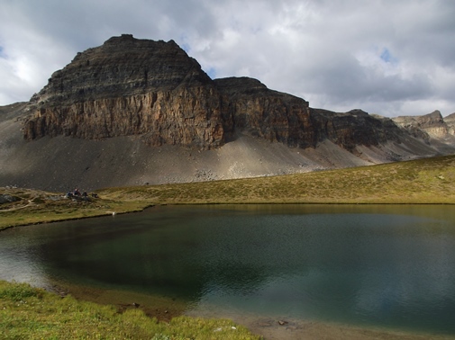
After soaking in the views we climbed above Helen Lake with the intention of proceeding towards Dolomite Pass. Somehow, after reaching the ridgetop above the lake, we took the wrong trail, an unmarked social trail that led us along the canyon ridge. Though it didn’t take us where we intended to go, it did offer outstanding views of both Helen and Katherine Lakes, as well as the mountains that surrounded them. With threatening skies moving in once again, we decided to end our hike there.


Trail: Dolomite Pass (Helen Lake)
RT Distance: 11.1 Miles (18km)
Elevation Gain: 1968 feet (600m)
TH Location: Icefields Parkway
Map: Yoho and Banff North Trails Illustrated Map
Canadian Rockies Trail Guide Known affectionately as the Bible by outdoor enthusiasts, the Canadian Rockies Trail Guide was the first guidebook with accurate distances and detailed descriptions to the trails of the Canadian Rockies. The book includes 227 hikes for all fitness levels. Not only is Canadian Rockies Trail Guide known locally as the Bible, it is also the only hiking guide to the region recommended by Fodor's, Frommer's and Lonely Planet. With over 250,000 copies in print, the Canadian Rockies Trail Guide is one of the best-selling non-fiction books in Canadian publishing history
Jeff
RockyMountainHikingTrails.com
TetonHikingTrails.com
HikinginGlacier.com
HikingintheSmokys.com
This outstanding hike leads to a spectacular alpine meadow filled with wildflowers after the snowmelt, before visiting two lakes and a mountain pass that offers stunning panoramic views. The hike begins with a climb up the south-facing slopes of the Bow Valley, which eventually offers views of Crowfoot Glacier across the valley. After 3.5 miles hikers will reach their first destination on this hike, Helen Lake. The cirque mountain walls that frame Helen Lake are home to a large community of marmots. Though we didn’t actually see any, we heard their distinctive whistles echoing off the walls of the natural amphitheater. We also saw a golden eagle soaring along the updrafts. It appeared to be nesting high along the mountain opposite the lake.
After soaking in the views we climbed above Helen Lake with the intention of proceeding towards Dolomite Pass. Somehow, after reaching the ridgetop above the lake, we took the wrong trail, an unmarked social trail that led us along the canyon ridge. Though it didn’t take us where we intended to go, it did offer outstanding views of both Helen and Katherine Lakes, as well as the mountains that surrounded them. With threatening skies moving in once again, we decided to end our hike there.
Trail: Dolomite Pass (Helen Lake)
RT Distance: 11.1 Miles (18km)
Elevation Gain: 1968 feet (600m)
TH Location: Icefields Parkway
Map: Yoho and Banff North Trails Illustrated Map
Canadian Rockies Trail Guide Known affectionately as the Bible by outdoor enthusiasts, the Canadian Rockies Trail Guide was the first guidebook with accurate distances and detailed descriptions to the trails of the Canadian Rockies. The book includes 227 hikes for all fitness levels. Not only is Canadian Rockies Trail Guide known locally as the Bible, it is also the only hiking guide to the region recommended by Fodor's, Frommer's and Lonely Planet. With over 250,000 copies in print, the Canadian Rockies Trail Guide is one of the best-selling non-fiction books in Canadian publishing history
Jeff
RockyMountainHikingTrails.com
TetonHikingTrails.com
HikinginGlacier.com
HikingintheSmokys.com
Subscribe to:
Posts (Atom)