
Meanwhile, Colorado has a brand new lowest fourteener. After shrinking nearly two feet, Huron Peak is set to be demoted. As a result of this, and Sunshine Peak growing about a half-foot, Sunshine Peak will officially surpass Huron by a few inches. Quandary Peak, one of Colorado's more popular fourteeners, has also lost 2.1 feet.
The biggest losers were Mt. Massive and Longs Peak, both having lost more than three feet. In fact, nearly every fourteener in Colorado will officially lose elevation once the new national vertical datum is implemented. The new elevations were recently published in the Journal of Geodesy by a team of researchers from the National Geodetic Survey (NGS).
* All of the 14ers have updated estimated elevations and uncertainties. The changes in elevations are due to both:
-- the upcoming adoption of a new national geopotential datum
-- as well as a re-analysis of the original heights based on classical geodetic surveying techniques
* All the 14ers continue to be above the 14,000’ threshold, though there is some “shuffling” in their rankings. No peak is newly ‘elevated’ to the 14er level. Huron Peak, is now the lowest 14er, with an estimated elevation of 14,004.1’ in the new geopotential datum.
* Currently published North American Vertical Datum of 1988 (NAVD 88) elevations on the mountain peak triangulation stations are found to be systematically too high by roughly 1 meter. To investigate and correct this, the team developed a novel technique to redetermine these heights from the historical triangulation data that was measured in the 1950s.
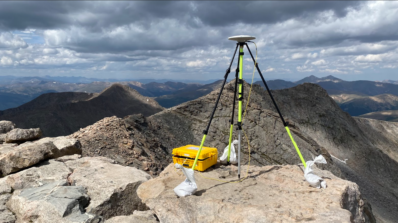
The mountain summit elevations were determined using a combination of two data sources:
* Airborne LiDAR data, acquired via the United States Geological Survey (USGS) 3-D Elevation Program (3DEP) and Colorado Water Conservation Board. These data were used to provide raw ellipsoidal heights.
* A number of available geoid models (i.e. high-resolution models of the Earth’s geopotential field) were used to convert the ellipsoidal heights into orthometric heights (i.e. “heights above sea level”). A combination of these models was used as a proxy for the eventual, “final” model that will serve as the new vertical datum in the National Spatial Reference System (NSRS).
The results of this paper have broad implications for all elevations across the nation with the upcoming modernization of the National Spatial Reference System. The new NSRS will be the foundation for all surveying and mapping in the US going forward.
Jeff
RockyMountainHikingTrails.com
HikinginGlacier.com
TetonHikingTrails.com
Ramble On (2nd edition book on the rich history of hiking)
Exploring Glacier National Park
Exploring Grand Teton National Park
No comments:
Post a Comment