Tuesday, July 28, 2026

Hiker walks 10 miles after being impaled by trekking pole

A Billings, Montana man was impaled by a trekking pole on Granite Peak last week. The freak accident occurred roughly 2 miles below the summit. After assesing his injuries, David Cifaldi, a nurse, determined that he could walk back to the trailhead on his own power. That trip covered nearly 10 miles and took roughly six and a half hours to complete.

KCENNews in Texas provided a full report on the story. Warning: some of the images may be a little disturbing:


              ************************************************************************************

Check out our online trail guides:


Thursday, July 23, 2026

Lightning in the Rockies

Rocky Mountain National Park posted this on their social media yesterday:
Thunderstorms and lightning are common in Rocky Mountain National Park during the summer monsoon season during the months of July and August. Before heading out on your next adventure, know how to protect yourself when thunder roars and lightning strikes.

When you recreate, take time to pay attention to your surroundings and know the most high-risk places to be compared to the safest locations to be during a lightning storm. When it comes to lighting, there are no fully safe places in the outdoors.

If possible, shelter inside a vehicle or a building. If you are out on a hiking trail, the next best option is to get below treeline and shelter at the base of a cluster of low-height trees or in a lower elevation dry ditch or gully.

Taking a drive on Trail Ridge or Old Fall River Roads? Stay in your vehicle. Do not walk to overlooks or stand outside in parking areas.

Avoid the following highest-risk locations during a storm:

🌩️ The top of a mountain peak
🌩️ Exposed open slopes above tree line
🌩️ Caves or rock outcroppings on the side of a mountain
🌩️ Areas near open water
🌩️ The base of a single tall tree
🌩️ The inside of a tent when camping in an exposed area
🌩️ Areas near rivers, streams, creeks and places with wet and boggy ground

For more lightning safety tips, visit www.nps.gov/romo/planyourvisit/lightning-safety.htm


                *******************************************************************************

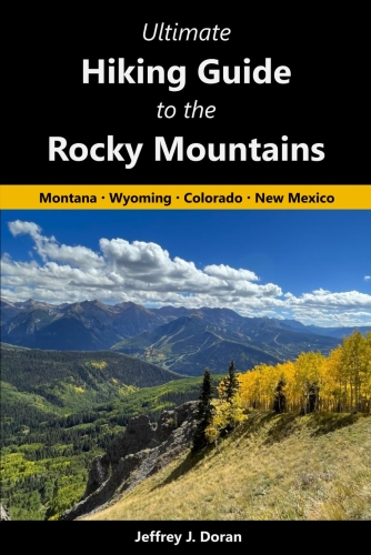
From Montana to New Mexico, the American Rockies stretch for more than a thousand miles. Within this spectacular mountain range are thousands of miles of hiking trails. With such an overwhelming number of options, how will you find and choose the most scenic and rewarding hikes?

Ultimate Hiking Guide to the Rocky Mountains takes all the guesswork out by focusing on some of the most amazing hikes across this range, and provides you with a handpicked list of options that will allow you to make the most of your trips in the Rockies:


Sunday, July 19, 2026

On this date in hiking history: Mazamas established atop Mt. Hood

In 1894, the Mazamas held their inaugural meeting atop Mt. Hood, the highest peak in Oregon. To become a charter member of the prospective club, hikers were required to attend this meeting.

On June 12, 1894, organizers published an advertisement in the Morning Oregonian announcing the forthcoming meeting, which was to include a “typical mountain banquet.” On July 17th, more than 300 people responded to the advertisement by arriving at one of two staging areas along the flanks of the 11,249-foot mountain. Two days later, a total of 193 climbers (155 men and 38 women) reached the snow-capped summit, of which 105 would become charter members. Before descending the peak, the newly minted organization released three homing pigeons with notes announcing to friends in Portland that the club had been successfully established.

Today, the Mazamas are one of the largest hiking and mountaineering clubs in America.

Here’s a photo of prospective members climbing the Cooper Spur on Mt. Hood to take part in the inaugural meeting atop the mountain:


                *******************************************************************************

Virtually no one went hiking before the 19th century. What occurred that inspired ordinary people to take a walk through the woods for pleasure? Ramble On: A History of Hiking explores the rich history of hiking, and how it evolved into one of the most popular pastimes in the world.


Saturday, July 18, 2026

Wild Basin Road in Rocky Mountain National Park will be closed to all uses this week

Rocky Mountain National Park posted this on their social media yesterday:
Beginning on Tuesday, July 21, through Thursday, July 23, the Wild Basin Road in Rocky Mountain National Park will be closed to all uses, including vehicles, bicycles and pedestrians for road maintenance.

This closure will occur at the Wild Basin Entrance Station and will include the entire two-mile section of the road to the Wild Basin Trailhead.

The park’s roads crew will be spreading gravel and grading this narrow road to address ruts, potholes and help with drainage. Due to the road being closed to all uses from July 21 through July 23, visitors should avoid this area of Rocky Mountain National Park during this time.

The trailhead parking area for the Sandbeach Lake Trail will not be impacted by this closure.


              ************************************************************************************

Check out our online trail guides:


Friday, July 17, 2026

Mudslides force closure in Curecanti National Recreation Area - 18 visitors evacuated

Around 5 p.m. on July 16, 2026, a thunderstorm dropped significant rainfall at Curecanti National Recreation Area, triggering at least three major mudslides on the East Portal Road. Extensive debris washed down from drainages above the roadway, covering significant lengths of the roadway with up to six feet of boulders, rocks, and mud. Debris also covered the entire East Portal campground and much of the East Portal picnic area.

The campground, picnic area, and the East Portal Road will be closed until assessments and repairs can be completed and all facilities are safe for public access. Those assessments and repairs are underway. There is currently no estimate of total damage, costs, or opening dates. The road is close to all traffic including pedestrians and bicyclists.

Twenty-one-day trippers, campers, and anglers were temporarily stranded at the bottom of East Portal Road on July 16. Responders were on scene by 5:45 p.m., and no injuries were reported.

Law enforcement from the National Park Service and facility management crews from the NPS and Bureau of Reclamation arrived, secured the area, and began clearing the roadway with heavy equipment. They were able to evacuate 18 visitors by midnight. One visitor on a motorcycle and two visitors with vehicle problems waited until the roadway was less saturated to depart in daylight and were evacuated by 9 a.m., July 17.

East Portal Road is managed by the Bureau of Reclamation and provides access to the Crystal Dam and Gunnison Tunnel. It also accesses the East Portal Campground and recreational opportunities in Black Canyon of the Gunnison National Park and Curecanti National Recreation Area. The six-mile road has a steep grade of 16%. The road passes through forested areas burned by the 2025 South Rim Fire.

The NPS advises visitors to use extreme caution while traveling in areas with fire scars during times of rain. Soil with little vegetation cover can become saturated and trigger landslides.

Updates on road and campground status can be found on the park websites at www.nps.gov/blca and www.nps.gov/cure.


              ************************************************************************************

Check out our online trail guides: