Wednesday, April 16, 2025

Black Canyon moves cashless fee collection

Effective immediately, Black Canyon of the Gunnison National Park will transition to a fully cashless fee system and only accept mobile or electronic payments for entrance, camping, and permit fees. Transition to electronic payment is safer, reduces transaction times, allows for reservations and prepayment, and improves accountability. At Black Canyon, entrance fees, campground fees, and wilderness route permits are all available through www.recreation.gov.

Credit and debit sales already represent as much as 95% of in-person sales in the park. Cash handling costs include park rangers’ time counting money, auditing collections, making bank deposits, storage of payment envelopes and files, and processing paperwork, most of which is remedied through cashless sales. The transition to cashless payments will allow the NPS to redirect cash-processing time and direct costs to other work that directly benefits park visitors. Travelers are able to pay for entrance fees, advanced reservations for camping, user fees, and more at hundreds of National Park Service, US Forest Service, Bureau of Land Management, Fish and Wildlife Service, and US Army Corps of Engineers sites throughout the country using the Recreation.gov online service, the mobile app, and the contact center.

Black Canyon National Park also provides travelers with the option to pay for first-come, first-serve camping opportunities through the Scan and Pay option within the Recreation.gov mobile app. To use Scan and Pay in lieu of other traditional forms of payment for first-come, first-come camping fees, visitors must first download the free Recreation.gov mobile app. After downloading the app and creating an account, simply scan the QR code at the campground to complete the payment. No signal, no problem. Even in remote areas with no mobile service, scan and pay allows visitors to pay offline and then process transactions once back online. A temporary confirmation ID is provided for verification. For additional information on how to use the Scan and Pay option, please visit Recreation.gov (video tutorial) .

Western National Parks Association (WNPA), the park’s cooperating association that runs the park store in the South Rim Visitor Center, has already moved to cashless operations. Partial proceeds from purchases assist park operations with education and interpretation efforts.


              ************************************************************************************

Check out our online trail guides:


Monday, April 14, 2025

Rocky Mountain National Park Announces Plans For Prescribed Burn on Tuesday, April 15, 2025 if Conditions Allow - Beaver Meadows Entrance Access Closed Between 10 a.m. to 2 p.m.

Based upon the potential for favorable weather and conditions, fire managers at Rocky Mountain National Park are planning to conduct a prescribed burn on Tuesday, April 15, 2025. Firefighters plan to burn approximately 60 acres of the 334-acre Headquarters Unit. This burn unit is located inside Rocky Mountain National Park, west of Beaver Meadows Visitor Center and south of U.S. Highway 36. Because of the fuel type that will be burned, which includes mainly grasses and small shrubs, heavy and prolonged smoke is not expected from this operation.

Due to the proximity of burn operations near the road, U.S. Highway 36 inside Rocky Mountain National Park will be temporarily closed from just west of Beaver Meadows Visitor Center to the Beaver Meadows Entrance between the hours of 10 a.m. and 2 p.m. During this time, visitors will need to enter and exit the park through the Fall River Entrance on US 34.

Beaver Meadows Visitor Center, RMNP’s Wilderness Office and the Rocky Mountain Conservancy Nature Store, located inside the visitor center, will be open as regularly scheduled.

The primary goal of the project is to reduce the threat of wildland fire to adjacent communities and NPS infrastructure by using prescribed fire to reduce the amount of fuels available in this area. When fighting the East Troublesome Fire in 2020 and the Fern Lake Fire in 2012, firefighters were able to take advantage of previous and existing prescribed fire and hazardous fuels treatment areas that provided a buffer between the fire and the town of Estes Park. Prior hazard fuels projects were instrumental in stopping the fire from jumping Bear Lake Road and Trail Ridge Road.

If conditions are favorable, ignitions are planned to occur on Tuesday, April 15. Firefighters will be on scene for the duration of the operation and will be patrolling the burned area. Smoke from the prescribed burn will be visible throughout the day of the burn, mostly during the warmest part of the day. With cooler temperatures in the evening, smoke may linger and accumulate in low-lying areas.

Additional information will be shared on InciWeb at https://inciweb.wildfire.gov/incident-information/cormp-front-country-prescribed-fire, on www.nps.gov/romo and on Rocky Mountain National Park’s official social media channels. Follow us on Facebook, Instagram, and X @RockyNPS.

Smoke may be visible both inside and outside the park. Every effort will be made to minimize smoke impacts on visitors and the adjacent community; however, some smoke is anticipated to disperse east of the park. Smoke may affect your health: For more information see https://www.colorado.gov/pacific/cdphe/wood-smoke-and-health. No trail or road closures are anticipated but visitors passing through active burning areas may be escorted by fire personnel to ensure their safety.

Safety factors, weather conditions, air quality, personnel availability and environmental regulations are continually monitored as a part of any fire management operation.


              ************************************************************************************

Check out our online trail guides:


Friday, April 11, 2025

Transponder Sales and Renewals to Resume at Rocky Mountain National Park Beginning Sunday, April 13

Beginning this Sunday, April 13, voluntary automated gate transponders will again be available for purchase on Sundays at Rocky Mountain National Park’s Beaver Meadows Visitor Center between the hours of 9 a.m. to noon and 1 p.m. to 4 p.m. These devices are available to interested annual and lifetime passholders, including RMNP, America the Beautiful, Senior, Military, Veterans, Access and Fourth grade passes. For individuals who purchased a transponder from February to June 2024, transponder renewals will also available.

Due to unforeseen technical difficulties, transponder sales have not been available since June of 2024. Technical challenges have been resolved and interested pass holders are eager for this voluntary amenity to be available once again.

Transponder lanes assist passholders and park staff by reducing queuing and congestion at entrance stations particularly on busy winter weekends, as well as prior to 9 a.m. and after 2 p.m. during months when timed entry reservations are in place.

Visitors who choose to purchase this optional transponder device will be able to enter RMNP using the transponder lane at Beaver Meadows and Fall River Entrances. A new transponder lane will be available on the west side of the park at the Grand Lake Entrance later this year. The previous transponder lane at Grand Lake Entrance was destroyed in the 2020 East Troublesome Fire.

A transponder is a small, credit card-sized device that must be attached to a vehicle’s windshield. The amenity fee for those interested in this voluntary transponder is $15. One transponder may be purchased per valid annual or lifetime pass and the transponder is valid for up to one year. For those who are renewing transponders purchased between February to June 2024, the $5 renewal rate will be waived. Renewals must be done in person. All future transponder renewals will be $5 after the initial purchase.

Transponders must be attached to the inside, top-right corner (passenger side) of a vehicle’s windshield and are non-removable, non-transferable, and non-refundable. When using a transponder in the park, visitors must have their passes with them as well.

In 2004, Rocky Mountain National Park constructed a fast pass lane at the Beaver Meadows Entrance and in 2011, an additional fast pass lane was installed at the Grand Lake Entrance. Rocky Mountain National Park was one of the only national parks with fast pass lanes for visitors. Visitors who purchased an annual park pass or lifetime pass were able to use their pass to operate the automated gate. However, in 2019, the National Park Service modified the format of annual and lifetime passes. The new national passes were not compatible with the park’s gate system technology. As a result, the fast pass gate was not operational for the last few years. To address this challenge, RMNP transitioned to windshield transponders for interested annual and lifetime passholders to access a new transponder lane during the times of day when timed entry is not in effect.


                *******************************************************************************

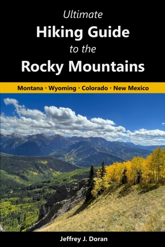
From Montana to New Mexico, the American Rockies stretch for more than a thousand miles. Within this spectacular mountain range are thousands of miles of hiking trails. With such an overwhelming number of options, how will you find and choose the most scenic and rewarding hikes?

Ultimate Hiking Guide to the Rocky Mountains takes all the guesswork out by focusing on some of the most amazing hikes across this range, and provides you with a handpicked list of options that will allow you to make the most of your trips in the Rockies:


Thursday, April 10, 2025

San Juan N.F. roads and trails begin opening in April and May

Southwest Colorado is experiencing warm, dry weather in the low country, but many of the San Juan National Forest’s roads and trails remain buried under snow. Roads are closed seasonally to protect drivers from hazardous conditions, to protect wildlife, and to prevent road damage. Wet, muddy areas where snow has begun to melt are easily damaged by hikers, bikers, horses, and vehicles. Budget and resource limitations could hinder future road repairs, so we ask that public please stay off wet and muddy roads and trails and respect gate closures.

TRAILS: Some low elevation trails have begun to thaw out, which can tempt hikers, bikers and horseback riders. Hiking and riding on muddy paths damage our valuable forest assets, such as streams, vegetation, and fish and wildlife. Hikers and bikers often walk or ride along the edges of paths and trails on live vegetation to avoid muddy paths. This damages plants, widens and braids the trails, and leads to erosion and sedimentation in waterways. Still want to recreate? We recommend visiting gravel roads or paved pathways that have melted out and are accessible without causing resource damage.

ROADS: The Dolores and Pagosa Ranger District staff have begun opening roads as conditions allow, except for roads closed to protect elk and deer, which will open May 1st. The Columbine Ranger District will begin opening low elevation roads May 1st, and will follow the Motor Vehicle Use Map dates for all roads. Upper elevation and backcountry roads will be opened June 1st or as conditions permit. Spring conditions are variable and even dangerous, and visitors should be prepared to encounter system roads that are impassable due to snow drifts, waterlogged roads, down trees, or other debris. All travel on the Forest is regulated by the Motor Vehicle Use Maps that can be found online. For specific road information, visit our road conditions webpage or contact your local district office listed below:

Columbine Ranger District (970) 884-2512
Dolores Ranger District (970) 882-7296
Pagosa Ranger District (970) 264-2268


              ************************************************************************************

Check out our online trail guides:


Friday, April 4, 2025

Fungus Linked to White Nose Syndrome Detected in Rocky Mountain National Park

Laboratory tests conducted by the U.S. Geological Survey (USGS) have confirmed that the fungus Pseudogymnoascus destructans (Pd) has been positively detected in bats found in the Holzwarth Historic Site area located on the west side of Rocky Mountain National Park. This is the first confirmed detection of Pd in Grand County, Colorado.

Pd is an invasive fungus that causes white-nose syndrome (WNS), a fatal disease that impacts bats. This fungus can spread rapidly, primarily through bat-to-bat contact.

WNS does not cause illness in humans, but humans are able to spread the fungus to new places. To protect yourselves and conserve bat populations, we recommend visitors:

Report dead/injured bats to park personnel. To protect yourself and bats, never touch or pick up a bat. Although WNS does not cause illness in humans, a small percentage of bats can be infected with other dangerous diseases, such as rabies.

Decontaminate. Ensure you properly decontaminate your gear and outerwear after visiting a cave or other bat habitat.

Earlier this year, swabs taken from bats in the Holzwarth area of the park found a probability of Pd. Following this probable result, National Park Service wildlife biologists at the park collected bat guano from locations in the Holzwarth Historic Site area for follow up testing to verify the results. The results of these tests have positively detected Pd.

Any new detection of Pd is worrisome because bats are vital for healthy ecosystems. Rocky Mountain National Park is home to nine known species of bats, five of which have been found living in areas above 11,000 feet. WNS has been blamed for millions of bat deaths nationwide since its initial detection in New York State in 2006. In July 2022, the first confirmed case of WNS was reported in Southeastern Colorado. Pd and WNS have also been confirmed in Larimer County, Colorado.

Colorado Parks and Wildlife and the USGS, along with U.S. Fish and Wildlife Service and National Park Service, have been conducting WNS surveys for over a decade, monitoring bats for presence of Pd. Colorado is home to 19 native bat species, at least 13 of which may be susceptible to this disease. Colorado's native bats are all insect eaters and use various habitat types across the state. They are most active during the summer months and spend the winter either hibernating in underground roosts throughout the state or migrating south. The National Park Service and other state and federal agencies will continue to monitor bats throughout Colorado.

To learn more about White Nose Syndrome and how it impacts bats, visit https://www.whitenosesyndrome.org/


              ************************************************************************************

Check out our online trail guides:


Wednesday, April 2, 2025

Seeking Information on Reckless Driving within Rocky Mountain National Park

During activities within Rocky Mountain National Park on February 17 and March 1, park rangers received reports of a vehicle driving recklessly with disregard for the safety of others.

Rangers are investigating these reports and are seeking information from the public, including any photographs or video material. At this time, no further information will be provided regarding this ongoing investigation.

If you have information that could help investigators, please contact us. You don't have to tell us who you are, but please tell us what you know. Please contact the National Park Service Investigative Services Branch Tip Line 888-653-0009, or submit a tip online at go.nps.gov/SubmitATip or Email nps_isb@nps.gov


              ************************************************************************************

Check out our online trail guides:


Friday, March 28, 2025

State restoring 12 summit trails on Colorado 14ers

Yesterday, Governor Polis and Colorado Parks and Wildlife announced that the Non-Motorized Trail Grant Program recently awarded $2,438,000 for 26 projects that will connect Coloradans and visitors to the outdoors with new and improved opportunities to get outside, including restoring trails on 12 of Colorado’s 14ers. The Parks and Wildlife Commission unanimously approved the grants during the March 2025 PWC meeting.

“Our iconic 14ers will now be even more accessible and safe to summit! In Colorado, we are focused on expanding outdoor recreational opportunities for all Coloradans, while protecting our natural resources and public lands. This funding will help Coloradans have fun, get outside, and be active while protecting our awe-inspiring natural landscapes, keeping Colorado beautiful for generations to come,” said Governor Polis.

The Non-Motorized Trails Grant Program is a multi-agency partnership that includes CPW, Great Outdoors Colorado (GOCO), Colorado Lottery, and the Federal Recreational Trails Program (RTP).

Last year, a new Trail Stewardship pilot program with additional support from Great Outdoors Colorado was launched. This program provides funding specifically to support trail stewardship crews hired by land managers and nonprofits who focus on maintenance work throughout Colorado. This year, the State Trails Program received $1,500,000 in funding from Great Outdoors Colorado.

“As we continue to see increased use and natural disasters impact our outdoor spaces, we are fortunate to partner with Great Outdoors Colorado to launch a new opportunity to fund stewardship crews who are caring for trails across the state,” said CPW Assistant Director of Outdoor Recreation and Lands, Fletcher Jacobs. “These increased 'boots on the ground' trail crews will help support the Governor’s Wildly Important Goals to balance conservation and recreation by increasing the number of trail crew hours funded by the State Trails Program.”

2025 Grant Stats

Construction
3 grants totaling $575,000

Maintenance
10 grants totaling $1,089,281

Planning/Support
8 grants totaling $280,023

Trail Stewardship
5 grant totaling $493,710

Some of the highlights from this year’s awarded projects include:

Statewide 14ers Trail Maintenance 2025 (Maintenance grant) The Colorado Fourteeners Initiative was awarded a $250,000 grant to reconstruct and restore 12 summit trails on 14,000-foot peaks. The will include basic maintenance, intensive trail reconstruction and thousands of feet of closure/restoration. Reconstruction will include boardwalk repair, backwall supporting tundra beds, installation of timer check and rock steps.

The 12 summit trails included in the maintenance plan include:

* Mt. Bierstadt
* Mt. Blue Sky
* Quandary Peak
* Mt. Democrat
* Mt. Princeton
* Mt. Massive
* Capitol Peak
* Mt. Columbia
* San Luis Peak
* Redcloud Peak
* Wetterhorn Peak
* Mt. Sneffels


                *******************************************************************************

From Montana to New Mexico, the American Rockies stretch for more than a thousand miles. Within this spectacular mountain range are thousands of miles of hiking trails. With such an overwhelming number of options, how will you find and choose the most scenic and rewarding hikes?

Ultimate Hiking Guide to the Rocky Mountains takes all the guesswork out by focusing on some of the most amazing hikes across this range, and provides you with a handpicked list of options that will allow you to make the most of your trips in the Rockies:


Wednesday, March 26, 2025

It's tick bite prevention week in RMNP

Rocky Mountain National Park posted this on their social media today:
It's tick bite prevention week, and this is a timely conversation since the arrival of spring and warmer temperatures means that ticks are now out in lower elevation areas of Rocky Mountain National Park.

Ticks are small arachnids that feed on the blood of their hosts. Rocky Mountain Wood Ticks (Dermacentor andersoni), along with other species of ticks around the country, often inhabit areas with tall vegetation and leaf litter. They easily jump from vegetation like tall grasses to a new host, like humans when hiking.

It is important to be tick aware, as they can transmit diseases to humans like Rocky Mountain Spotted Fever and Colorado Tick Fever. The best way to prevent tick borne illnesses is to not allow ticks to become embedded on you. Protect Yourself from Ticks by taking the following actions:

🥾 When hiking, walk in the middle of trails away from tall grasses. Check yourself and your kids for ticks every few hours. Check your head, ankles, wrists and waistbands.

🧥 Cover your skin by wearing long sleeves and long pants. Pull socks over the cuffs of your pants to prevent ticks from finding the skin around your ankles.

🧴 Consider using insect repellent that contains DEET or permethrin, which can be effective in repelling ticks.

For more information, visit the CDC's webpage about ticks at https://www.cdc.gov/ticks/about/index.html and RMNP's tick safety webpage at https://www.nps.gov/romo/planyourvisit/tick-safety.htm


              ************************************************************************************

Check out our online trail guides:


Friday, March 21, 2025

Spring migration season is here!

Rocky Mountain National Park posted this on their social media the other day:
Spring migration season is beginning for many species of wildlife, including Mule deer and elk. Help protect wildlife on the move. How can you help?

🦌 When driving, slow down and follow the posted speed limits. Scan the sides of roads for wildlife and be prepared to stop for wildlife.

🐇 Wildlife can walk, fly, or hop across roads at any time. Be especially careful in the early morning and early evening hours of the day.

🚗 It is our responsibility to keep an eye out for wildlife crossing roads. When you see wildlife trying to cross a road in the park, slow down and stop. Give them space and time to safely cross.

Thank you for doing your part to help protect wildlife!


              ************************************************************************************

Check out our online trail guides:


Wednesday, March 19, 2025

Black Canyon Park Missing Person Update

Park Rangers and a member of the Black Canyon Search and Rescue Team located human remains within a remote and highly technical area to access within the wilderness area at Black Canyon of the Gunnison National Park. The remains are believed to be those of Jordan Marsters. On February 15 family members reported to the Denver Police Department that Masters was missing. Park Rangers found clues placing Marsters in Black Canyon of the Gunnison National Park and search efforts began.

Due to the complexity of the location, efforts are underway to recover the remains for positive identification by the medical examiner's office. The National Park is currently reaching out to adjacent parks that have extreme technical skill sets to help with the recovery. The National Park Service is not providing the location or additional information until after the remains have been recovered.


              ************************************************************************************

Check out our online trail guides:


Tuesday, March 18, 2025

It's time to start planning your hiking adventures!

If you haven't already done so, now's the time to start planning your hiking adventures for the upcoming season. With hiking soaring in popularity in recent years, there are many things you need to consider ahead of time, such as securing lodging or camping reservations, as well as timed entry and other trail access permits (in accord with local regulations). Most importantly, you need to plan which hikes you would like to take, especially if you wish to avoid crowds.

Last summer I published a guide for hikes spanning across the entire Rocky Mountains Range. This is the culmination of several decades of hiking in the region. Ultimate Hiking Guide to the Rocky Mountains: Montana, Wyoming, Colorado, New Mexico focuses on some of the most amazing hikes across the American Rockies, and provides you with a handpicked list of options that will allow you to make the most of your trips in the region.

What’s in the trail guide?

* Detailed descriptions for 75 day hikes that lead to tranquil backcountry lakes, roaring waterfalls, deep canyons, alpine meadows and placid glaciers. Many ascend to high mountain passes and summits. All of them will lead you to extraordinary places that offer breathtaking scenery.

Ultimate Hiking Guide to the Rocky Mountains is available on Amazon.


Friday, March 14, 2025

Summer Hanging Lake reservations available beginning Monday

With an anticipated July 1 reopening of the Hanging Lake Trail, summer reservations will be available at www.visitglenwood.com beginning March 17 at 8 a.m.

Reconstruction of the main trail and its seven bridges will be completed before the trail reopens, while construction will continue into the fall at the main trailhead and Spouting Rock area.

Work to make the 1.2-mile Hanging Lake Trail more sustainable and better able to handle high water began in May 2024. The trail was intermittently open throughout summer 2024, with a full closure in place in the fall once the old bridges were removed.

The trail and associated bridges suffered significant damage following the July 2021 debris flows in Glenwood Canyon. A temporary trail was in place to allow visitation while this larger reconstruction effort was planned and implemented.

“We know people are excited to hike to Hanging Lake again, and I think they will be impressed with the beautiful new trail that is being built to last for 100 years,” said Eagle-Holy Cross District Ranger Leanne Veldhuis. “This important work to repair and improve one of Colorado’s most iconic trails would not be possible without the significant support of our partners.”

The Hanging Lake Reconstruction Project is being funded through Great Outdoors Colorado, Colorado Lottery, Colorado Parks and Wildlife State Trails Program, the National Forest Foundation, City of Glenwood Springs, and the USDA Forest Service.


              ************************************************************************************

Check out our online trail guides:


Sunday, March 9, 2025

Rocky Mountain National Park Announces Plans for Prescribed Burn on Monday, March 10, 2025 If Conditions Allow

Based upon the potential for favorable weather and fuels conditions, fire managers at Rocky Mountain National Park are planning to conduct a prescribed burn beginning on Monday, March 10, 2025. Firefighters plan to burn approximately 50 acres of the 334-acre Headquarters Unit. This burn unit is located inside Rocky Mountain National Park, west of the Beaver Meadows Visitor Center and south of U.S. Highway 36. Because of the fuel type that will be burned, which include mainly grasses, heavy and prolonged smoke is not expected from this operation.

The primary goal of the project is to reduce the threat of wildland fire to adjacent communities and NPS infrastructure by using prescribed fire to reduce the amount of fuels available in this area. When fighting the East Troublesome Fire in 2020 and the Fern Lake Fire in 2012, firefighters were able to take advantage of previous and existing prescribed fire and hazardous fuels treatment areas that provided a buffer between the fires and the town of Estes Park. Prior hazard fuels projects were instrumental in stopping both fires from crossing Bear Lake and Trail Ridge Roads.

If conditions are favorable, ignitions are planned to occur on Monday, March 10. Firefighters will be on scene for the duration of the operation and will be patrolling the burned area. Smoke from the prescribed burn will be visible throughout the day of the burn, mostly during the warmest part of the day. With cooler temperatures in the evening, smoke may linger and accumulate in low-lying areas.

Fire operations near the Beaver Meadows Entrance to RMNP may cause brief delays or temporary road closures. Traffic may be diverted through Fall River Entrance. Motorists should watch for fire vehicles on the roads and allow extra time for entering and exiting the park. Traffic control will be in place on U.S. Highway 36 within the burn area. Additional information will be shared on InciWeb at https://inciweb.wildfire.gov/incident-information/cormp-front-country-prescribed-fire and on RMNP’s official social media channels.

For the safety of visitors and firefighters, park visitors will not be allowed to stop along U.S. Highway 36 within the burn area. Visitors will also not be able to walk within the burn area.

Smoke may be visible both inside and outside the park. Every effort will be made to minimize smoke impacts on visitors and the adjacent community; however, some smoke is anticipated to disperse east of the park. Smoke may affect your health: For more information see https://www.colorado.gov/pacific/cdphe/wood-smoke-and-health.

Safety factors, weather conditions, air quality, personnel availability and environmental regulations are continually monitored as part of any fire management operation. For more information please contact the park Information Office at (970) 586-1206.


              ************************************************************************************

Check out our online trail guides:


Friday, March 7, 2025

Two hikers rescued after being stranded on snowy mountain for 3 days

Two hikers who were stranded for three days after falling down a snowy cliff were rescued on Monday near Idyllwild, California.

The hikers were traveling along the Tahquitz Mountain trail on Saturday, March 1, when they suddenly plummeted approximately 800 feet down a snowy cliff. They called 911, stating they were "injured badly and needed help." A helicopter was sent to rescue the two individuals, but due to 45 mph winds, the rescuers failed in their attempt.

Later that day deputies from the Hemet Sheriff’s Station responded to the trailhead leading to Tahquitz Peak. Deputies and rescue personnel established a Command Post at the Idyllwild Fire Protection District building. A search team, including medically trained personnel, hiked into the worsening weather conditions and located both injured hikers. The hikers were stabilized and outfitted with warm-weather gear to withstand high winds, freezing temperatures, rain, and snow. Due to the adverse weather conditions, rescue operations were not feasible.

Mutual Aid from several other county search teams assisted with the rescue, including those from Sierra Madre, Orange County, San Diego County, San Bernardino County, and Los Angeles County. On Monday, March 3, 2025, the Riverside Sheriff’s rescue helicopter, along with the assistance of CalFire’s rescue helicopter, was able to hoist the hikers out safely. They were treated at a local hospital for moderate to severe injuries. Both hikers are expected to make a full recovery.

Here's a report from KCAL News:


And here's some raw footage from the rescue:


              ************************************************************************************

Check out our online trail guides:


Tuesday, March 4, 2025

Remains of Thomas Irwin Located in Mesa Verde National Park

On Friday, February 28th, 2025, National Park Service Rangers located the remains of Thomas Irwin of Indianapolis, Indiana.

Irwin was last seen on January 15th, 2024, while hiking the Petroglyph Point Trail. On January 16th, his family contacted the park, and a search and rescue operation began. After an extensive, initial 10-day effort, searchers were unable to locate Irwin.

Over the last year, park officials continued the search, leading to Friday’s discovery of Irwin. Using a human remains detection canine, he was located within the original search area during an off-trail grid search.

"We sincerely appreciate and recognize the dedication of the Mesa Verde Resource and Visitor Protection Team and other park staff who continued the search for Mr. Irwin,” said Mesa Verde Superintendent Kayci Cook. “We are glad this provides some closure for his family.”


              ************************************************************************************

Check out our online trail guides:


Saturday, March 1, 2025

The Dark Side of the Rainbow

On this date in 1973, Pink Floyd released The Dark Side of the Moon. Almost from the start, rumors began circulating that when you played the album while watching The Wizard of Oz, strange synchronicities would appear like magic. Is this real, a cosmic coincidence, an ingenious marketing ploy, or just another conspiracy theory?


What are the chances that one of the most beloved movies of all time is artistically linked to one of the greatest rock albums ever recorded? On the surface the question seems preposterous, maybe even laughable. The effort required to succeed in a task of this magnitude seems daunting, if not impossible. Perhaps more importantly, all four members of Pink Floyd have repeatedly claimed that it’s absolute rubbish that The Dark Side of the Moon was purposely synchronized to The Wizard of Oz.

No doubt, there are many who accept these denials as the final word on the topic. And let’s be honest, it’s pretty hard not to. The band, after all, should be the most authoritative source, right? However, while many scoff at the notion of any intentional connections, there are numerous others who find the synchronicities to be uncanny, if not utterly remarkable. They argue that it’s impossible to ignore or dismiss the dozens of striking coincidences one sees on the screen as the album is played. Lyrics, chords and musical moods seemingly play in conjunction with the movie in numerous instances. Despite the denials from the band, many people still insist they, or perhaps Roger Waters alone, secretly scored the movie. There are a couple of musicians who have even gone on the record to make this argument. In 1997, the phenomenon began to spread like wildfire after the theory was brought to light in several local and national media outlets. In June of that year, The Tulsa World quoted Richard Lebos, the lead guitarist for a funk-rock band known as the The Kind, who stated that he knew “how unlikely it would be for the songs to match the movie so well (through coincidence). At least eight out of 10 tracks from the CD fit the action in the movie perfectly. There's no way it's a fluke.” Alex Harm, a drummer from Lowell, Massachusetts, told Helen Kennedy of the New York Daily News that he knew how difficult it was “just to write music, let alone music choreographed to action. To make it match up so well, you'd have to plan it."

Over the years several individuals have suggested that Roger Waters planned the entire score, but never let his fellow bandmates in on the secret. In 2000, Boston deejay George Taylor Morris told the Los Angeles Times that “Things happen musically and lyrically in sync to the film where you have to say that Roger Waters, Pink Floyd’s lead singer and lyricist, must have written it purposely for the movie.” When Q Magazine asked David Gilmour about the synchronicities in 1999, however, the lead guitarist sarcastically replied that if Roger had somehow orchestrated the mashup, he must have done it behind his back.

When looking at the mashup one must ask a few important questions: Is it a pure coincidence that the original movie switched from black-and-white to Technicolor at the exact moment the original vinyl record needed to be flipped over to play the second side? Is it just a fluke that as the album comes to an end with the sound of a fading heartbeat, Dorothy leans towards the Tin Man's chest to see if she can hear a heartbeat? Is it only an accident that as "Brain Damage" begins to play, the Scarecrow is in the act of singing "If I Only Had a Brain?" Moreover, there are numerous examples where the music seemingly fits the mood and emotion of the film and its characters, such as the tornado scene while “The Great Gig in the Sky” is playing. These are just a few of the many truly amazing and bizarre synchronicities you’ll find when you listen to The Dark Side of the Moon while watching The Wizard of Oz. These connections are now a part of what is widely referred to as “The Dark Side of the Rainbow,” a theory that asserts that one can find dozens of synchronicities when the album begins playing at the exact moment the MGM lion roars for the third time at the beginning of the classic 1939 movie.


A book born out of curiosity

I distinctly recall hearing about the theory in my late teens back in the mid-1980’s, but had completely forgotten about it somewhere along the line. Somehow or another, the old urban legend popped into my consciousness a few years ago, and I finally took the time to watch the synced video on YouTube. I clicked on the link expecting to find only a few mild coincidences, but was astonished to see numerous compelling connections throughout the movie. Like countless others before me, the mashup blew my mind. Needless to say, I was thoroughly intrigued at that point, and wanted more information. Were these connections truly significant? Did Pink Floyd purposely do this? As I dug deeper, I discovered that the theory has been a widespread cultural phenomenon for several decades now. My curiosity about the theory eventually led to this book. The overarching purpose for this volume is to explore the convoluted history of “The Dark Side of the Rainbow” theory. I also wanted to provide you with a thorough background on the original Frank Baum book, the MGM movie and The Dark Side of the Moon, as well as a list of the most compelling connections so that you can fully appreciate the synced movie as you watch it. This book also delves into the controversial hidden meanings of The Wonderful Wizard of Oz, which some say, including several scholars, was written as an allegory for the highly turbulent populist era of the late 1800s. Some of the symbolism from these allegorical interpretations is now a part of the Dark Side of the Rainbow theory.

Finally, I wanted to mention that during my research I stumbled upon a plausible explanation for the synchronicities that I don’t believe has ever been fully considered. I’ll explore this theory in more detail later in the book. To be clear, I didn’t write this to convince you that Pink Floyd purposely choreographed The Dark Side of the Moon to The Wizard of Oz, but rather to provide you with the ability to fully appreciate the synchronicities, and to present you with a possible explanation for their existence.

As you’ll see, the web of connections between the book, movie, band and album are quite extraordinary.

The Dark Side of the Rainbow is now available on Amazon in both paperback and eBook formats.


Friday, February 28, 2025

Wilderness backpacking permits for Rocky Mountain National Park go on sale tomorrow

Rocky Mountain National Park posted this on their social media the other day:
Planning to go wilderness overnight backpacking in Rocky Mountain National Park this summer? Now is the time to get ready! Advanced online reservations for all 2025 summer season Wilderness Overnight Backpacking permits within the park will go on sale via Recreation.gov this Saturday, March 1, at 8 a.m. MST.

#PlanLikeAParkRanger - To get important tips and begin planning for your summer wilderness overnight backpacking trips, visit the park's Wilderness Overnight Backpacking webpage at https://go.nps.gov/romo/wildernessbackpacking

Take time to become familiar with route maps, wilderness campsite locations, and the park's wilderness overnight backpacking regulations.

Next, visit Rocky's wilderness permits site on Recreation.gov at https://www.recreation.gov/permits/4675320 and take time to become familiar with the site.

𝐖𝐡𝐞𝐧 𝐜𝐚𝐧 𝐈 𝐛𝐨𝐨𝐤 𝐦𝐲 𝐬𝐮𝐦𝐦𝐞𝐫 𝐛𝐚𝐜𝐤𝐩𝐚𝐜𝐤𝐢𝐧𝐠 𝐭𝐫𝐢𝐩?

💻 Beginning on March 1 at 8 a.m. MT, you will be able to book trips for small groups (1-7 people) and large groups (8-12 people) by clicking the "Check Availability" feature on the Wilderness Permits page for Rocky Mountain National Park on Recreation.gov. From there, select the starting area that corresponds to the site at which you hope to camp, filling in your desired start date, and entering the total number of members in your group.

Reminders: Help Protect Rocky's Wilderness Through the Following Actions:

ALL scented items must be secured inside a self-provided, hard-sided, lockable, commercially manufactured carry in/out bear-resistant food storage canister and campfires are strictly prohibited.


              ************************************************************************************

Check out our online trail guides:


Thursday, February 27, 2025

Top "off the beaten trail" Hikes in Rocky Mountain National Park

As you've likely noticed in recent years, national parks are getting crowded. And Rocky Mountain National Park is no exception. As a result, most of the more well-known hikes in the park are also getting quite crowded. Not to mention finding a parking spot can be a hassle as well. Fortunately, if you dig a little deeper, there are still many hikes you can take to get away from the crowds, and still enjoy outstanding scenery. With more than 350 miles of trails meandering throughout the park, there are many options for hikers who seek a little solitude. Though not exaustive, here are 10 great hikes to consider:

1) Lion Lake No. 1: For whatever reason, I didn't take the opportunity to take this hike until 2021. Wow! What was I waiting for? The rugged subalpine landscape that surrounds this lake offers some of the most beautiful scenery in the park, while making it by far the most scenic lake in Wild Basin.

2) Baker Pass - Parika Lake Loop: This hike travels into the heart of the Never Summer Mountains, located just west of Rocky Mountain National Park. Although the hike begins along Trail Ridge Road in RMNP, this area sees relatively few visitors. This is a big mistake for those who seek awesome scenery, as the trail visits some absolutely beautiful spots, including Baker Pass and Parika Lake.

3) Pear Lake: This is another beautiful lake hike in Wild Basin. We saw lots of wildlife on this one, including a couple of moose near the trailhead.

4) Thunder Lake: Yet another beautiful lake tucked into the heart of Wild Basin. Though everyone else might be heading towards Ouzel Lake or Bluebird Lake, you might have this lake to yourself.

5) Little Horseshoe Park Loop: I would have to say that this loop (really a "lollipop hike") is a hidden gem. This short hike offers spectacular views of the Mummy Mountains, a plethora of wildflowers, as well as great opportunities for spotting a wide variety of wildlife.

6) Lumpy Ridge Loop: Wow! The views of and from the MacGregor Ranch are simply outstanding. Do this one in the early morning, and you'll likely be rewarded!

7) Lake Verna: The ultimate destination on this hike is 6.9 miles from the trailhead. If the thought of trekking that far seems too daunting you could shorten it by ending it at Lone Pine Lake, or taking a really short hike and stopping at a low bluff that overlooks East Meadow where you'll have a great opportunity of spotting moose and elk. No matter your choice, each destination passes Adams Falls near the trailhead.

8) Upper Beaver Meadows Loop: Expansive views of Longs Peak and the mountains along the Continental Divide await you from the montane grassy meadows along this one-way loop.

9) Poudre River Trail: This hike travels along the upper portions of the Cache La Poudre River, which was designated as a Wild and Scenic River by Congress in 1986.

10) Cascade Falls: One of the most voluminous waterfalls you'll find in Rocky Mountain National Park!


                *******************************************************************************

From Montana to New Mexico, the American Rockies stretch for more than a thousand miles. Within this spectacular mountain range are thousands of miles of hiking trails. With such an overwhelming number of options, how will you find and choose the most scenic and rewarding hikes?

Ultimate Hiking Guide to the Rocky Mountains takes all the guesswork out by focusing on some of the most amazing hikes across this range, and provides you with a handpicked list of options that will allow you to make the most of your trips in the Rockies:


Tuesday, February 25, 2025

New Book Shines Light on the “Dark Side of the Rainbow” Theory

Is it real, a cosmic coincidence, an ingenious marketing ploy, or just another conspiracy theory?

What are the chances that one of the most beloved movies of all time is artistically linked to one of the greatest rock albums ever recorded? For the uninitiated, the “Dark Side of the Rainbow” theory asserts that Pink Floyd purposely synchronized The Dark Side of the Moon to The Wizard of Oz. For those who have seen it, the mashup produces dozens of striking coincidences between the film and the album, where actions on the screen seemingly correspond to the lyrics, chords and musical moods of the Dark Side tracks.

In addition to a complete viewing guide for the synchronicities, the book explores an explanation for their existence.

I'm super excited to announce the release of my brand new book: The Dark Side of the Rainbow.

Now available in both paperback and eBook: amazon.com/dp/B0DXVND79V


Monday, February 24, 2025

National Park Service and Montrose County Sheriff’s Office conducts search for missing man at Black Canyon

Black Canyon of the Gunnison National Park staff and the Montrose County Sheriff’s Office staff are seeking the public’s assistance in locating a missing person. Jordan Marsters is a 31-year-old male who resides in Denver, Colorado. Marsters was traveling through Grand Junction on February 11 and in Montrose on February 12. His last known locations were in Montrose on February 12 and 13 and at Black Canyon of the Gunnison National Park on the morning of February 13 at approximately 7:20 am.

If anyone has information or was in contact with Mr. Marsters on the days leading up to February 13, please contact Black Canyon National of the Gunnison National Park at 970-249-1914 ext. 436.

Physical Description
Age: 31
Height: 5’7”
Weight: 140 lbs.
Hair: Blonde
Eyes: Blue

Jordan Marsters was driving a white Kia Fuente rental car with Texas license plates “TXH4349.” Mr. Marsters was last seen wearing a tan jacket and black hoodie.


              ************************************************************************************

Check out our online trail guides:


Thursday, February 20, 2025

Avalanche danger in Rocky Mountain National Park

Rocky Mountain National Park is warning backcountry recreators that avalanche danger is high right now in certain areas:
Planning to recreate in the mountains? Avalanche danger for Thursday, February 20 ranges from moderate to considerable in Rocky Mountain National Park.

Before heading out into the backcountry, make sure that everyone in your group is avalanche aware. If recreating in these areas, all members of your party are advised to have rescue equipment, education and experience to make informed decisions about traveling in avalanche terrain.

For more detailed information, visit the Colorado Avalanche Information Center - CAIC webpage at https://avalanche.state.co.us/ and follow them on social media.


              ************************************************************************************

Check out our online trail guides:


Wednesday, February 19, 2025

Seven Outstanding Hikes in Colorado

With endless amounts of stunning mountain scenery, the State of Colorado arguably ranks as the top hiking destination in the country. Although I’m quite partial to the hiking in Rocky Mountain National Park, there are many other places around the state that are on par with the national park. Here are seven hikes that I think you’ll find to be quite amazing, and may want to consider for your hiking bucket list:

Sneffels Highline
The Sneffels Highline is among the best hikes I've ever done. This spectacular loop offers several miles of exceptional views as it travels above treeline through the Uncompahgre National Forest and Mount Sneffels Wilderness Area. I highly recommend this hike during the fall when the aspens explode in brilliant shades of yellows. Since there's no parking at the trailhead, located at the top of Aspen Street in downtown Telluride, be sure to catch the Galloping Goose shuttle from several places around town.
Ice Lakes
Located just outside of Silverton in the San Juan National Forest, Ice Lakes likely has the most intense cobalt blue color I’ve ever seen in nature. Combine this extraordinarily beautiful alpine lake with outstanding mountain scenery and several thousand wildflowers, and you have one of the best hikes found just about anywhere.


Blue Lakes
The Blue Lakes Trail travels to an extremely scenic glacial basin within the Mt. Sneffels Wilderness area. Although not a national park, the San Juan Mountains near Ouray could easily qualify as one, and would probably rank as one of the crown jewels within the entire national park system. You could also make a strong argument that the hike to Blue Lakes would rank high on a list of the best hikes among all of our national parks.


Black Face Mountain
Although Black Face Mountain may look fairly nondescript from the top of Lizard Head Pass just outside of Telluride, you shouldn't be deceived - the views from the summit are quite amazing. After a relatively easy climb hikers will enjoy stunning panoramic views of several 13 and 14,000-foot peaks, as well as the iconic Lizard Head. Strong hikers can continue along the trail to create an epic loop that visits Bilk Basin Overlook.


Gilpin Lake Loop
The Gilpin Lake / Gold Creek Lake Loop (now referred to as the Zirkel Circle) in the Mount Zirkel Wilderness area near Steamboat Springs is an extremely popular hike. The trail visits waterfalls, broad glacially-carved meadows, and two scenic lakes. From the top of Gilpin Ridge you’ll enjoy absolutely stunning views of Gilpin Lake, a deep blue, alpine lake that lies below the gaze of 12,180-foot Mt. Zirkel and Big Agnes Mountain.


Mt. Elbert
Why not just go to the top of Colorado? Not only is 14,440-foot Mt. Elbert the highest point in Colorado, it’s also the highest point between Mt. Whitney in California, Fairweather Mountain in Canada, La Malinche Mountain in Mexico, and Mont Blanc in France. From the “roof of Colorado” hikers will enjoy outstanding panoramic views. Moreover, as “fourteeners” go, the hike to the summit is relatively easy.


Quandary Peak
At 14,265 feet Quandary Peak ranks as the 13th highest mountain in Colorado, and is one of the more accessible fourteeners in the state. The trailhead is located only 8 miles south of Breckenridge, and doesn't require a 4-wheel drive vehicle to reach it. Moreover, the 6.75-mile roundtrip route has very little exposure to steep drop-offs, thus making this a great first mountain for novice peak baggers.


                *******************************************************************************

From Montana to New Mexico, the American Rockies stretch for more than a thousand miles. Within this spectacular mountain range are thousands of miles of hiking trails. With such an overwhelming number of options, how will you find and choose the most scenic and rewarding hikes?

Ultimate Hiking Guide to the Rocky Mountains takes all the guesswork out by focusing on some of the most amazing hikes across this range, and provides you with a handpicked list of options that will allow you to make the most of your trips in the Rockies:


Monday, February 17, 2025

2025 Colorado Trail Crew Schedule Announcement

Get ready to make a difference on The Colorado Trail this year! Registration for 2025 trail crews opens in early March. For more information, please click here. The Colorado Trail Foundation also published this short video offering additional information:


              ************************************************************************************

Check out our online trail guides:


Friday, February 14, 2025

New bill aims to boost U.S. aerial firefighting resources for wildfires

The "Aerial Firefighting Enhancement Act of 2025" has been introduced to Congress to strengthen the U.S. aerial wildfire suppression fleet. This bipartisan effort seeks to address the increasing threat of catastrophic wildfires by enhancing resources for aerial firefighting.

The bill was introduced by U.S. Senators Tim Sheehy and Martin Heinrich (D- NM) who say the initiative emphasizes the importance of combatting the threat of catastrophic wildfires as a year-round mission. It seeks to ensure the aerial wildfire suppression fleet has the necessary resources to protect communities.

The Aerial Firefighting Enhancement Act of 2025 amends the Wildfire Suppression Aircraft Transfer Act of 1996. It reauthorizes the sale of aircraft and parts by the Department of Defense for wildfire suppression. This will facilitate the acquisition of military excess aircraft, sold at fair market value, for the aerial wildfire suppression fleet.

The bill reauthorizes the Secretary of Defense to sell excess Department of Defense aircraft and aircraft parts to entities that contract with the government for wildfire suppression. The aircraft and parts must be used solely for this purpose. The initial authority expired in 2005, was reauthorized from 2012 to 2017, and has now lapsed again.

The United Aerial Firefighters Association has endorsed the bill, recognizing its potential to enhance the nation's ability to combat wildfires effectively.

For more information, please click here.


              ************************************************************************************

Check out our online trail guides:


Tuesday, February 11, 2025

Top "off the beaten trail" Hikes in Glacier National Park

As you've likely noticed in recent years, national parks are getting crowded. And Glacier National Park is no exception. As a result, most of the more well-known hikes in the park are also getting quite crowded. Not to mention finding a parking spot can be a hassle as well. Fortunately, if you dig a little deeper, there are still many hikes you can take to get away from the masses, and still enjoy outstanding scenery. With more than 740 miles of trails meandering through the park, there are many options for hikers who seek a little solitude. Though not an exaustive list, here are 10 great hikes to consider:

1) Gable Pass: After ascending Lee Ridge, hikers will enjoy expansive panoramic views that include Chief Mountain, Gable Mountain, as well as the highest point in Glacier National Park, 10,466-foot Mt. Cleveland. You'll also have the chance to see the odd gravel stripes along this stretch. In my opinion, these are arguably some of the best views in park.

2) Belly River Ranger Station: This hike visits the historic Belly River Ranger Station in the northeast sector of the park - just north of Many Glacier. The district contains several historic buildings, including the original ranger cabin constructed in 1912, making it one of the oldest continually manned ranger stations in Glacier National Park. The station also has the distinction of being the only ranger station in the park to be accessible by trail only. Did I mention the great views?

3) Triple Divide Pass: If you're looking for a little bit of solitude in Glacier National Park, Triple Divide Pass just may be the ticket. The trailhead is located in Cut Bank, roughly half-way between Two Medicine and St. Mary. The pass lies just below Triple Divide Peak, the only hydrological apex in North America - or is it? After soaking in the panoramic views at the pass we saw a white wolf trotting through a meadow in the valley below as we proceeding down the mountain.

4) Two Medicine Pass: During our trek to the pass we saw a ton of wildlife, including an owl, an extremely large bull moose just below Rockwell Falls, and then, as we neared the pass, we came upon a large herd of Bighorn sheep. Numbering at least three dozen, it was by far the largest herd of Bighorns we've ever seen in one place. Once atop the pass we enjoyed outstanding panoramic views on both sides of the narrow ridge.

5) Firebrand Pass: This hike begins from the Lubec Trailhead in the southeast corner of the park. It visits a pass that was named for the devastating forest fires that hit this region in 1910, the year Glacier became a national park. From the pass hikers will enjoy commanding views of 7347-foot Skeleton Mountain and the Ole Creek drainage area.

6) Medicine Grizzly Lake: This hike is also located in the fairly remote Cut Bank valley. The hike visits a fairly large lake that rests in a basin below the Continental Divide, and is surrounded by towering mountains. Look closely and you'll notice several waterfalls cascading hundreds of feet down the walls of those peaks.

7) Gunsight Lake: In addition to visiting an extremely beautiful alpine lake, you'll also pass Mirror Pond along the way, which just might be one of the most sublime spots in the entire park!

8) Apgar Lookout: From the historic fire tower hikers will enjoy grand views of the entire length of Lake McDonald, as well as the high peaks in the heart of Glacier. The Apgar Lookout Trail is also one of the first trails with great views to be free of snow, making this an excellent choice for an early season hike.

9) Mt. Brown Lookout: The historic Mount Brown Lookout was constructed in 1929. From it, hikers will enjoy commanding views of Mount Vaught, McPartland Mountain and Heavens Peak towards the north, Sperry Glacier towards the east, as well as Lake McDonald in the valley far below. The trail leading to the tower climbs more than 4200 feet in just 5 miles, making it one of the toughest hikes in the park.

10) Beaver Pond Loop: As the name would imply, the hike visits a couple of small beaver ponds, as well as the Historic 1913 Ranger Station. A very short side trip from the loop leads to the shore of St. Mary Lake, which offers exceptional views from this vantage point. This trail is also one of first trails in the park to be free of snow in the spring. A preponderance of aspens makes this a great fall hike as well.


                *******************************************************************************

Glacier National Park preserves more than a million acres of some of the most spectacular scenery on Earth. With more than 740 miles of trails meandering throughout this vast park, how will you find and choose the most scenic and rewarding hikes?

Exploring Glacier National Park takes all the guesswork out by focusing on the most amazing hikes, and provides you with handpicked recommendations that will allow you to make the most of your trip to Glacier:


Friday, February 7, 2025

Ranger-led Avalanche Rescue Basics Program this Sunday

Rocky Mountain National Park published this event notification on their social media yesterday:
Are you interested in learning some basic avalanche rescue skills? Join us at Hidden Valley this Sunday, February 9, at 1 p.m. for a Ranger-led Avalanche Rescue Basics Program.

This 2-hour program is free and open to the public. A park entrance fee or annual/lifetime park entrance pass is required to enter Rocky Mountain National Park. No prior experience is needed to attend. Practice rescue equipment will be provided.

Can't join us this week, that's ok! This program will be offered at 1 p.m. on Sundays through March 23, 2025, weather and snow conditions permitting.

Program participants will learn how to identify potential avalanche terrain and hazards, learn what tools to use when traveling in avalanche terrain, how to use those tools, and more! Program participants will meet your park ranger guide at the Hidden Valley Warming Hut, located near the Hidden Valley Parking Area. Hidden Valley is located on the east side of RMNP and accessed via Trail Ridge Road approximately 7 miles from the Beaver Meadows and Fall River Entrances.

The program will start at the Warming Hut and take place mostly outdoors. Participants should bring their own food, water, traction devices, and dress in warm layers to be comfortable for the full program. Based on weather and conditions, the program may move to the Hidden Valley Warming Hut. At an elevation of 9,240 feet, Hidden Valley can be very windy and cold.


              ************************************************************************************

Check out our online trail guides:


Thursday, January 30, 2025

My Top 30 Hikes of All-Time

Looking back at my childhood, I must say that I was extremely fortunate to have grown up in a semi-rural area. Though it's more than likely you never heard of Mack, Ohio, you're probably well aware of our largest suburb just to our east: Cincinnati. The dead-end street that we lived on backed-up to a fairly large wooded area covering several hundred acres. No doubt, this is where my love for the outdoors was ingrained into my soul. My friends and I spent countless hours in those woods; hiking, riding our Huffy bikes on trails created by us and others, building tree camps and camping around open fires. After we learned how to drive we discovered the Red River Gorge in central Kentucky where we started taking our first real hikes. We later graduated to the Great Smoky Mountains where we enjoyed our first real taste of big mountains and expansive wilderness areas. Then in 1986, while enjoying a couple of beers in the basement of a friend, the three of us came up with the wild-eyed idea of taking a grand road trip out west. This trip took us to the Badlands and Black Hills of South Dakota, before reaching our ultimate destinations of Yellowstone, Grand Teton and Rocky Mountain National Park. The die was cast at this point, and I was forever hooked on the outdoors.

I was also very fortunate to have found a wife that enjoys hiking as much as I do. Together we have explored dozens of national parks, monuments and forests over the years. As a result of the hundreds, probably thousands of miles of hiking I've done over the years, I wanted to put together a list of what I consider to be my all-time favorite hikes. Though I've attempted to rank them in order of best/most favorite, you may not want to assume that this ranking is absolute. I must admit that there is likely a great deal of recency bias, as I have tendency to think that my latest hike was the greatest. Ultimately, I hope that this list will inspire you, or provide you with some new places to explore in the future.

I also wanted to point out that 24 of these hikes are included in my new trail guide, Ultimate Hiking Guide to the Rocky Mountains: Montana, Wyoming, Colorado, New Mexico


Without further ado, here are my top 30 hikes:

1) Lake O'Hara (Yoho National Park): Parks Canada now limits the number of people that can visit this pristine area. For good reason! In addition to the epic scenery, Lake O’Hara is also famous for its alpine circuit, a loop hike that traverses precipitous ledges with frightening exposure to steep drop-offs. However, there are many other options that hikers can take to enjoy this truly spectacular landscape.

2) Skyline Loop Trail (Mt. Rainier National Park): "Oh, what a paradise!" was Martha Longmire’s reaction upon seeing the lush meadows and spectacular wildflowers of Mount Rainier’s southern valley for the very first time in 1885. The description would stick, as the most popular area in the park is now known as “Paradise”. Once you set your own eyes upon it you’ll understand why. This hike was so incredibly beautiful that it was the first time that I ever kept a camera in my hand for the entire trip. The amazing scenery never ended!

3) Grinnell Glacier Overlook (Glacier National Park): This hike travels along the world famous Highline Trail for much of its distance. The incredible views, the wildlife, and the wildflowers, all combine to make this a trek you'll remember the rest of your life. Though hikers will have a couple of options for enjoying the Highline Trail, I highly recommend taking the steep side trail that leads up to the spectacular Grinnell Glacier Overlook atop the Garden Wall. For a similar, but easier route, you may want to consider the Highline Loop.

4) Wenkchemna Pass (Banff National Park): The hike to Wenkchemna Pass begins from Moraine Lake, which sits at the foot of the Valley of the Ten Peaks. Both the lake and the valley were featured on the reverse side of the Canadian twenty dollar bill between 1969 and 1979. At the foot of the lake is a large pile of boulders and rocks, leftovers from the glaciers that retreated thousands of years ago. A climb to the top of the rock pile is a popular destination for photographers. The view there of the lake and the valley is considered to be one of the most photographed scenes in Canada, and is now known as the "Twenty Dollar View".

5) Swiftcurrent Pass (Glacier National Park): Although this is one of the toughest hikes in Glacier, it includes tons of spectacular scenery. You'll pass by three lakes and a waterfall while traveling up the Swiftcurrent Valley. Once above the valley floor the trail offers outstanding birds-eye views of six glacial lakes, as well as Swiftcurrent Glacier. At the pass you'll enjoy stunning views of Heavens Peak and Granite Park.

6) Iceline Trail (Yoho National Park): While ascending an avalanche path hikers will enjoy views of Takakkaw Falls across the valley. Once at the top the trail begins crossing over the broken terrain of ancient glacial moraines. From this point forward you’ll enjoy epic alpine scenery, including outstanding views of Emerald Glacier, several small tarns, as well as the spectacular surrounding mountains within Yoho National Park.

7) Ice Lakes (San Juan National Forest): Ice Lake just might have the most intense cobalt blue color I’ve ever seen in nature. Combine this extraordinarily beautiful alpine lake with outstanding mountain scenery and several thousand wildflowers, and you have one of the best hikes found just about anywhere.

8) Static Peak Divide (Grand Teton National Park): Cascade Canyon gets all the accolades whenever outdoor media types discuss hiking in the Grand Tetons. However, in my humble opinion, the pundits simply haven't done their homework. I'll admit this is an extremely tough hike, but the alpine scenery is simply epic, and easily makes this the best hike in Grand Teton National Park.

9) Lake Solitude (Grand Teton National Park): This hike just about has it all: a beautiful subalpine lake, stunning mountain scenery, wildlife, wildflowers, and the largest waterfall in the park. Although this is another tough hike, it does provide hikers with the opportunity to explore more of the stunning scenery in the Cascade Canyon area. For an easier option, you could end your hike in Cascade Canyon.

10) Siyeh Pass Loop (Glacier National Park): This one-way hike offers visitors the chance to take-in some of the best of what Glacier has to offer. Hikers will pass through the incredibly beautiful Preston Park, climb along one of the highest maintained trails in Glacier, and then travel back down the Baring Creek Valley where you'll enjoy a relatively close-up view of Sexton Glacier.

11) Mt. Ida (Rocky Mountain National Park): Hands down this is the best hike in Rocky Mountain National Park. The views from the summit are simply epic. In fact, hikers will enjoy outstanding panoramic views along much of the route. Although the terrain becomes fairly rugged on the final leg to the summit, you'll have very little exposure to steep drop-offs. If this still sounds like this might be a little bit out of your comfort zone, you could simply end your hike atop Peak 12,150, a sub-peak along the ridge approaching the summit.

12) Sneffels Highline (Mount Sneffels Wilderness): The Sneffels Highline is among the best hikes I've ever done. This spectacular loop offers several miles of exceptional views as it travels above treeline through the Uncompahgre National Forest and Mount Sneffels Wilderness Area. I highly recommend this hike during the fall when the aspens explode in brilliant shades of yellows.

13) Blue Lakes (Uncompahgre National Forest): The Blue Lakes Trail travels to an extremely scenic glacial basin within the Mt. Sneffels Wilderness area. Although not a national park, the San Juan Mountains near Ouray could easily qualify as one, and would probably rank as one of the crown jewels within the entire national park system. You could also make a strong argument that the hike to Blue Lakes would rank high on the list of the best hikes among all of our national parks.

14) Dragon's Tail (Glacier National Park): This is a great alternative if you're looking to avoid the extreme crowds at Hidden Lake Overlook. Although you'll start-off on the same trail, the "climbers route" to the Dragon's Tail splits off the main trail after roughly a mile. Hikers will enjoy sweeping views of Hidden Lake and the surrounding mountains from the east and southeast side of the lake.

15) Grinnell Glacier (Glacier National Park): This is an extremely popular hike in the Many Glacier area, and for good reason. This spectacular trail visits the edge of the famous 300-acre glacier that sits just below the Continental Divide.

16) Mt. Elbert (San Isabel National Forest): Why not just go to the top of Colorado? Not only is 14,440-foot Mt. Elbert the highest point in Colorado, it’s also the highest point between Mt. Whitney in California, Fairweather Mountain in Canada, La Malinche Mountain in Mexico, and Mont Blanc in France. From the “roof of Colorado” hikers will enjoy outstanding panoramic views. Moreover, as “fourteeners” go, the trek to the summit is relatively easy.

17) Chasm Lake (Rocky Mountain National Park): In my humble opinion this is the best lake hike in Rocky Mountain National Park. In addition to the outstanding panoramic views you'll encounter on the way up, you'll also enjoy up-close views of the famous "Diamond" - the east-facing wall of Longs Peak which rises more than 2,400 feet above this incredibly beautiful alpine lake.

18) Huron Peak (Collegiate Peaks Wilderness): At 14,003 feet, Huron Peak just barely qualifies as a “fourteener”. However, that doesn’t mean the views are any less stunning than peaks that are hundreds of feet higher. The summit still offers mind-blowing views of Colorado’s Sawatch Range, including the Three Apostles.

19) Hallet Peak (Rocky Mountain National Park): For those that feel that Longs Peak is just a little too hard, or maybe a little too dangerous, Hallett Peak just might be the perfect mountain to satisfy your big mountain, "summit fever". Reaching a height of 12,713 feet, the mountain provides a great opportunity to feel like you're on top of the Rockies, without being exposed to dangerous drop-offs.

20) Pitamakan Pass (Glacier National Park): Dawson Pass usually gets all the attention in the Two Medicine area. However, at least for me, I think the views from Pitamakan Pass are much more dramatic. From the knife-edge pass you can see five lakes on either side of you.

21) Chapin / Chiquita / Ypsilon (Rocky Mountain National Park): This is another alpine hike that ventures up into the highest elevations of Rocky Mountain National Park. On this hike you'll have the choice of either summiting one, two or all three mountains along the so called "CCY Route". The highest among these three peaks is Ypsilon Mountain, which is also the 5th highest mountain in the park. No matter your choice, the views from either of these mountains are quite amazing.

22) Piegan Pass (Glacier National Park): Maybe not quite as scenic as its more popular neighbors, the hike to Piegan Pass is far less crowded. Big expansive views, that include Jackson Glacier and Blackfoot Glacier, await hikers along much of this route near Logan Pass.

23) Ptarmigan Tunnel (Glacier National Park): If you're anywhere near Many Glacier the hike to Ptarmigan Tunnel shouldn't be passed up. The highlight of the hike is passing through a 240-foot tunnel that cuts a hole through the Ptarmigan Wall. It was built for horses and early park tours by the Civilian Conservation Corp in the 1930's. After hiking all morning in the Many Glacier Valley, walking to the other side of the tunnel is like passing into another world.

24) Black Face Mountain (Lizard Head Wilderness): Although Black Face Mountain may look fairly nondescript from the top of Lizard Head Pass just outside of Telluride, you shouldn't be deceived - the views from the summit are quite amazing. After a relatively easy climb hikers will enjoy stunning panoramic views of several 13 and 14,000-foot peaks, as well as the iconic Lizard Head.

25) Sheepherder Lakes (Beartooth Highway): This hike passes through an exceptionally beautiful basin that visits several alpine lakes. The entire route travels through open terrain known as the High Lakes.

26) Lake Josephine Loop (Glacier National Park): This loop takes you around both Lake Josephine and Swiftcurrent Lake in the Many Glacier Valley. The hike is mostly flat, making it a great choice for almost everyone in the family. Oh yea, the views are simply outstanding! Moreover, nearly every time we've hiked in this area we've seen at least one moose.

27) North Rim Trail (Yellowstone National Park): The North Rim Trail allows you to see sights along the rim of the Grand Canyon of the Yellowstone. This includes stops at overlooks that provide spectacular views of Crystal Falls, the Brink of the Upper Falls, the Brink of the Lower Falls, Red Rock Point, Grand View Point and Inspiration Point.

28) Beehive Basin (Beartooth Highway): This hike visits an unnamed lake below the rugged Spanish Peaks of Montana. During the summer months the meadows that surround this beautiful jewel are filled with a plethora of wildflowers.

29) Lion Lake No. 1 (Rocky Mountain National Park): For whatever reason, I didn't take the opportunity to take this hike until 2021. Wow! What was I waiting for? The rugged subalpine landscape that surrounds this lake offers some of the most beautiful scenery in the park, while making it by far the most scenic lake in Wild Basin.

30) Sky Pond (Rocky Mountain National Park): Surrounded on three sides by sheer cliff walls, Sky Pond offers hikers dramatic alpine scenery. What makes this hike a RMNP classic is that you'll visit two waterfalls and two other stunning lakes along the way. However, the scramble alongside Timberline Falls to reach the basin may present a challenge to some with a fear of heights.


                *******************************************************************************

From Montana to New Mexico, the American Rockies stretch for more than a thousand miles. Within this spectacular mountain range are thousands of miles of hiking trails. With such an overwhelming number of options, how will you find and choose the most scenic and rewarding hikes?

Ultimate Hiking Guide to the Rocky Mountains takes all the guesswork out by focusing on some of the most amazing hikes across this range, and provides you with a handpicked list of options that will allow you to make the most of your trips in the Rockies: