Saturday, August 30, 2025

Beginning on September 1 Annual Meadow Closures in Place for Elk Rut Season In Rocky Mountain National Park

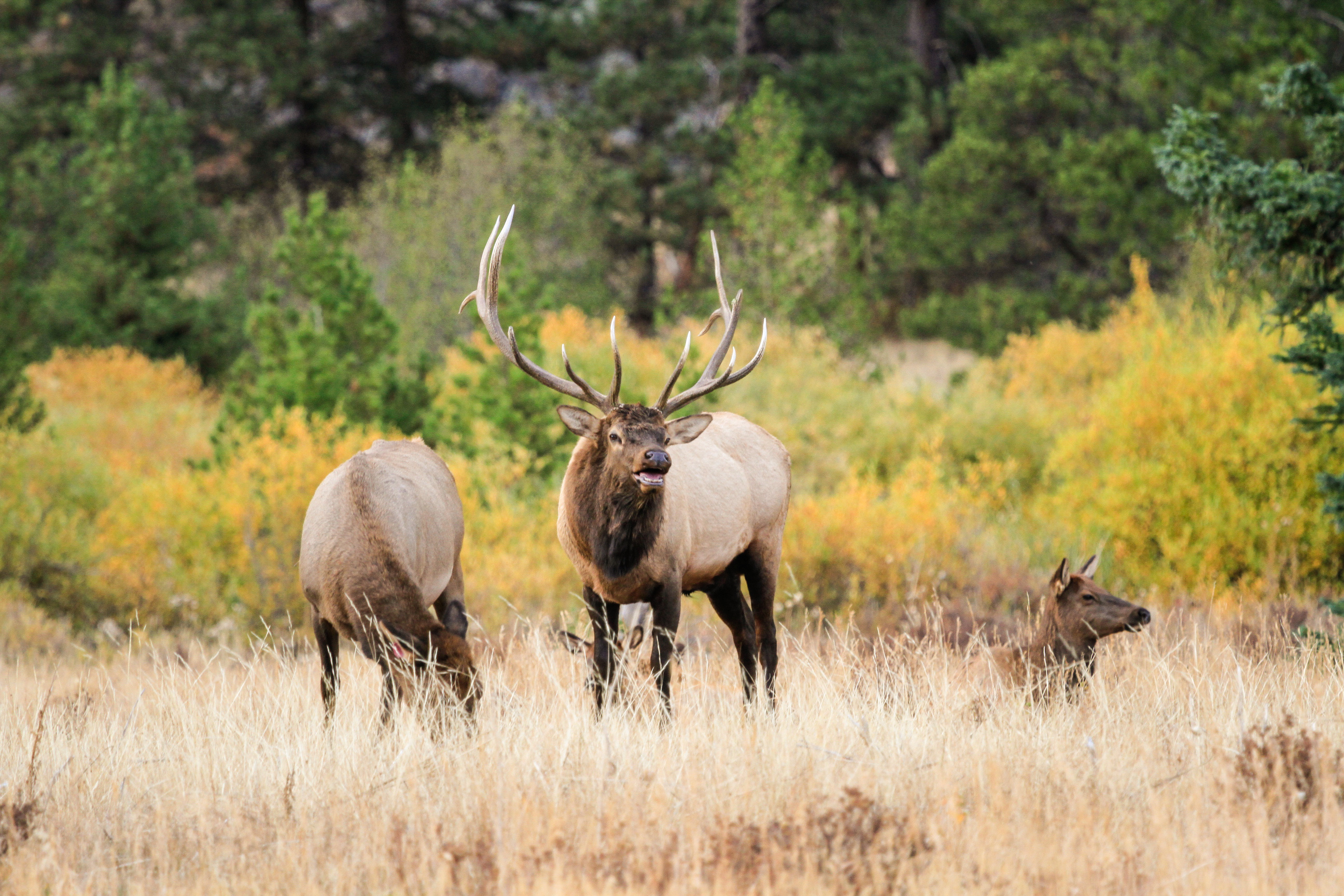
Beginning on Monday, September 1, annual meadow closures will go into effect in Rocky Mountain National Park to prevent the disturbance and harassment of elk during their fall mating season. Meadow closures are also in place for safety and enjoyment of park visitors who are enjoying wildlife viewing during the elk rut season.

Meadow closures will be in place between the hours of 5 p.m. to 10 a.m. Areas that are closed include meadow areas in Horseshoe Park, Upper Beaver Meadows, Moraine Park, Harbison Meadow and Holzwarth Meadow. During the specified hours, these meadow areas will be closed to all travel on foot or via horseback off established roads and trails. Meadow closures will remain in effect through October 31, 2025.
Fishing locations along the Fall River, Thompson River, and Colorado River that are accessed by walking through closed meadow areas are closed to fishing between the hours of 5 p.m. to 7 a.m.

Wildlife viewing is one of the most popular activities that visitors enjoy each fall. Keep your distance and view wildlife with respect. When viewing elk keep back at least 75 feet (23 m). This is the length of two school buses. It is our responsibility to keep our distance. Don’t keep approaching wildlife until they react to you. As always, elk calling and the use of spotlights or vehicle headlights for spotting wildlife is prohibited within Rocky Mountain National Park.


              ************************************************************************************

Check out our online trail guides:


Thursday, August 28, 2025

Moraine Park Campground Additional Release of Campsite Reservations From September 10 through September 27

Rocky Mountain National Park will be releasing additional campsite reservations at Moraine Park Campground beginning on Thursday, August 28 at 8 a.m. Mountain Time, for reservations for September 10 through September 27. Reservations will be available through www.recreation.gov.

The campground will close on September 28 to complete a few remaining construction items and is planned to reopen for winter camping opportunities on a first come, first serve basis on October 20.

The Moraine Park Campground and Utility Rehabilitation Project is a critical infrastructure project that is improving water, wastewater and electrical distribution systems that serve not only Moraine Park Campground, but also Beaver Meadows Visitor Center and Rocky Mountain National Park’s headquarters area and many other critical park facilities.


              ************************************************************************************

Check out our online trail guides:


Tuesday, August 26, 2025

Forest Service seeks comments on Southern Tenmile Range Access Plan

The White River National Forest seeks public comments on a multi-jurisdictional plan to improve recreation management in the southern Tenmile Range south of Breckenridge, including the popular Spruce Creek, McCullough Gulch, Blue Lakes and Quandary Peak areas.

The White River National Forest, Summit County, and Town of Breckenridge have developed the plan in coordination with the Town of Blue River, Colorado Springs Utilities, and other stakeholders. The southern Tenmile area currently receives approximately 237,000 annual visits, with visitation increasing each year. The area is also an important source of water for residents of Colorado Springs and Summit County.

“We simply do not currently have the facilities such as bathrooms to adequately manage this level of visitation,” said Acting Dillon Ranger Amanda Wheelock. “Taking steps now to provide more sustainably managed recreation will help us more sustainably manage recreational use and improve visitor experiences.”

The plan includes expanding the existing Quandary Peak/McCullough Gulch parking reservation and trailhead shuttle system to other access points and designated campsites within the project area, improving trailhead parking lots to include infrastructure such as bathrooms, shuttle stops, and signage, and trail improvements to create a more sustainable and connected system.

“Residents and visitors cherish the beautiful peaks, high alpine lakes and waterfalls at the southern end of Summit County,” said Summit County Open Space & Trails Coordinator Katherine King. “This plan aims to adequately manage the existing use – not increase it - so that we can enjoy this special place in its high quality, natural state for generations to come.”

“As partnering land managers, we have worked diligently to create a plan for the Southern Tenmile component of the Camp Hale National Monument that balances protecting natural resources with preserving a quality user experience. Public engagement is a critical next step in the process to ensure all voices are represented in crafting the best plan possible,” said Duke Barlow, Town of Breckenridge Open Space and Trails Manager.

The partners are hosting a public open house meeting Aug. 27 from 5 p.m. to 7 p.m. at the Breckenridge Recreation Center, 880 Airport Road, to provide more information and answer questions.

More information, including the proposal and how to comment, is available at https://cara.fs2c.usda.gov/Public/CommentInput?Project=68593. Comments will be most helpful if received by Sept. 15, 2025.


                *******************************************************************************

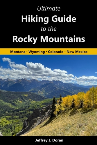
From Montana to New Mexico, the American Rockies stretch for more than a thousand miles. Within this spectacular mountain range are thousands of miles of hiking trails. With such an overwhelming number of options, how will you find and choose the most scenic and rewarding hikes?

Ultimate Hiking Guide to the Rocky Mountains takes all the guesswork out by focusing on some of the most amazing hikes across this range, and provides you with a handpicked list of options that will allow you to make the most of your trips in the Rockies:

Sunday, August 24, 2025

Recreation closures to support reintroduction of Colorado’s state fish

Temporary closures to public access will be in place from Aug. 25 to Aug. 31. near the boundary of Arapaho and Roosevelt National Forests and Rocky Mountain National Park while a multi-agency coalition conducts non-native fish removal. This effort is a critical step toward restoring native greenback cutthroat trout to the headwaters of the Cache la Poudre River. The greenback cutthroat trout is Colorado’s state fish and is listed as federally threatened under the U.S. Endangered Species Act.

This effort is part of the Poudre Headwaters Project, a collaboration between the USDA Forest Service, Colorado Parks and Wildlife, Rocky Mountain National Park, U.S. Fish and Wildlife Service, the Bureau of Land Management, Colorado Trout Unlimited, and Rocky Mountain Flycasters Trout Unlimited.

Due to the high level of activity during the implementation of this project, temporary closures will be in effect and include:

• Rocky Mountain National Park Closures: Portions of the Grand Ditch system, Colorado River Trail, and all upstream/downstream tributaries in the project zone.

• Sulphur Ranger District Closures (Grand County): Baker Gulch Trail (#29), Baker Pass Trail (#29.1) from its intersection with Parika Lake Trail (#29.2) to the Baker Gulch Trail; Bowen Gulch Trail (#119) from the park boundary to the Bowen Gulch Connector Trail (#119.1); Parika Creek and Baker Creek with a 300-foot buffer; Baker Gulch and tributaries with a 300-foot buffer.

• Canyon Lakes Ranger District Closures (Larimer County): La Poudre Pass Creek downstream to the inlet of Long Draw Reservoir; designated dispersed campsites near Grandview Campground (posts 23–29) with buffers; Grandview Campground.

These areas will be closed to all uses, including hiking and fishing, during treatment dates. Signs and placards will be posted at access points. All treated water flowing out of the treatment area will be detoxified with potassium permanganate, an oxidizing chemical that is commonly used in drinking water treatment.

To remove non-native fish from targeted waters, biologists will use rotenone, an Environmental Protection Agency-approved organic compound commonly used by state and federal land management agencies. Rotenone is an ideal tool for this purpose given that it works quickly and breaks down rapidly in the environment. When applied it only affects gilled organisms such as fish and some macroinvertebrates, animals without backbones that are large enough to be seen without the use of a microscope, and they have been shown to rapidly recolonize treated stream reaches. Rotenone will not harm other species that use the creeks or that eat the carcasses of fish. In addition, rotenone does not persist in the environment.

For additional information about the Arapaho and Roosevelt National Forests and to see the closure maps, visit www.fs.usda.gov/r02/arp/alerts/grand-ditch-and-tributaries-chemical-reclamation-area-and-trail-closures


              ************************************************************************************

Check out our online trail guides:


Friday, August 22, 2025

Colorado 14er hiking use up slightly in 2024

Hiking use on Colorado’s 14,000-foot peaks edged up 1.9 percent overall in 2024 to an estimated 265,000 hiker use days compared to the prior year according to Colorado Fourteeners Initiative’s 10th edition of the hiking use report. The reopening of the Decalibron Loop near Alma and a revised calculation for Mount Blue Sky were the largest factors increasing estimated hiking use, while declines at several top locations largely offset these higher levels. Fourteener hiking use peaked during the 2020 pandemic summer at 415,000 hiker days but has steadily returned to the mean since then.

“Opening or closing hiking access to a few key fourteeners has been a significant cause of fluctuating hiking use levels over recent years,” said Lloyd F. Athearn, executive director of Colorado Fourteeners Initiative (CFI). “With Mount Democrat becoming public land in 2024 and an electronic waiver system also in place by the landowner of Mount Lincoln, hiking use levels on the Decalibron Loop effectively doubled last year compared to 2023 when the loop was closed for half the season. However, reduced hiking use on perennial top-tier peaks, including Grays and Torreys Peaks and Mount Elbert, largely offset this increase. Tweaks to the modeling code also resulted in swings in estimated use for both Mount Blue Sky and Longs Peak that largely offset each other.”

In terms of the most popular fourteeners, Mount Bierstadt and Quandary Peak again topped the list in 2024 with use on both peaks estimated to be in the 25,000 to 30,000 hiker days range. Bierstadt’s trail counter captured data suggesting that hiking use on the mountain was above 28,000 days (a very slight decrease from 2023), while Quandary’s trail counter recorded more than 26,500 hiker days during the full season. Changes to one of the modeling factors—assuming most people climbed the 5.5 round-trip miles from Summit Lake rather than the 17 miles from Echo Lake—caused Mount Blue Sky to jump into the second tier (20,000 to 25,000 hiker use days). In 2023 Blue Sky was in the fourth tier (10,000 to 15,000 days). The best-guess estimate for Blue Sky last year was 20,600. Mount Elbert and Grays and Torreys Peaks, which had all been in the second tier of use in 2023, fell to the third tier in 2024, suggesting only 15,000 to 20,000 climbers hiked those mountains. Best-guess estimates were 17,200 for Elbert and 18,400 for Grays/Torreys. The Decalibron Loop (Mounts Democrat, Cameron, Lincoln and the Bross bypass), which was in the 7,000-to-10,000 range in 2023 due to a key landowner closure, rebounded in 2024 to the 15,000-to-20,000 range. The best-guess Decalibron Loop estimate was 15,300.

In 2024, an estimated 54 percent of statewide hiking use (144,344 hiker days) occurred on the 12 closest fourteeners to the metro area (Front Range, Tenmile Range, Mosquito Range and Mount Elbert). The remaining 46 peaks accounted for 120,656 hiker days.

Compared to 2023, hiking use in 2024 fell in three mountain ranges: Sawatch Range (-7500 days, -8.9 percent), Sangre de Cristo Range (-1500 days, -15 percent), and the Tenmile Range (-500 days, -1.9 percent). Hiking use was up in in four ranges: Mosquito Range (+8000 days, +55 percent), San Juan Mountains (+3000, +9.2 percent), Front Range (+2000 days, 2.4 percent), and the Elk Mountains (+1500 days, +20 percent).

Several factors could be influencing CFI’s estimated hiking levels. The State Demographer’s Office noted much slower population growth recently than in prior decades, with additional demographic changes that could affect the population hiking 14ers. The population aged under 18 declined in absolute terms, those between 25 and 44 grew at a considerably reduced rate, while those over age 65 increased significantly. A recent report from the Colorado Tourism Office detailed a decrease in overnight visitors to the mountains last summer. The statewide economic impact of hiking Colorado fourteeners in 2024 was $71.9 million, based on historic fourteener hiking use expenditure studies.

Access to Mount Lindsey in the southern Sangre de Cristo Range was closed to public use the entire season due to landowner liability concerns. People continued to climb the peak as tresspassers, but at lower levels than usual.

CFI maintained a network of 23 counter locations in 2024. Counters that had observed data for more than 90 percent of the season included Mount Bierstadt (93 percent), Quandary Peak (100 percent), and Kit Carson/Challenger Point (100 percent). Counters that collected between 60 and 90 percent of the season included: Grays/Torreys (74 percent), Bross (68 percent), La Plata (71 percent), Shavano (74 percent), Handies (77 percent), Sneffels (62 percent), Wilson Peak (62 percent), and Redcloud/Sunshine (77 percent).

CFI’s most recent estimate of hiking use suggests a statewide economic impact of $71.9 million directly attributable to hiking fourteeners based on economic expenditure studies performed by Colorado State University economists John Loomis and Catherine Keske. Their 2009 study found that climbers of Quandary Peak near Breckenridge spent an average of $271.17 per day for gasoline, food, lodging, equipment, and other retail purchases.i This expenditure estimate has not been updated in more than a decade, so it is likely understated. CFI’s hiking use projections are based on the combination of several data sources. 1) CFI collected hourby-hour data during the 2024 hiking season using compact infrared trail counters that were placed at 23 locations adjacent to summit hiking trails servicing 22 fourteener peaks. Hiking use is estimated for the period between May 26 and October 5. Missing data were modeled using a linear model incorporating week number, day of the week, holiday and use levels on other similar peaks, which has shown to be statistically accurate. 2) Hiking use projections for all other fourteeners were based on crowdsourced “14er checklists” submitted to the 14ers.com website by more than 25,900 individual hikers. Estimates for peaks without trail counters were determined using a trend line calculated by the relative frequency of reported hiking use on all peaks using data points as anchors for peaks that had trail counters in 2024.

CFI began deploying compact infrared trail counters as part of a pilot program in 2014 at five locations: Grays/Torreys, Castle, Quandary, Redcloud/Sunshine, and Handies Peaks (American Basin). The program was expanded in 2015 to five additional locations: Mt. Elbert (3 locations), Mt. Democrat, and Handies Peak (Grizzly Gulch). Additional funding in 2016 allowed CFI to add 10 new monitoring locations: Mounts Sneffels, Sherman, Princeton, Antero, and Shavano, La Plata, Huron Peak and Wilson Peak, Challenger Point/Kit Carson Peak and Blanca Peak/Ellingwood Point. In 2017, the Antero counter was moved to the Winfield approach to La Plata Peak. In 2018, two new counters were deployed on Pikes Peak (Barr Trail and Devil’s Playground), while the La Plata (Winfield) counter was moved to the West Ridge of Quandary, and the Princeton counter was moved to Mt. Lindsey. In 2020 the West Ridge of Quandary counter was moved to a better location on Mt. Princeton, while a new counter was deployed to Mt. Bierstadt. In 2024 the Bierstadt counter was replaced for a third time—two counters were stolen over consecutive years—and counters were placed on Bross and the Winfield approach to La Plata. The Lindsey and Blanca/Ellingwood counters were not placed in 2024 for staffing reasons.

CFI uses the term “hiker use days” to report hiking use on the fourteeners. This represents one person hiking one peak on one day. Anecdotally we know that individual enthusiasts may hike multiple fourteeners over the course of a given year, including climbing the same peak multiple times. Using “hiker use days” reports the number of days of hiking use that occurred but does not represent the number of individual people who hiked fourteeners that year.


                *******************************************************************************

From Montana to New Mexico, the American Rockies stretch for more than a thousand miles. Within this spectacular mountain range are thousands of miles of hiking trails. With such an overwhelming number of options, how will you find and choose the most scenic and rewarding hikes?

Ultimate Hiking Guide to the Rocky Mountains takes all the guesswork out by focusing on some of the most amazing hikes across this range, and provides you with a handpicked list of options that will allow you to make the most of your trips in the Rockies: