In 2014 Outside Magazine ranked the Keyhole Route on Longs Peak in Rocky Mountain National Park as one of the 20 most dangerous hikes in the world. The article cited the peak's narrow ledges and its exposure to steep cliffs as some of the primary reasons as to why so many people have died while trying to reach its summit. Being located in a very popular national park, as well as being in close proximity to several major population centers, it's also one of the most popular fourteeners in Colorado. An estimated 10,000 to 15,000 hikers and climbers reach the summit each year (compared to just 260 in 1915, or 623 in 1916). Although the standard route isn't a technical climb, as Outside points out, it's still relatively easy for inexperienced climbers to get in over their heads. All of this is a recipe for disaster, as many people have fatally discovered.
To put a finer point on this risk, park spokeswoman Kyle Patterson was quoted in the National Parks Traveler in 2018, where she stated that; "We are one of the busiest search-and-rescue operations parks in the National Park Service. Last year we were the third busiest. Approximately 20 percent of our overall SAR incidents this year have occurred in the Longs Peak/Mount Meeker areas."
Roughly eight years ago I published a blog that reviewed some basic statistics on the people who have died while climbing Longs Peak. That post was based on a list of all deaths on the mountain published in the Summer 2011 edition of Trail & Timberline, a quarterly publication from the Colorado Mountain Club. Since the publication of that article, and my blog post, the peak has claimed several more lives. In this blog post I wanted to provide an updated review of the general statistics, offer a few observations into recent trends, and see if there's anything prospective climbers can learn from them.
Between 1915, the year Rocky Mountain was established as a national park, and 2021, a total of 387 park visitors have died as a result of accidents, car crashes, heart attacks and various other reasons. Included within those statistics are 71 fatalities associated with climbing Longs Peak. The following are a few observations from the data collected by the national park:
* Among the 71 fatalities recorded on Longs Peak between 1915 and 2021, only 4 were women. This may have a lot to do with the ratio of men versus women climbing the mountain, but could also suggest that women take less risks or are much more careful. Unfortunately there's not enough data to make any solid conclusions regarding this. Interestingly, the first person to die on the mountain was a woman. After successfully reaching the summit on September 23, 1884, Carrie J. Welton died of exhaustion and hypothermia while descending the Keyhole Route. Ms. Welton also has the distinction of being the first known person to die within the boundaries of the future national park. No woman has died on the mountain since 1972.
* The average age for those that have died while climbing the mountain is 32.4 years of age. The oldest person to die was 75 when he slipped on ice along the Narrows section of the Keyhole Route. Throughout the lifespan of the park there have been two 16-year-olds that have perished on the peak; one in 1932, and the other in 1980. A total of 10 victims were teenagers, which represents roughly 14% of all deaths. Just over 59% of all victims were under the age of 30.
* Interestingly, however, during the eleven years between 1999 and 2009, the average age among the 11 climbers that died during that time period unexplainably jumped to 47. Since then, the average age among the 14 victims that have died since 2009 has reverted back to 33.0 years of age, which is roughly equal to the long-term average.
* During the second decade of the 21st Century the mountain claimed 13 lives, tying it with 1970s for two most deadliest decades on record.
* Just over 70% of all deaths were the result of a fall - most of them un-roped.
* The technical East Face route has witnessed 15 deaths over the lifespan of the park. The popular Keyhole Route, however, has reported the most fatalities during that same time period. Twenty people have lost their lives while climbing above the Keyhole. Nine of those deaths have occurred since 2009. Additionally, three other people have died at or near the Keyhole, while another died of hypothermia at the Boulder Field. An additional 4 other people have died while hiking on the Longs Peak Trail (below the Boulder Field) - all were heart attack victims.
* Both the Homestretch and the Ledges on the Keyhole Route have witnessed the most fatalities of any one location on the mountain. Both have recorded 6 deaths since 1915.
* 20 people have died on the mountain for reasons other than falls, including 8 from hypothermia, 6 from heart attacks, 3 by lightning, and 3 from exhaustion and exposure. Two people have died as a result of suicide, including one person who ingested anti-freeze at the Narrows in 1979. The young man was reported to be depressed over inadequate scores on his medical school entrance exams.
* As you might expect, the vast majority of deaths have occurred during the summer climbing months. 21 deaths, or nearly 30% of all deaths were recorded in the month of August. Nearly 65% of all fatalities occurred during the summer months of July, August and September. Surpringly, the month of January has seen the same number of deaths as June - 6 in each of those months.
* Perhaps the most famous person to perish on the mountain was Agnes Vaille. On January 25, 1925, Ms. Vaille became the first woman to climb Longs Peak in the winter. While making her descent along the Keyhole Route, Vaille slipped and fell about 150 feet. Spent with fatigue, Vaille insisted she needed a short nap, but froze to death before her hiking partner could bring back help. Today, just below the Keyhole, is the Agnes Vaille Shelter. Built as a memorial to Ms. Vaille, the rock shelter also serves as a refuge for hikers and climbers in need.
* One other notable death occurred in 1889 - prior to the park's establishment. Frank Stryker was descending along the Homestretch on the Keyhole Route (according to Death, Daring & Disaster he was still ascending) when a loaded pistol fell out of his pocket and discharged into his neck. You could say there was a bit of karma involved. The 28-year-old was taking pleasure in launching large boulders down the mountain. The newspaper account at the time said "he announced his intentions of sending off a particularly huge stone" just before the accident occurred. The man continued to cling to life for ten more hours while his companions attempted to transport him down the mountain on a makeshift litter.
If you're considering a hike to the Keyhole or Chasm Lake, or even a climb to the summit of Longs Peak, it's always a good idea to know your limits and to respect the mountain. The park website warns that the Keyhole Route "is not a 'walk in the park.' This is much more than a hike. This is a climb, a classic mountaineering route that should not be underestimated."
* For more information on hiking to the Keyhole, please click here.
* For more information on hiking to Chasm Lake, please click here.
*******************************************************************************
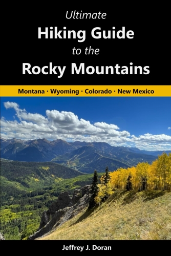
From Montana to New Mexico, the American Rockies stretch for more than a thousand miles. Within this spectacular mountain range are thousands of miles of hiking trails. With such an overwhelming number of options, how will you find and choose the most scenic and rewarding hikes?
Ultimate Hiking Guide to the Rocky Mountains takes all the guesswork out by focusing on some of the most amazing hikes across this range, and provides you with a handpicked list of options that will allow you to make the most of your trips in the Rockies:
Thursday, March 25, 2021
Tuesday, March 23, 2021
Colorado Parks and Wildlife Commission approves 20 Recreational Trail Grants, providing more opportunities for Coloradans to get outside
The Colorado Parks and Wildlife Commission unanimously approved recommended trail-funding allocations for the 2021 Non-Motorized Trail Grants at its virtual meeting on March 18.
Non-Motorized Trail Grants
There were a total of 20 Recreational Trail Grants funded this year totaling $3,520,752. Statewide Trails Program Manager Fletcher Jacobs highlighted the Colorado Recreational Trails Committee’s wildlife review process and the importance of balancing wildlife and habitat needs with recreation needs in Colorado. “These trail projects will connect Coloradans to the outdoors with new and improved trails and provide more places for everyone to get outside,” Jacobs said.
The Non-motorized Trail Grant Program is a multi-agency funding partnership that includes Great Outdoors Colorado, Colorado Lottery, Federal Recreational Trails Program funds and Federal Land and Water Conservation funds. This grant program provides funding for trail planning projects as well as small and large trail construction and maintenance projects.
Grant Stats
Construction: 3 grants totaling $749,487
Maintenance: 9 grants totaling $1,009,228
Planning: 2 grants totaling $89,300
Support: 2 grants totaling $90,000
Land and Water Conservation Fund: 4 grants totaling $1,582,752
Some of the highlights from this year’s awarded projects include:
North Mt. Elbert Trail Maintenance (Maintenance Grant)
The Non-motorized Trail Grant Program is a multi-agency funding partnership that includes Great Outdoors Colorado, Colorado Lottery, Federal Recreational Trails Program funds and Federal Land and Water Conservation funds. This grant program provides funding for trail planning projects as well as small and large trail construction and maintenance projects.
Grant Stats
Construction: 3 grants totaling $749,487
Maintenance: 9 grants totaling $1,009,228
Planning: 2 grants totaling $89,300
Support: 2 grants totaling $90,000
Land and Water Conservation Fund: 4 grants totaling $1,582,752
Some of the highlights from this year’s awarded projects include:
North Mt. Elbert Trail Maintenance (Maintenance Grant)
This $245,000 grant award will allow the National Forest Foundation to work with the Leadville Ranger District, local youth corps crews, and other partners to complete the final rehabilitation phase of a multi-year project on Colorado’s highest peak. This phase will prioritize needs on 3.5 miles of the North Mt. Elbert Trail for maintenance and restoration, including a 0.25-mile technical trail alignment between 13,400 and 13,680 feet. The NFF and partners will maintain and restore the fragile alpine tundra and ensure long-term sustainable access to the summit.
A complete list of the Recreational Trail Grants is available here.
Jeff
RockyMountainHikingTrails.com
HikinginGlacier.com
TetonHikingTrails.com
Ramble On: A History of Hiking
Exploring Glacier National Park
Exploring Grand Teton National Park
Jeff
RockyMountainHikingTrails.com
HikinginGlacier.com
TetonHikingTrails.com
Ramble On: A History of Hiking
Exploring Glacier National Park
Exploring Grand Teton National Park
Saturday, March 20, 2021
Cameron Peak Fire Area Closure Update
Another area impacted by the Cameron Peak Fire has opened, following the opening of numerous areas in February. The new area opening up is north of County Road 44H (Buckhorn Rd.) and south of Old Flowers Road. This does not open any additional roads or trails within the fire perimeter, but does open up some general forest area. Visitors to the area are reminded there are safety hazards within burn areas to be aware of, including but not limited to, falling trees, flood risks, stump holes and rock fall danger.
Most areas impacted by the fire remain closed for safety and natural resource protection. The general area that remains closed is all National Forest System lands east of the Laramie River Road north of the West Branch Trailhead and east of Colorado State Forest State Park south of the trailhead; west of County Roads 69, 63E, and 27; south of County Road 86; and north of Rocky Mountain Park and County Road 43. Details of the latest closure and map are available on the Forest website.
Other areas that have reopened this year include the Lower Dadd Gulch Trail, Chambers Lake and Access Road, Long Draw Road (for over-snow use only and no overnight use), Long Draw Reservoir, the Neota Wilderness and the Joe Wright Ski Trail. The Zimmerman Lake Trailhead and restroom (which opens Zimmerman Lake, Zimmerman Loop, upper portion of the Meadows Trail and Montgomery Pass trails); Cameron Pass Trailhead and restroom (which opens the Cameron Connection Trail); and Joe Wright Trailhead and restroom (reservoir is open for ice fishing when appropriate) are open, along with the Long Draw ski route and the lower portion of Meadows Trail. For these open trails and road, the area opened is 50 feet on either side of the trail or road.
Crews continue to evaluate other recreation areas as conditions allow. Forest Service staff and volunteer trail crews from the Cameron Peak Nordic Rangers and Poudre Wilderness Volunteers have worked hard in areas that are open. There are more than 120 miles of Forest Service trails within the Cameron Peak Fire perimeter and over 350 miles of Forest Service roads. Most areas will not be safely accessible for evaluation until after the snow melts. Many factors come into play when determining when an area can reopen. Beyond the immediate risk of hazard trees, considerations need to be made for trail markers, erosion control and trail stabilization issues, damaged infrastructure like bridges, and safety signage. The district is hopeful a few more areas will open before Memorial Day, but this will be heavily dependent on impacts from spring runoff.
Jeff
RockyMountainHikingTrails.com
HikinginGlacier.com
TetonHikingTrails.com
Ramble On: A History of Hiking
Exploring Glacier National Park
Exploring Grand Teton National Park
Most areas impacted by the fire remain closed for safety and natural resource protection. The general area that remains closed is all National Forest System lands east of the Laramie River Road north of the West Branch Trailhead and east of Colorado State Forest State Park south of the trailhead; west of County Roads 69, 63E, and 27; south of County Road 86; and north of Rocky Mountain Park and County Road 43. Details of the latest closure and map are available on the Forest website.
Other areas that have reopened this year include the Lower Dadd Gulch Trail, Chambers Lake and Access Road, Long Draw Road (for over-snow use only and no overnight use), Long Draw Reservoir, the Neota Wilderness and the Joe Wright Ski Trail. The Zimmerman Lake Trailhead and restroom (which opens Zimmerman Lake, Zimmerman Loop, upper portion of the Meadows Trail and Montgomery Pass trails); Cameron Pass Trailhead and restroom (which opens the Cameron Connection Trail); and Joe Wright Trailhead and restroom (reservoir is open for ice fishing when appropriate) are open, along with the Long Draw ski route and the lower portion of Meadows Trail. For these open trails and road, the area opened is 50 feet on either side of the trail or road.
Crews continue to evaluate other recreation areas as conditions allow. Forest Service staff and volunteer trail crews from the Cameron Peak Nordic Rangers and Poudre Wilderness Volunteers have worked hard in areas that are open. There are more than 120 miles of Forest Service trails within the Cameron Peak Fire perimeter and over 350 miles of Forest Service roads. Most areas will not be safely accessible for evaluation until after the snow melts. Many factors come into play when determining when an area can reopen. Beyond the immediate risk of hazard trees, considerations need to be made for trail markers, erosion control and trail stabilization issues, damaged infrastructure like bridges, and safety signage. The district is hopeful a few more areas will open before Memorial Day, but this will be heavily dependent on impacts from spring runoff.
Jeff
RockyMountainHikingTrails.com
HikinginGlacier.com
TetonHikingTrails.com
Ramble On: A History of Hiking
Exploring Glacier National Park
Exploring Grand Teton National Park
Wednesday, March 17, 2021
USDA Forest Service Rocky Mountain Region Invests in Infrastructure Improvements on National Forests in Colorado, Kansas, Nebraska, South Dakota, and Wyoming
The USDA Forest Service announced the investment of $285 million to fund Great American Outdoors Act projects in 2021. Of this amount, approximately $31.5M will go to the Rocky Mountain Region to fund ninety projects. This is a five-year program and similar dollar amounts are expected over the next five years. This significant influx of funding will be used to address infrastructure and deferred maintenance needs, enhance economic benefits, and improve recreation and public access on national forests by leveraging National Parks and Public Land Legacy Restoration Funds provided by Congress.
Specifically, the funds will be used to modernize recreation facilities, improve roadways, upgrade campgrounds, design and build new trails or rehabilitate existing trails, repair water systems and update toilets, to name just a few of the wide range of projects slated for the Rocky Mountain Region.
“The Legacy Restoration Funds will allow us to address a backlog of maintenance projects across the region,” said Tammy Angel, Acting Regional Forester. “We are thrilled to be moving forward with much needed improvements to transportation infrastructure and recreation facilities and we are committed to accomplishing all of the funded projects,” she added.
This year’s $31.5 million investment is made possible by the newly created National Parks and Public Land Legacy Restoration Fund, established in 2020 by the Great American Outdoors Act. These funds will allow the Forest Service’s Rocky Mountain Region to implement more than ninety infrastructure improvement projects essential to the continued use and enjoyment of national forests lands.
The projects will also serve as a catalyst for economic development and employment opportunities in rural communities. These new investments will strengthen shared stewardship of national forests and grasslands by expanding the Forest Service work with public and private partners.
Projects funded by the Legacy Restoration Fund will contribute to efforts to develop more sustainable infrastructure resilient to climate change impacts. Projects may also address Administration objectives to provide improved recreational opportunities and access to underserved communities.
For more information on these projects in the Rocky Mountain Region, visit the Rocky Mountain Region GAOA website.
Jeff
RockyMountainHikingTrails.com
HikinginGlacier.com
TetonHikingTrails.com
Ramble On: A History of Hiking
Exploring Glacier National Park
Exploring Grand Teton National Park
Specifically, the funds will be used to modernize recreation facilities, improve roadways, upgrade campgrounds, design and build new trails or rehabilitate existing trails, repair water systems and update toilets, to name just a few of the wide range of projects slated for the Rocky Mountain Region.
“The Legacy Restoration Funds will allow us to address a backlog of maintenance projects across the region,” said Tammy Angel, Acting Regional Forester. “We are thrilled to be moving forward with much needed improvements to transportation infrastructure and recreation facilities and we are committed to accomplishing all of the funded projects,” she added.
This year’s $31.5 million investment is made possible by the newly created National Parks and Public Land Legacy Restoration Fund, established in 2020 by the Great American Outdoors Act. These funds will allow the Forest Service’s Rocky Mountain Region to implement more than ninety infrastructure improvement projects essential to the continued use and enjoyment of national forests lands.
The projects will also serve as a catalyst for economic development and employment opportunities in rural communities. These new investments will strengthen shared stewardship of national forests and grasslands by expanding the Forest Service work with public and private partners.
Projects funded by the Legacy Restoration Fund will contribute to efforts to develop more sustainable infrastructure resilient to climate change impacts. Projects may also address Administration objectives to provide improved recreational opportunities and access to underserved communities.
For more information on these projects in the Rocky Mountain Region, visit the Rocky Mountain Region GAOA website.
Jeff
RockyMountainHikingTrails.com
HikinginGlacier.com
TetonHikingTrails.com
Ramble On: A History of Hiking
Exploring Glacier National Park
Exploring Grand Teton National Park
Saturday, March 13, 2021
Winter Storm Warning until MON 6:00 AM MDT
The following weather bulletin was posted earlier this morning:
Issued By
Issued By
Denver/Boulder - CO, US, National Weather Service
Affected Area
Affected Area
Rocky Mountain National Park and the Medicine Bow Range, The Mountains of Summit County, the Mosquito Range, and the Indian Peaks, The Northern Front Range Foothills, and The Southern Front Range Foothills
Description
Description
...WINTER STORM WARNING REMAINS IN EFFECT UNTIL 6 AM MDT MONDAY...
WHAT...Heavy snow. Total snow accumulations of 2 to 4 feet possible with the heaviest totals in the northern Front Range Foothills. Locations west of the Eisenhower Tunnel will receive 8 to 16 inches. Winds could gust as high as 35 mph.
WHERE...Rocky Mountain National Park and the Medicine Bow Range, The Mountains of Summit County, the Mosquito Range, and the Indian Peaks, The Northern Front Range Foothills, and The Southern Front Range Foothills.
WHEN...Until 6 AM MDT Monday.
IMPACTS...Travel could be very difficult to impossible.
PRECAUTIONARY/PREPAREDNESS ACTIONS...
If you must travel, keep an extra flashlight, food, and water in your vehicle in case of an emergency. The latest road conditions for Colorado can be obtained by calling 5 1 1 or by going to www.cotrip.org
More Information
WHAT...Heavy snow. Total snow accumulations of 2 to 4 feet possible with the heaviest totals in the northern Front Range Foothills. Locations west of the Eisenhower Tunnel will receive 8 to 16 inches. Winds could gust as high as 35 mph.
WHERE...Rocky Mountain National Park and the Medicine Bow Range, The Mountains of Summit County, the Mosquito Range, and the Indian Peaks, The Northern Front Range Foothills, and The Southern Front Range Foothills.
WHEN...Until 6 AM MDT Monday.
IMPACTS...Travel could be very difficult to impossible.
PRECAUTIONARY/PREPAREDNESS ACTIONS...
If you must travel, keep an extra flashlight, food, and water in your vehicle in case of an emergency. The latest road conditions for Colorado can be obtained by calling 5 1 1 or by going to www.cotrip.org
More Information
...POWERFUL WINTER STORM ON TRACK FOR THIS WEEKEND...
.A significant late season winter storm now across Utah and Arizona will move to near the Four Corners region by midday today, and then track east/northeast across southeast Colorado Sunday. This track will bring significant snowfall to much of northeast and north central Colorado, and likely result in difficult if not impossible travel from late Saturday afternoon or evening through Sunday and Sunday night. The most severe conditions from deep accumulating snow will likely occur in and near the Front Range Mountains and Foothills where 2 to 4 feet of snow may fall, and along the I-25 Urban Corridor where up to 2 feet of snow can be expected. The favored locations for the heaviest snow totals along the I-25 Corridor will be from Boulder north through the Fort Collins area. Temperatures will be warm enough to bring a mix of rain and snow to areas east of a Fort Morgan to Limon line today into Saturday evening, but temperatures should turn cold enough there Saturday night into Sunday for mostly snow. Winds are also expected to increase by Sunday, with blowing and drifting snow possible across the plains.
For the latest updates and forecasts, please click here.
Jeff
RockyMountainHikingTrails.com
HikinginGlacier.com
TetonHikingTrails.com
Ramble On: A History of Hiking
Exploring Glacier National Park
Exploring Grand Teton National Park
.A significant late season winter storm now across Utah and Arizona will move to near the Four Corners region by midday today, and then track east/northeast across southeast Colorado Sunday. This track will bring significant snowfall to much of northeast and north central Colorado, and likely result in difficult if not impossible travel from late Saturday afternoon or evening through Sunday and Sunday night. The most severe conditions from deep accumulating snow will likely occur in and near the Front Range Mountains and Foothills where 2 to 4 feet of snow may fall, and along the I-25 Urban Corridor where up to 2 feet of snow can be expected. The favored locations for the heaviest snow totals along the I-25 Corridor will be from Boulder north through the Fort Collins area. Temperatures will be warm enough to bring a mix of rain and snow to areas east of a Fort Morgan to Limon line today into Saturday evening, but temperatures should turn cold enough there Saturday night into Sunday for mostly snow. Winds are also expected to increase by Sunday, with blowing and drifting snow possible across the plains.
For the latest updates and forecasts, please click here.
Jeff
RockyMountainHikingTrails.com
HikinginGlacier.com
TetonHikingTrails.com
Ramble On: A History of Hiking
Exploring Glacier National Park
Exploring Grand Teton National Park
Subscribe to:
Posts (Atom)


