Today, Governor Polis and Colorado Parks and Wildlife (CPW) released the 2025 Statewide Comprehensive Outdoor Recreation Plan (SCORP), which outlines a path to ensure Colorado’s exceptional outdoor experiences remain world-class for current and future generations.
“Outdoor recreation is a major economic driver in Colorado and this report shows just how big of an impact outdoor recreation has, supporting 404,000 jobs and generating billions in revenue. This plan lays out a strategic path forward to ensure that everyone can enjoy our great outdoors while building on this economic success. Through this plan, CPW and our administration will continue to improve recreational opportunities that ensure Coloradans and visitors are able to enjoy our world-class outdoors and beautiful landscapes while conserving our resources for future generations,” said Governor Jared Polis.
According to the report, in 2023 outdoor recreation generated $65.8 billion in economic output; $36.5 billion in GDP (8.5% of the entire state GDP); supported 404,000 jobs (12.5% of the labor force); and generated $11.2 billion in local, state, and federal tax revenue.
Following the release of two economic reports showing the importance of outdoor recreation to Colorado’s economy — a SCORP study and the U.S. Bureau of Economic Analysis Outdoor Recreation Satellite account — the SCORP presents a five-year action plan with four key priorities for ensuring that recreation remains world class in the state. These priorities are: 1) Access and Opportunity, 2) Stewardship, 3) Land, Water and Wildlife Conservation, and 4) Financial Sustainability.
“With this statewide plan, Colorado Parks and Wildlife conducted extensive research and stakeholder engagement in order to better understand how outdoor recreation resources meet the needs of Coloradans, as well as the challenges and opportunities faced by land managers,” said CPW Director Jeff Davis. “As the 2025 SCORP confirms, outdoor recreation is essential to Colorado's economy and quality of life and CPW looks forward to putting this plan into action to ensure that recreation remains outstanding for future generations.”
This plan was written with extensive input from land managers, outdoor recreation providers, user groups, nonprofit organizations and other stakeholders. Priorities and action items reflect the top issues identified by extensive partner engagement. As part of the plan’s development, 479 land managers participated in a survey earlier this year representing local parks, open space, and state and federal public lands. According to the survey, land managers identified trails as a top priority, including the need to invest in maintenance, development of new trails and connections for existing trails through loops and networks. Managers also identified visitor safety, the need for improved access and infrastructure for Americans with disabilities, and the need for more capacity and funding for management and infrastructure.
While growth in outdoor recreation has slowed since the COVID pandemic, people are still enjoying Colorado’s outdoors in growing numbers. According to the 2025 SCORP public survey, 72% of Coloradans recreate outdoors once a week or more. The SCORP applauds Coloradans getting outdoors and spending time in nature, while also presenting actions to ensure that the outdoors support wildlife, species biodiversity and ecosystem function. Since the last SCORP was released five years ago, Colorado has seen extensive wildfires, drought and flooding which have caused trail closers and displaced recreational activities. Among the priorities presented in the 2025 SCORP, strategies call out building a stewardship ethic, integrating climate resilience into recreation planning and management, and building capacity for government and nongovernmental organizations that provide for and support outdoor recreation in Colorado.
“Colorado Parks and Wildlife is greatly appreciative to the contributions of everyone involved in the creation and publication of the 2025 SCORP, including members of the Colorado Outdoor Partnership and the many other organizational partners who provided valuable input,” said Fletcher Jacobs, Assistant Director for CPW Outdoor Recreation and Lands. “Together, the partners identified priority areas and outlined the goals, objectives and strategies necessary to balance the needs of those who live and recreate in Colorado with the needs of the wildlife and landscapes that make Colorado recreation exceptional,” Jacobs said.
Colorado continues to advance nation-leading outdoor recreation and conservation efforts and the 2025 SCORP is both informed by and informs coordinated efforts such as the ongoing work with Colorado's Outdoors Strategy among many other efforts. To read the full SCORP, including priorities and research findings on outdoor recreation in Colorado, go to: cpw.state.co.us/plans-and-reports.

Sunday, December 29, 2024
Thursday, December 26, 2024
Colorado First Day Hikes 2025
On Jan. 1, 2025, Colorado Parks and Wildlife (CPW) invites you to participate in a First Day Hike at a Colorado state park.
First Day Hikes offers a chance to start 2025 off on the right foot by exercising in nature. Each participating state park provides a unique opportunity to enjoy self-guided hikes, scavenger hunts or guided hikes.
About First Day Hikes:
Hikes are free, but park visitors must possess a valid state park pass (this includes a Keep Colorado Wild Pass purchased through the DMV during a vehicle registration). Hikes will vary in skill level and length depending on location and weather conditions. Participating parks may require a reservation before the hike; check the park’s webpage for details. For a list of the first day hikes being offered, please click here.
Monday, December 23, 2024
Rocky Mountain National Park to Host a Variety of Fun Programs for All Ages on the West Side of the Park During Winter 2025
For many, winter is their favorite time of year to visit Rocky Mountain National Park. The park is less crowded, yet alive with activity. For those who are prepared, winter is an enchanting time to explore the scenic beauty of the southern Rockies.
Interested in experiencing the wonders of the west side of Rocky Mountain National Park with a park ranger? Weather and snow conditions permitting, beginning on Saturday, January 4, and continuing through late-March, enjoy one of RMNP’s ranger-led winter programs! These programs will take place at various locations inside the park near the town of Grand Lake, CO.
Join a Snowshoe Walk
Enjoy the quiet of winter in Rocky as you walk across a snow-covered landscape using snowshoes. These snowshoe walks are two-hours in length and program participants will walk through hilly, uneven, snow-covered meadows and mixed conifer forest areas within Rocky Mountain National Park. Along the way, learn about plants and wildlife that call the park home. No previous snowshoe experience is required. These walks are considered moderately strenuous. Participants should have a baseline fitness level that allows them to snowshoe approximately one mile over hilly terrain at high elevations. These programs take place at 8,700-9,300 feet in elevation.
Ranger-led Snowshoe Walks are free (park entrance fees are required). These programs will take place on Saturdays & Sundays at 1 p.m. and advanced reservations are required. It is recommended to plan ahead when possible, as these programs are very popular and fill quickly.
To make a reservation, call 970-586-1513. Reservations can be scheduled up to seven days in advance of a scheduled program. A maximum of 6 people in the same group may sign up per walk. Participants must be 8 years or older.
New in 2025: Family-Friendly Snowshoe Walks
Rocky Mountain National Park is offering a new program this year, Family-Friendly Snowshoes Walks! Designed for families with children ages 5 and older, these programs offer a great way for the whole family to get outside and explore the wonders of winter in Rocky. These snowshoe walks are two-hours in length.
Family-Friendly Snowshoe Walks will take place at 1 p.m. on the following Fridays: February 7, 14, 21, and 28. Advanced reservations are required and these programs are expected to fill quickly. To make a reservation, call 970-586-1513.
To Participate in a Snowshoe Walk, What Equipment is Provided?
For all Ranger-led Snowshoe Walks on the west side of RMNP, snowshoes are provided for your use. A range of adult and child sizes are available and all snowshoes must be turned in at the end of the program. Planning to go snowshoeing on your own? Visitors can rent snowshoes at locations outside of the park or bring their own.
For your comfort and safety, program participants are encouraged to wear appropriate clothing to help keep you warm. Recommended items include waterproof winter jackets, snow pants, warm socks, waterproof boots, gloves/mittens, a hat, and sunglasses or goggles.
Ranger-led Cross-Country Ski Tours
Do you like to go cross-country skiing? Would you like to go skiing with an experienced ranger guide? Beginning on Saturday, January 18, Ranger-led Cross-Country Ski Tours will be available on Saturdays at 10 a.m. Weather and snow conditions permitting, they will continue through March 15.
To participate, some cross-country skiing experience is required. Program participants must be 16 or older. These programs are expected to fill quickly and advanced reservations are required. To make a reservation, call 970-586-1513. Space is limited to 12 people per program and a maximum of 4 people in the same group may sign up per program. Participants must bring or rent their own skis. Equipment rentals are available outside of the park.
For more information on all winter interpretive programs, visit the park’s webpage at www.nps.gov/romo/planyourvisit/ranger-led-snowshoe-walks.htm.
Saturday, December 21, 2024
Browns Canyon National Monument recognized as stargazing destination with new Dark Sky Park status
Browns Canyon National Monument in Colorado has been certified as an International Dark Sky Park by DarkSky International. The monument now joins the growing list of International Dark Sky Places known for undertaking dark-sky conservation and education efforts through management of all exterior lighting and promoting best practices to visitors and nearby communities through interpretive programming. Browns Canyon National Monument now becomes Colorado’s 18th certified International Dark Sky Place, and its 12th International Dark Sky Park.
“Browns Canyon National Monument is a haven for dark skies in central Colorado, a region that continues to push for stronger protections of the precious natural resource of the night sky,” said DarkSky International Program Associate Michael Rymer. “Browns Canyon’s example will no doubt be a substantial one in influencing communities surrounding the national monument and beyond to practice responsible outdoor lighting to better impact the night-time environment of the site. Furthermore, the staff’s ingenuity in bringing the monument’s lighting into full compliance is something worthy of praise and promotion.”
Browns Canyon has many outstanding characteristics, including a scenic river corridor, impressive wilderness areas and numerous recreational opportunities. It is an area rich in history and is highly valued by Indigenous and First Nations people for its deep cultural significance. It was designated as a national monument on Feb. 19, 2015, by President Barack Obama. Currently, the land is jointly managed by the U.S. Department of Agriculture Forest Service and the Bureau of Land Management. River-based recreation is managed by Colorado Parks and Wildlife through the Arkansas Headwaters Recreation Area.
Browns Canyon National Monument encompasses a section of the Arkansas River and includes nearly 22,000 acres of pristine public lands. Just a short drive from major urban centers, the monument is located in Chaffee County—an area known for spectacular daytime recreational opportunities. As a Dark Sky Park, its special night sky viewing opportunities are now recognized.
The effort to seek DarkSky certification was organized by a local advocacy group, Friends of Browns Canyon. The group hosted night sky events, including fundraisers, concerts and photography outings. They also conducted the light meter readings and hired a contractor to assist them in developing the application.
Since the location is naturally suited for night sky viewing, the work required to meet standards for DarkSky certification was minimal. “Because we have a lot of camping in the area, we had to retrofit some of our lighting near Browns Canyon National Monument to make sure we met certification standards,” said Tom Waters, Park Manager for the Arkansas Headwaters Recreation Area. “With a bit of ingenuity from our staff, and some exceptional coordination with our local and federal partners, we have been able to provide this exciting opportunity to our community and visitors.”
The Bureau of Land Management and Arkansas Headwaters Recreation Area are training staff to deliver night sky programming and to educate visitors on the expanded recreation options being offered in the area.
Thursday, December 19, 2024
Two hikers perish in two separate incidents on Flatirons
On Monday, December 16th, at approximately 9:00 pm, the Boulder County Sheriff's Office responded to the report of an overdue hiker in the area of the Second Flatiron just outside of Boulder, Colorado. It was reported by friends of the 42-year old hiker after he failed to return home around dark the previous evening. Friends of the hiker searched the area and found the man deceased on a rock ledge on the Second Flatiron. It's believed that he fell.
The Boulder County Sheriff's Office, Boulder Parks and Open Space Rangers, Rocky Mountain Rescue group, American Medical response ambulance, Boulder Emergency Squad, and the Boulder County Coroner's office responded and recovered the remains of the decedent.
On Tuesday, December 17th, a 27-year-old male went missing while “scrambling” near the Third Flatiron. His sister reported him as an overdue hiker the following day after he failing to return home. Boulder County Sheriff’s Office personnel discovered his vehicle near the Gregory Canyon trailhead, which initiated a search operation. Utilizing drones from Boulder Emergency Squad, search teams located the man’s body in a remote area near the Third Flatiron. The recovery effort, requiring technical expertise from the Rocky Mountain Rescue Group, took approximately 8.5 hours to complete.
The identity of both victims is being withheld at this time, pending positive identification, and notification to the next of kin by the Boulder County Coroner's Office.
Tuesday, December 17, 2024
Hiking books make great last-minute gifts!
Christmas is just a week away! Still trying to figure out what to give to your hiking friends and relatives? Why not give the gift of a hikers dream bucket list? Our books (see below) provide all the information hikers will need to discover new hiking adventures throughout Glacier, Grand Teton, and across the entire Rocky Mountain Range.
Right now my entire collection of eBooks are half off at Amazon – just $4.95 each! They'll soon be returning to full price....
**********************************************************************************
From Montana to New Mexico, the American Rockies stretch for more than a thousand miles. Within this spectacular mountain range are thousands of miles of hiking trails. With such an overwhelming number of options, how will you find and choose the most scenic and rewarding hikes?
Ultimate Hiking Guide to the Rocky Mountains takes all the guesswork out by focusing on some of the most amazing hikes across this range, and provides you with a handpicked list of options that will allow you to make the most of your trips in the Rockies:
[This book is also available in paperback]
**********************************************************************************
Glacier National Park preserves more than a million acres of some of the most spectacular scenery on Earth. With more than 740 miles of trails meandering throughout this vast park, how will you find and choose the most scenic and rewarding hikes?
Exploring Glacier National Park takes all the guesswork out by focusing on the most amazing hikes, and provides you with handpicked recommendations that will allow you to make the most of your trip to Glacier:
**********************************************************************************
Rising more than 7000 feet above Jackson Hole, the majestic mountains of Grand Teton National Park provide one of the most dramatic landscapes in the world. With more than 240 miles of trails meandering throughout this park, how will you find and choose the most scenic and rewarding hikes?
Exploring Grand Teton National Park takes all the guesswork out by focusing on the most amazing hikes, and provides you with handpicked recommendations that will allow you to make the most of your trip to Grand Teton: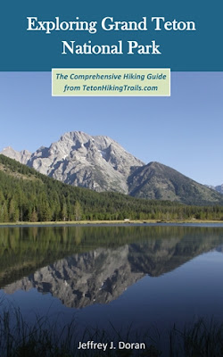
**********************************************************************************
Virtually no one went hiking before the 19th century. What occurred that inspired ordinary people to take a walk in the woods for pleasure?
Ramble On explores the rich history of hiking, and how it evolved into one of the most popular pastimes in the world:
[This book is also available in paperback]
As always, thank you very much!
Thursday, December 12, 2024
Five Great Reasons to Visit Rocky Mountain National Park
Encompassing more than 265,000 acres, and with more than sixty peaks topping out above 12,000 feet, Rocky Mountain National Park is home to some of the most spectacular scenery on Earth. From wooded forests to alpine tundra, these majestic mountains provide habitat to more than 60 species of mammals, while more than 280 species of birds visit or reside within the park. With more than 350 miles of trails meandering throughout the park, Rocky Mountain is also widely recognized as a hiker’s paradise. Here are five great reasons why you should visit Rocky Mountain:
The Continental Divide
One of the best things about Rocky Mountain National Park is its accessibility to the high country. No other park in the country allows visitors to gain lofty elevations so easily. Roughly one-third of the park is above tree-line, and more than 60 peaks top out above 12,000 feet, including 14,259-foot Longs Peak, the highest peak in the park. In addition to trails like the Flattop Mountain Trail or the route to Mt. Ida, visitors can drive over the Continental Divide along the highest continuous paved road in North America. With a maximum elevation of 12,183 feet, and more than eight miles traveling above 11,000 feet, Trail Ridge Road connects Estes Park with Grand Lake. The road also provides access to several outstanding tundra hikes, such as the Ute Trail, the Tundra Communities Trail and the Alpine Ridge Trail. Each of these are categorized as easy or moderate hikes, but don't forget to acclimate first!

Wildflowers
Wet springs can bring exceptional wildflower seasons to Rocky Mountain National Park. Even during normal years the park explodes with a variety of wildflowers. Some of the varieties visitors might enjoy include Alpine Clover, Rock Primrose, Western Wallflower, Sky Pilot and Alpine Sunflowers in the tundra areas of the park, as well as Mountain Iris, Lupine, Mariposa-lily and Colorado Columbines in the lower elevations. Some of best wildflower hikes include Big Meadows, Cascade Falls, Emerald Lake and the Lumpy Ridge Loop, among many others.

Longs Peak
At 14,259 feet, Longs Peak is the highest mountain in Rocky Mountain National Park. The iconic sentinel is seen from almost anywhere in the park, as well as from many locations around northern Colorado. It’s also one of most popular “fourteeners” for hikers and climbers to tackle in a state that boasts 53 peaks that rise above 14,000 feet. Although considered a mountaineering route, thousands of hikers attempt to summit the peak each summer using the famous Keyhole Route. Personally, I don’t want anything to do with the narrow ledges and steep cliffs along the upper portions of the route. I much prefer safer climbs such as Hallett Peak and the Chapin-Chiquita-Ypsilon Mountains to cure my big mountain summit fever.

Elk Rut
The annual elk rut is one of the premier attractions in Rocky Mountain National Park. Each fall elk descend from the high country to the lower elevation meadows during the annual breeding season. During the rut, bull elk compete with one another for the right to breed with herds of females. Mature bulls compete for cows by bugling, posturing, displaying their antlers and herding, while occasionally fighting off young challengers. The peak season for the rut generally lasts from mid-September to mid-October in Rocky Mountain National Park.

Fall Aspens
Just as the elk rut is kicking into high gear, another annual event that draws tourists to the park during the autumn are the brilliant fall colors of aspens. Each September the leaves of quacking aspens turn from green to orange and golden yellow throughout the park. Some of best hikes for viewing fall aspens include Bierstadt Lake, Alberta Falls, Cub Lake, Finch Lake, Adams Falls and Chasm Lake, among many others.

In addition to the hikes discussed above, Rocky Mountain National Park has many other outstanding hikes that take-in the best scenery the park has to offer. If you do plan to visit Rocky Mountain this year, please note that our hiking website also offers a wide variety of accommodation listings and other things to do to help with all your vacation planning.
*******************************************************************************
From Montana to New Mexico, the American Rockies stretch for more than a thousand miles. Within this spectacular mountain range are thousands of miles of hiking trails. With such an overwhelming number of options, how will you find and choose the most scenic and rewarding hikes?
Ultimate Hiking Guide to the Rocky Mountains takes all the guesswork out by focusing on some of the most amazing hikes across this range, and provides you with a handpicked list of options that will allow you to make the most of your trips in the Rockies:
The Continental Divide
One of the best things about Rocky Mountain National Park is its accessibility to the high country. No other park in the country allows visitors to gain lofty elevations so easily. Roughly one-third of the park is above tree-line, and more than 60 peaks top out above 12,000 feet, including 14,259-foot Longs Peak, the highest peak in the park. In addition to trails like the Flattop Mountain Trail or the route to Mt. Ida, visitors can drive over the Continental Divide along the highest continuous paved road in North America. With a maximum elevation of 12,183 feet, and more than eight miles traveling above 11,000 feet, Trail Ridge Road connects Estes Park with Grand Lake. The road also provides access to several outstanding tundra hikes, such as the Ute Trail, the Tundra Communities Trail and the Alpine Ridge Trail. Each of these are categorized as easy or moderate hikes, but don't forget to acclimate first!
Wildflowers
Wet springs can bring exceptional wildflower seasons to Rocky Mountain National Park. Even during normal years the park explodes with a variety of wildflowers. Some of the varieties visitors might enjoy include Alpine Clover, Rock Primrose, Western Wallflower, Sky Pilot and Alpine Sunflowers in the tundra areas of the park, as well as Mountain Iris, Lupine, Mariposa-lily and Colorado Columbines in the lower elevations. Some of best wildflower hikes include Big Meadows, Cascade Falls, Emerald Lake and the Lumpy Ridge Loop, among many others.
Longs Peak
At 14,259 feet, Longs Peak is the highest mountain in Rocky Mountain National Park. The iconic sentinel is seen from almost anywhere in the park, as well as from many locations around northern Colorado. It’s also one of most popular “fourteeners” for hikers and climbers to tackle in a state that boasts 53 peaks that rise above 14,000 feet. Although considered a mountaineering route, thousands of hikers attempt to summit the peak each summer using the famous Keyhole Route. Personally, I don’t want anything to do with the narrow ledges and steep cliffs along the upper portions of the route. I much prefer safer climbs such as Hallett Peak and the Chapin-Chiquita-Ypsilon Mountains to cure my big mountain summit fever.
Elk Rut
The annual elk rut is one of the premier attractions in Rocky Mountain National Park. Each fall elk descend from the high country to the lower elevation meadows during the annual breeding season. During the rut, bull elk compete with one another for the right to breed with herds of females. Mature bulls compete for cows by bugling, posturing, displaying their antlers and herding, while occasionally fighting off young challengers. The peak season for the rut generally lasts from mid-September to mid-October in Rocky Mountain National Park.
Fall Aspens
Just as the elk rut is kicking into high gear, another annual event that draws tourists to the park during the autumn are the brilliant fall colors of aspens. Each September the leaves of quacking aspens turn from green to orange and golden yellow throughout the park. Some of best hikes for viewing fall aspens include Bierstadt Lake, Alberta Falls, Cub Lake, Finch Lake, Adams Falls and Chasm Lake, among many others.
In addition to the hikes discussed above, Rocky Mountain National Park has many other outstanding hikes that take-in the best scenery the park has to offer. If you do plan to visit Rocky Mountain this year, please note that our hiking website also offers a wide variety of accommodation listings and other things to do to help with all your vacation planning.
*******************************************************************************
From Montana to New Mexico, the American Rockies stretch for more than a thousand miles. Within this spectacular mountain range are thousands of miles of hiking trails. With such an overwhelming number of options, how will you find and choose the most scenic and rewarding hikes?
Ultimate Hiking Guide to the Rocky Mountains takes all the guesswork out by focusing on some of the most amazing hikes across this range, and provides you with a handpicked list of options that will allow you to make the most of your trips in the Rockies:
Monday, December 9, 2024
NPS announces 2025 free entrance days
Are you ready to explore the breathtaking beauty of America's national parks? In 2025, the National Park Service (NPS) invites everyone, especially those who may not have considered a visit, to plan and prepare for their next national park trip early. Next year, the National Park Service will waive the entrance fee to national parks on six days —an opportunity to experience the wonders of nature, culture, and history without the cost of entry!
On designated days throughout the year, all visitors can enjoy free entrance to more than 400 national parks across the country. Whether you are a family looking for a weekend getaway, friends seeking a memorable outing, or even solo adventurers desiring to connect with nature, free entrance days make it easier for everyone to explore the parks.
The 2025 free entrance days are:
January 20 – Martin Luther King, Jr. Day
April 19 – First Day of National Park Week
June 19 – Juneteenth National Independence Day
August 4 – Great American Outdoors Act Signing Day
September 27 – National Public Lands Day
November 11 – Veterans Day
With over 400 national parks, monuments, and historic sites, there’s something for everyone. Visit NPS.gov/findapark to explore the park options nearest you.
Saturday, December 7, 2024
Rocky Mountain National Park Announces Plans for Either Pile Burning or a Prescribed Burn on Monday, December 9, 2024
Based upon the potential for favorable weather and fuels conditions early next week, fire managers at Rocky Mountain National Park are planning to burn either a 60-acre section of the Headquarters Prescribed Fire Unit or conduct a pile burning operation near Wild Basin which will be visible from Highway 7 beginning on Monday, December 9, 2024. Fire managers will be actively monitoring weather and fuels conditions between now and Monday morning to determine which fire operation will take place.
Last month, NPS fire staff worked with several partner agencies to burn 100 acres of the 334-acre Headquarters Prescribed Fire Unit. If conditions remain favorable, the 60 acres the park plans to burn next week make up the second section of this unit. Fire managers would burn in an area located inside Rocky Mountain National Park, west of the Beaver Meadows Visitor Center and south of U.S. Highway 36. Because of the fuel type that will be burned, which include mainly grasses and small shrubs, heavy and prolonged smoke is not expected from this operation.
If fire managers decide that conditions are more conducive for a pile burning operation, the park plans to burn up to 500 slash piles located inside Rocky Mountain National Park near the Wild Basin area in the southern part of the park. Slash from several fuels reduction and hazard tree removal projects have been cut and piled by park fire crews and contractors over the last two years. These piles are now dry enough to burn. Pile burning operations only occur when weather and conditions allow.
The primary goal of both of these burn operations is to reduce the threat of wildland fire to adjacent communities and to NPS infrastructure by reducing the amount of fuels available on the landscape. When fighting the East Troublesome Fire in 2020 and the Fern Lake Fire in 2012, firefighters were able to take advantage of previous and existing prescribed fire and hazardous fuels treatment areas that provided a buffer between the fires and the town of Estes Park. Prior hazard fuels projects were instrumental in stopping both fires from crossing Bear Lake and Trail Ridge Roads.
If conditions are favorable for a prescribed fire, ignitions are planned to occur on Monday, December 9. Firefighters will be on scene for the duration of either operation and will patrol throughout the day and overnight.
Fire operations near the Beaver Meadows Entrance to RMNP may cause delays or road closures. If closures take place, inbound and outbound traffic will be divered through Fall River Entrance. Motorists should watch for fire vehicles on the roads and allow extra time for entering and exiting the park. Additional information will be shared on InciWeb at https://inciweb.wildfire.gov/incident-information/cormp-front-country-prescribed-fire and on RMNP’s official social media channels. NPS staff will be available at Beaver Meadows Visitor Center to answer questions.
For the safety of visitors and firefighters, park visitors will not be allowed to stop along U.S. Highway 36 within the burn area. Visitors will also not be able to walk within the burn area.
Smoke from either burn operation may be visible both inside and outside the park. With cooler temperatures in the evening, smoke may linger and accumulate in low-lying areas. Every effort will be made to minimize smoke impacts on visitors and the adjacent community; however, some smoke is anticipated to disperse east of the park.
Thursday, December 5, 2024
Five Great Reasons to Visit Grand Teton National Park
Rising more than 7000 feet above Jackson Hole, the lofty peaks of Grand Teton National Park provide one of the most dramatic landscapes in the entire world. Although many people seem to treat it as an afterthought, only visiting the park as a side trip while visiting its more famous neighbor to the north, more time and focus should be given to this stunning landscape. Within its 310,000 acres the majestic mountains of the Teton Range are home to a wide variety of wildlife, eight peaks that top out above 12,000 feet, more than 100 alpine and backcountry lakes, and more than 240 miles of trails that provide intimate access to all of this incredibly beautiful scenery. The following are among some of the top reasons why you should pay a visit to this amazing park:
1) Cascade Canyon
The Cascade Canyon Trail is widely touted as one of the best hikes in the entire National Park System. In addition to the stunning views of 12,928-foot Mt. Owen, the trail visits Hidden Falls and Inspiration Point. The route is also known for the wide variety of wildlife that's frequently seen, especially bears and moose.

2) Lake Views
Lying along the eastern base of the Teton Range is a series of glacially-carved lakes. Rising sharply above their western shores, the views of the rugged mountains are stunning and dramatic. From the shores of Jackson, Leigh, Jenny, Phelps, Bradley and Taggart Lakes, hikers will enjoy some of the most striking views in the park, especially in the early morning

3) Wildlife
Although Yellowstone rightfully receives a lot of attention for its wildlife viewing opportunities, the Grand Tetons are also known for its diversity of wildlife. The rugged mountains provide habitat to a wide variety of wildlife, including black bears, grizzly bears, elk, bison, bighorn sheep, moose, pronghorn, wolves, fox, lynx, bobcats and mountain lions. There are also more than 300 species of birds, including trumpeter swans, ospreys and bald eagles. A drive along Moose-Wilson Road is a popular way of spotting mega fauna, such as bears and moose. However, hikes such as Amphitheater Lake, Hermitage Point, Moose Ponds and the Emma Matilda Lake Loop are all great choices if you're wishing to spot wildlife in the backcountry.

4) Photography
The abrupt rise of the Tetons from the valley floor arguably makes them one of the most photogenic mountain ranges in the world. As a result, professional and amateur photographers alike will enjoy a multitude of photo opportunities around the park. Some of the best spots for getting that perfect shot include Mormon Row, Oxbow Bend, Schwabacher’s Landing, as well as the Snake River Overlook, which was made famous by Ansel Adams' 1942 photograph. Of course all of the backcountry locations mentioned above will also provide outstanding photo opportunities.

5) Snake River Float Trip
The Snake River meanders along the sage brush flats below the Teton Range, and provides park visitors with the unique opportunity of enjoying the majestic mountain scenery from a raft. Although outfitters offer trips throughout the day, I highly recommend the morning trips, as the mountains typically look their finest when bathed in the glow of early morning sunshine. Morning also provides the best opportunity for spotting wildlife along the river banks, including bald eagles.

With more than 240 miles of trails meandering throughout the park, hiking is the absolute best way to see Grand Teton National Park. In addition to the hikes listed above, the park offers a variety of other outstanding hikes. If you do plan to visit Grand Teton this year, please note that our hiking website also offers a wide variety of accommodation listings as well as other things to do to help with all your vacation planning.
*******************************************************************************
Rising more than 7000 feet above Jackson Hole, the majestic mountains of Grand Teton National Park provide one of the most dramatic landscapes in the world. With more than 240 miles of trails meandering throughout this park, how will you find and choose the most scenic and rewarding hikes?
Exploring Grand Teton National Park takes all the guesswork out by focusing on the most amazing hikes, and provides you with handpicked recommendations that will allow you to make the most of your trip to Grand Teton:
1) Cascade Canyon
The Cascade Canyon Trail is widely touted as one of the best hikes in the entire National Park System. In addition to the stunning views of 12,928-foot Mt. Owen, the trail visits Hidden Falls and Inspiration Point. The route is also known for the wide variety of wildlife that's frequently seen, especially bears and moose.
2) Lake Views
Lying along the eastern base of the Teton Range is a series of glacially-carved lakes. Rising sharply above their western shores, the views of the rugged mountains are stunning and dramatic. From the shores of Jackson, Leigh, Jenny, Phelps, Bradley and Taggart Lakes, hikers will enjoy some of the most striking views in the park, especially in the early morning
3) Wildlife
Although Yellowstone rightfully receives a lot of attention for its wildlife viewing opportunities, the Grand Tetons are also known for its diversity of wildlife. The rugged mountains provide habitat to a wide variety of wildlife, including black bears, grizzly bears, elk, bison, bighorn sheep, moose, pronghorn, wolves, fox, lynx, bobcats and mountain lions. There are also more than 300 species of birds, including trumpeter swans, ospreys and bald eagles. A drive along Moose-Wilson Road is a popular way of spotting mega fauna, such as bears and moose. However, hikes such as Amphitheater Lake, Hermitage Point, Moose Ponds and the Emma Matilda Lake Loop are all great choices if you're wishing to spot wildlife in the backcountry.

4) Photography
The abrupt rise of the Tetons from the valley floor arguably makes them one of the most photogenic mountain ranges in the world. As a result, professional and amateur photographers alike will enjoy a multitude of photo opportunities around the park. Some of the best spots for getting that perfect shot include Mormon Row, Oxbow Bend, Schwabacher’s Landing, as well as the Snake River Overlook, which was made famous by Ansel Adams' 1942 photograph. Of course all of the backcountry locations mentioned above will also provide outstanding photo opportunities.
5) Snake River Float Trip
The Snake River meanders along the sage brush flats below the Teton Range, and provides park visitors with the unique opportunity of enjoying the majestic mountain scenery from a raft. Although outfitters offer trips throughout the day, I highly recommend the morning trips, as the mountains typically look their finest when bathed in the glow of early morning sunshine. Morning also provides the best opportunity for spotting wildlife along the river banks, including bald eagles.
With more than 240 miles of trails meandering throughout the park, hiking is the absolute best way to see Grand Teton National Park. In addition to the hikes listed above, the park offers a variety of other outstanding hikes. If you do plan to visit Grand Teton this year, please note that our hiking website also offers a wide variety of accommodation listings as well as other things to do to help with all your vacation planning.
*******************************************************************************
Rising more than 7000 feet above Jackson Hole, the majestic mountains of Grand Teton National Park provide one of the most dramatic landscapes in the world. With more than 240 miles of trails meandering throughout this park, how will you find and choose the most scenic and rewarding hikes?
Exploring Grand Teton National Park takes all the guesswork out by focusing on the most amazing hikes, and provides you with handpicked recommendations that will allow you to make the most of your trip to Grand Teton:
Wednesday, December 4, 2024
Vista Recreation increases campground and day-use fees for 2025 season on the Arapaho Roosevelt Pawnee
Acting Forest Supervisor Kevin Khung recently approved a fee increase for all concessionaire operated campgrounds and day-use areas on the Arapaho and Roosevelt National Forests and Pawnee National Grassland for the 2025 season.
“Concessionaires play a crucial part in helping us operate, maintain and improve our recreation sites,” Khung said. “Adjusting fees allows the concessionaire to deliver a quality recreation experience at the level and quality visitors on the Front Range have come to expect."
Vista Recreation requested the fee change to offset the rising cost of labor, contract work, services and supplies. The fee increase was supported by documentation, which showed the impacts of new federal minimum wage requirements for concessionaires and rising costs of goods and services. Special use permits allow concessionaires to request fee adjustments to charge prices that are comparable to competing businesses.
Fees will increase by 14% on average and will remain the same through 2026. For instance, single family campsites at Echo Lake Campground will increase from $23 to $26 per night, a 13% increase. Since 2019, concessionaire fees have been raised once.
Reservations that were made through recreation.gov before the price change will be honored. Senior and Access passes will continue to be accepted at campgrounds providing a 50 percent discount to holders. Vista Recreation will also honor all interagency passes, including Annual, Senior, Access, Military and Volunteer passes at day-use sites across the Forests and Grassland.
Vista Recreation operates 59 campgrounds and 31 day-use areas for the Arapaho, Roosevelt and Pawnee. The Forest Service has been operating campgrounds and day-use areas through concessionaires in this area since the mid-1990s. Concessionaires perform onsite operations and maintenance, returning a portion of their proceeds to the Forests and Grassland that are reinvested in improvements at recreation sites.
The 2025 campground fee and amenity list can be found at www.fs.usda.gov/goto/arp/campinglist. To make a camping reservation, visit Recreation.gov.
Sunday, December 1, 2024
Missing Hiker Found Alive After Surviving 50 Days in Canadian Wilderness
On Tuesday, November 26, at 11:30 am, Northern Rockies RCMP were notified that Sam Benastick, who was reported missing on October 19, 2024 had been located.
Two people were headed to the Redfern Lake trail for work, where they saw a man walking toward them. When they approached the man, they recognized him as Sam Benastick.
The two men took Sam to the hospital where police attended and confirmed the man to be the man reported missing.
Benastick told police that he stayed in his car for a couple of days and then walked to a creek, mountain side where he camped out for 10-15 days. Then moved down the valley, and built a camp and shelter in a dried-out creek bed. He then made his way to the location where he flagged down the two men and was taken to safety.
The CBC reported that Benastick was suffering from "frostbite and some smoke inhalation." A SAR volunteer from Prince George described the situation as being "incredibly challenging winter conditions." The area received more than 6 inches of snow, and temperatures had dipped below -4 degrees Fahrenheit.
Finding Sam alive is the absolute best outcome. After all the time he was missing, it was feared that this was would not be the outcome said Cpl Madonna Saunderson, BC RCMP Communications.
The RCMP thanked the Fort Nelson and North Peace and Search and Rescue teams including other Search and Rescue jurisdictions that provided mutual aid support, the Canadian Rangers along with many local volunteers with extensive back country knowledge of the area.
There are a few more details about the story in this CBC News report, though it's obvious many are still to be told:
*******************************************************************************
From Montana to New Mexico, the American Rockies stretch for more than a thousand miles. Within this spectacular mountain range are thousands of miles of hiking trails. With such an overwhelming number of options, how will you find and choose the most scenic and rewarding hikes?
Ultimate Hiking Guide to the Rocky Mountains takes all the guesswork out by focusing on some of the most amazing hikes across this range, and provides you with a handpicked list of options that will allow you to make the most of your trips in the Rockies:
Friday, November 29, 2024
Daines' bill seeks reauthorization of fund to address NPS maintenance backlog
U.S. Senators Steve Daines and Angus King (I-Maine), along with Senators Kevin Cramer (R-N.D.) and Mark Warner (D-Va.), have recently introduced the “America the Beautiful Act.” The bill would reauthorize the National Parks and Public Land Legacy Restoration Fund (LRF) and increase funding for public land management.
“People travel from every corner of the world to connect with America’s incredible natural beauty and to make memories that last a lifetime,” said King. “However, deferred repairs on aging infrastructure like roads and trails can become unsafe for visitors and diminish the quality of our public lands and National Parks. The bipartisan America the Beautiful Act protects our lands and the visitor experience — by addressing maintenance backlogs and reauthorizing the historic Legacy Restoration Fund. This legislation is an important step forward in establishing lasting protections for our public lands, and serves as a proud reminder that stewardship is not a partisan issue.”
“The Great American Outdoors Act brought real results to North Dakota’s outdoor recreation opportunities,” said Cramer. “Visitors to Theodore Roosevelt National Park will be able to travel the South Loop road, which washed out several years ago, and recreationists can enjoy the updated trails and campsites in the nearby grasslands. Let’s keep this momentum going by passing the America the Beautiful Act, so we maintain our national treasures.”
Background:
Senator Daines introduced the “The Great American Outdoors Act,” in the 116th Congress which was signed into law by President Trump in 2020 and authorized the LRF for five years to address the maintenance backlog on public lands and national parks. The “America the Beautiful Act” reauthorizes and strengthens the LRF for 8 years (through 2033) and also does the following:
* Increases funding from $1.9 billion to $2 billion per year
* Prioritizes projects that have a 15 percent match from stakeholders
* Requires agencies to have a two-year running list of projects
* Allows the agencies to move forward with next year’s projects under a Continuing Resolution
* Ensures that all lands administered by the Fish and Wildlife Service are eligible
* Bolsters the ability for public donations to the fund by requiring agencies to run public awareness campaigns and make known the ability to donate
* Requires the agencies to assess and dispose of unneeded constructed assets
* Requires additional reporting to Congress on actions taken by the agency to reduce their Deferred Maintenance backlogs.
* Read the text of the bill HERE.
The National Park Foundation, National Parks Conservation Association (NPCA), Montana Outfitters and Guides Association, Friends of Acadia, Boone and Crockett, and the Congressional Sportsmen’s Foundation are among many groups supporting the legislation.
Wednesday, November 27, 2024
Fee increases approved for Black Canyon and Curecanti
The National Park Service (NPS) proposed this summer to charge fees for wilderness permits on the South Rim of Black Canyon of the Gunnison National Park and increase group campsite fees for Curecanti National Recreation Area. Park managers sought public comment on the fee changes in July. Comments were reviewed and the fee increase was approved in November. The proposed fee changes will take effect in January 2025.
NPS fee staff completed a fee compatibility study for wilderness permits and group campsites. The study demonstrated that comparable wilderness permit costs vary widely but are typically uniformly higher than current Black Canyon permits. Additionally, significant price increases have occurred at most comparable group campgrounds in recent years. The proposed fees would bring both parks into closer alignment with comparable wilderness permits and group campgrounds.
Black Canyon of the Gunnison National Park changes: A permit is required for wilderness use at the park. All day and overnight use of Black Canyon’s South Rim wilderness routes, (Warner, Gunnison, and Tomichi) will be available for reservation on www.recreation.gov beginning in April 2025 for trips between May and October. Daily hiking quotas exist for each route. Red Rock Canyon is already on the reservation system. The wilderness permit fee will be $6 plus an additional $4 per person per permit. To minimize resource impacts and maintain wilderness character, wilderness use permits will be issued for no more than three nights and for a maximum group size of up to four people.
Wilderness permits will be available online only through www.recreation.gov for trips between May and October (not in-person at the Black Canyon Visitor Center). Advanced planning is needed. All permit holders will still be responsible for paying the park entrance fee. Permits for hiking wilderness routes off of the South Rim and at Red Rock Canyon from November through April will be available first-come, first-serve at the visitor center when open or by self-registration outside of visitor center when it is closed (no fee); same daily quotas apply.
Curecanti National Recreation Area changes: The Curecanti group campsite at East Elk Creek, which accommodates between 9 and 50 individuals, will have a nightly fee of $120. The smaller group campsite at Red Creek, which accommodates between 9 and 20 people, will have a nightly fee of $60.
The 2004 Federal Lands Recreation Enhancement Act (FLREA) authorizes the National Park Service to charge fees for recreation amenities at national parks. The law requires that recreational fees are appropriate to the benefits and services provided, and comparable to fees charged by others in the local area for similar benefits and services. Eighty percent (80%) of the fees collected at Black Canyon and Curecanti will remain at the parks to fund projects such as the rehabilitation of trails, upgrades to campgrounds, and improvements to water, sewer, and solid waste systems. The remaining twenty percent (20%) will be utilized agency wide.
Monday, November 25, 2024
How to help the victims of Hurricane Helene during Christmas
Before jumping into the main point of my post, I'm writing this because it feels like the media has forgotten the victims of Hurricane Helene, especially those who live in North Carolina. The situation on the ground is far worse than you probably think. I don't know the numbers, but there are still many people living in tents, and winter is already moving into the mountains. If you're not aware of how bad things are, I would encourage you to do a little snooping on social media, and listen to the testimony of those who have been impacted.
Last week I ran into a Twitter post that provided a great idea for helping the victims of Hurricane Helene during the upcoming Christmas season. That is; by doing as much of your online Christmas shopping as possible by purchasing from small businesses in hurricane-ravaged areas. This post picks-up on that theme by focusing on businesses in areas that felt the greatest impact during the late-September storm, namely Western North Carolina. In particular, I focused on businesses that I thought hikers and outdoor enthusiasts would be most interested in. I also provided links to lists of currently open businesses so that you can find gifts from a broader universe of stores. Many of these businesses have sustained damage or have completely lost their physical store fronts, but were able to maintain their online stores. Businesses that managed to escape damage have also been greatly impacted, as tourism to the region has been shaprly curtailed. As a result, many of these business owners are in dire straight right now. All of them, I asure you, would greatly appreciate your business!
In addition to the links below, you should note that many lodging, attractions, wineries and restaurants are currently open. They desperately could use your business as well. Not just for the owners, but their employees as well. Moreover, any money spent at any business in the area helps to circulate much needed cash thoughout the community.
The Twitter posts that I saw are using these hashtags to get the word out, if you wish to help in that way: #ShopWNC / #ShopAsheville / #ShopHurricaneHelene
Each of the local businesses listed below I believe are open for online shopping:
Hiking, outdoor gear shops and local manufacturers
Mast General Store is a local institution originally out of Asheville: https://www.mastgeneralstore.com/
Regear Outdoors: https://regearnc.com/
Though the store was closed as of 10/18, Headwaters Outfitters stated in a newspaper article "In the meantime, you can shop the outdoor shop’s online store (send a note saying “Ship when the time is right”, Headwater recommends) or purchase a gift card for a future trip." https://shopheadwatersoutdoors.com/
Diamond Brand Gear: https://www.diamondbrandgear.com/
Eagles Nest Outfitters: https://eaglesnestoutfittersinc.com/
Astral Designs: https://astraldesigns.com/
This is Jen Pharr Davis's business - a legendary hiker. She has an online store, but she's also currently offering guided hikes: https://blueridgehikingco.com/
This Marshall, NC bike shop was completely devastated, but they're still selling a few cycling related items: https://www.oyb-nc.com/merch
Goodies and Gifts
What hikers don't like a little something sweet after a long hike? Many offerings here, all would also make great gift items:
French Broad Chocolate: https://www.frenchbroadchocolates.com/
The Chocolate Fetish: https://www.chocolatefetish.com/
The Dillsboro Chocolate Factory: https://www.dillsborochocolate.com/
Cold Mountain Toffee: https://www.coldmountaintoffee.com/
Ashe County Cheese: https://www.ashecountycheese.com/
Poppy Handcrafted Popcorn: https://poppyhandcraftedpopcorn.com/
Breweries
And seriously, what hikers don't like beer?!? If you're in their distribution region, check out the beers from these WNC breweries next time you're in a grocery store, liquor store, bar or restaurant. You can also support them by purchasing merchandise and gift cards from their online stores. There are dozens of breweries in the impacted region, many completely wiped out, however, these were the few that I could confirm that have regional distribution of their beers. There are likely many more, especially for those who live in North Carolina:
Highland Brewing is one of the finest craft breweries around, IMHO. Normally, I'm not a fan of winter ales or spiced beers, but their Cold Mountain is outstanding if you're looking for something for the holiday spirit! https://highlandbrewing.com/hurricane-helene-response/
Catawba Brewing Company: https://www.catawbabrewing.com/
Hi-Wire Brewing: https://hiwirebrewing.com/
Appalachian Mountain Brewing: https://www.amb.beer/
Weekend Getaways
Southern Living published an article last week that lays out 13 towns in the hurricane's path that are currently welcoming guests. The article includes information on things to do in each area.
Yes!! There are still a lot of trails open in WNC. All of the trails on the TN side of the Great Smoky Mountains are open as well.
The Nantahala Outdoor Center is currently offering fully guided trips, rentals, zip lines, and aerials. Their Outfitter’s Store, Lodging, and the Rivers End Restaurant are open for business as well. https://noc.com/noc-operations-updates/
The world-famous Biltmore in Asheville has also reopened: https://www.biltmore.com/things-to-do/events/christmas/
Tuckaseegee Fly Shop: https://www.tuckflyshop.com/
There are many other businesses open in the area. You can check on the following websites in some of the hardest hit areas to see what's open. Any and all of them would greatly appreciate your business!
General info:
https://www.exploreasheville.com/article/heres-what-reopened-asheville-buncombe-county-post-hurricane-helene
https://www.charlotteobserver.com/charlottefive/c5-around-town/c5-development/article293591474.html
Marshall & Hot Springs:
https://madisoncounty-nc.com/business-directory/
https://www.shopwnc.com/business-listings/hot-springs
https://www.shopwnc.com/business-listings/marshall
Swannanoa, Maggie Valley and Waynesville:
https://www.shopwnc.com/business-listings/maggie-valley
https://www.shopwnc.com/business-listings/waynesville
https://visithaywood.com/blog/haywood-county-business-updates-closures-post-hurricane-helene/
Chimney Rock & Lake Lure:
https://www.shopwnc.com/business-listings/lake-lure
Erwin, TN:
https://realwildunicoicounty.com/downtown/
https://unicoicounty.org/directory/
Other ways to help:
Samaritan's Purse - is still on the ground and doing wonderful work: https://www.samaritanspurse.org/article/pray-for-those-in-helenes-path/
Checkout the "Together We Rise T-Shirt" Proceeds go towards supporting Hurricane Helene relief: https://fuelgoods.com/products/together-we-rise-t-shirt-supporting-hurricane-helene-relief
DeFeet's Aireator 6" MTN Strong cycling socks. Proceeds also go towards supporting Hurricane Helene relief: https://defeet.com/products/aireator-6-mtn-strong
There are many other organizations on the ground that are doing great work. Before donating, however, I would highly encourage you to do a little homework first to make sure that as much of your donation is going towards the mission as possible, and not feeding a bloated bureaucracy. Unfortunately, there are many "charities" out there who are paying enourmous salaries to their boards of directors and management teams.
************************************************************************************
Check out our online trail guides:
- Glacier National Park: HikinginGlacier.com
- Grand Teton National Park: TetonHikingTrails.com
- Rocky Mountain National Park: RockyMountainHikingTrails.com
Sunday, November 24, 2024
CPW to use low-flying helicopters to assess deer, elk, bighorn sheep and moose in southeast Colorado
Beginning Dec. 2, Colorado Parks and Wildlife biologists will be conducting low-altitude helicopter flights to assess big game herds across the Southeast Region from Leadville to Trinidad and east of Interstate 25.
Flights to be conducted west of I-25 will involve both surveys of herds and some capture work. Those flights will occur in South Park, the Upper Arkansas River Valley, the Pikes Peak Region, the Sangre de Cristo mountains, the Wet Mountain Valley and Fishers Peak State Park in Trinidad.
On flights from Leadville to Cañon City, biologists will capture mule deer does and fawns to place radio-transmitting collars on them as part of a 26-year survival monitoring study.
Flights in the South Park area will include capturing elk as part of a study of elk survival and movement.
For the herd survey work, Southeast Region residents can expect to see helicopters that spend a short amount of time in a specific area and then move on as they search for herds. They will only hover long enough for wildlife biologists to count, determine sex of the animals and assess overall health. The flights provide important information to inform CPW wildlife biologists about individual herds.
“The helicopters will spend a brief amount of time in a specific area to count and categorize individual herds and then move on,” said Julie Stiver, senior wildlife biologist for CPW’s Southeast Region, based in Colorado Springs. “Each year, CPW biologists inventory tens of thousands of animals statewide to develop a picture of the productivity and composition of big game in Colorado. The data is critical to our work of forming population models, management strategies and to set future hunting license numbers.”
On the southeastern plains, helicopter surveys will be conducted in Kit Carson and Cheyenne counties followed by surveys in Kiowa, Prowers and Baca counties. CPW will be studying deer, elk, bighorn sheep and moose
CPW biologists also will fly along the Arkansas River and associated drainages from Pueblo to the Kansas state line. The biologists also will survey along the South Republican River drainage from Flagler to the Kansas state line.
Thursday, November 21, 2024
Seven Great Reasons to Visit Glacier National Park
Fully realizing this may sound a little over-the-top, but every person living in this country should visit Glacier National Park at least once in their life. It will forever change them. John Muir once said of Glacier:
Unparalleled Beauty
In my humble opinion, Glacier National Park is by far the most beautiful park I’ve ever been to. This includes almost every major national park in the lower 48. As a disclaimer, I should note that I haven’t had a chance to explore the interior of Alaska….yet. Having said that, my love affair with this park began immediately the first time I laid eyes on it. To be precise, it was during the drive from Browning along Highway 2 as we approached the East Glacier/Two Medicine area. My love and awe for the park has grown after each subsequent visit. At every turn on any road or trail is one spectacular scene after another. In fact, there are no bad or boring hikes. Photographers could spend a lifetime here taking photos of scenes that normally show up in Backpacker Magazine or National Geographic. One of the most famous photo locations in the entire National Park System is at a spot known as Wild Goose Island Overlook. You may recognize the scene in theis photo:

Glaciers
Most people assume that Glacier received its name as a result of the 25 glaciers located within the park. However, the park was actually given its name due to the rugged mountains that were carved by massive glaciers during the most recent ice ages. Fortunately for hikers, a few of these can be reached by trail. Some of the most popular hikes for enjoying front row views of glaciers include Iceberg Lake and Grinnell Glacier.

The Highline Trail
The Highline Trail from Logan Pass is widely recognized as one of the best hikes in the park, if not the entire National Park System. At every step, and every turn, hikers will enjoy spectacular scenery as they traverse along the Continental Divide. The exceptionally beautiful views, the excellent opportunities for spotting wildlife, and the wildflowers all combine to make this a hike you'll remember the rest of your life. If you can make it past the narrow ledge section near the trailhead you’ll have the option of traveling to Haystack Pass, Granite Park Chalet, or making the one-way hike to “The Loop”. You'll also have the option of taking the steep spur trail up to Grinnell Glacier Overlook.

The Going-to-the-Sun Road
The famous Going-to-the-Sun Road is the only road to cross Glacier National Park from east to west. The epic route transports visitors through some of the most spectacular scenery the park has to offer. This engineering marvel spans more than 50 miles across the park's interior, takes passengers over the Continental Divide at Logan Pass, and treats visitors to some of the grandest sights in the Rocky Mountains. Along its course the road passes glacial lakes and cedar forests in the lower valleys, as well as windswept alpine meadows and sweeping mountain vistas atop the 6646-foot pass.
Several scenic viewpoints and pullouts along the way provide motorists with ample opportunities to stop for extended views and photographs. Once at Logan Pass be sure to visit Hidden Lake Overlook, a relatively easy hike that takes hikers across the Continental Divide just above the Logan Pass Visitor Center.
Some drivers (and passengers) might be a little intimidated by the Going-to-the-Sun Road. Portions of it hug the mountainside as it traverses over steep drop-offs and steers through tight curves. If this gives you any pause, you may want to consider letting the drivers of the iconic Red "jammer" Buses take you across the mountains.

Wildlife
Outside of Yellowstone, Glacier National Park is arguably the best park for spotting and viewing wildlife. Although wildlife are frequently spotted along the road, a venture into the wilderness is likely to bring better results. Trails such as Iceberg Lake, Ptarmigan Tunnel, Grinnell Glacier and Swiftcurrent Pass are excellent choices if you wish to see a grizzly or black bear. Bullhead Lake, the Swiftcurrent Nature Trail, Dawson Pass and Cobalt Lake are all great choices for spotting moose. For bighorn sheep, check out Grinnell Glacier, Dawson Pass or the Highline Trail. For the best opportunities to possibly spot a mountain goat, check out Hidden Lake Overlook, the Highline Trail or Piegan Pass.

History, Culture and Ambiance
The Glacier experience is unlike any other national park. This is due in large part to its living history. Park visitors can still enjoy the magnificent grand lodges, backcountry chalets and trails that were built by the Great Northern Railway shortly after the turn of the 20th century. You can also relax and take in the sights in one of the historic boats that still ply the waters of Glacier's lakes. Another tradition from Glacier's bygone era are its famous Red Busses, which have been used as transportation since 1914. Visitors can take a step back in time by touring the park in one of these vehicles, each of which were built between 1936 and 1939. For unparalleled ambiance, there's absolutely nothing better than sipping a huckleberry beer on the back porch of the Many Glacier Hotel and soaking-in the profound beauty of Swiftcurrent Lake and the mountains that surround it. In many respects, and with maybe a little imaginaton, visitors can still enjoy a similar experience park visitors had in the past.
Backcountry Chalets
2024 marked the 110th anniversary of the Sperry and Granite Park Chalets. Both backcountry chalets were built in 1914 during a period when the Great Northern Railway was promoting Glacier National Park under the "See America First" campaign. Today the two backcountry chalets offer hikers the opportunity to trek to an overnight backcountry destination without being bogged down with a bunch of camping gear.
Perched at an elevation of more than 6500 feet, the Sperry Chalet sits high atop a rock ledge that offers visitors commanding views of majestic mountain peaks, waterfalls, as well as Lake McDonald in the valley far below. The Granite Park Chalet rests just below Swiftcurrent Pass, along the edge of a sub-alpine meadow that offers commanding views of Heavens Peak and the McDonald Valley. Day hikers and overnight guests commonly reach this chalet by one of three trails: the Highline Trail, the Granite Park Trail or the Swiftcurrent Pass Trail out of Many Glacier. Day hikers may want to note that Sperry Chalet also sells hot lunches.

With more than 740 miles of trails meandering throughout the park, hiking is the absolute best way to see Glacier National Park. In addition to the hikes listed above, the park offers a variety of other outstanding hikes. If you do plan to visit Glacier this year, please note that our hiking website also offers a wide variety of accommodation listings as well as other things to do to help with all your vacation planning.
*******************************************************************************
Glacier National Park preserves more than a million acres of some of the most spectacular scenery on Earth. With more than 740 miles of trails meandering throughout this vast park, how will you find and choose the most scenic and rewarding hikes?
Exploring Glacier National Park takes all the guesswork out by focusing on the most amazing hikes, and provides you with handpicked recommendations that will allow you to make the most of your trip to Glacier:
"Give a month at least to this precious reserve. The time will not be taken from the sum of your life. Instead of shortening, it will indefinitely lengthen it and make you truly immortal. Nevermore will time seem short or long, and cares will never again fall heavily on you, but gently and kindly as gifts from heaven."I know I can’t, but I'm pretty sure there aren’t too many people that can sum-up the Glacier experience better than Muir. Here are just a few of the reasons why I think Glacier is so special:
Unparalleled Beauty
In my humble opinion, Glacier National Park is by far the most beautiful park I’ve ever been to. This includes almost every major national park in the lower 48. As a disclaimer, I should note that I haven’t had a chance to explore the interior of Alaska….yet. Having said that, my love affair with this park began immediately the first time I laid eyes on it. To be precise, it was during the drive from Browning along Highway 2 as we approached the East Glacier/Two Medicine area. My love and awe for the park has grown after each subsequent visit. At every turn on any road or trail is one spectacular scene after another. In fact, there are no bad or boring hikes. Photographers could spend a lifetime here taking photos of scenes that normally show up in Backpacker Magazine or National Geographic. One of the most famous photo locations in the entire National Park System is at a spot known as Wild Goose Island Overlook. You may recognize the scene in theis photo:

Glaciers
Most people assume that Glacier received its name as a result of the 25 glaciers located within the park. However, the park was actually given its name due to the rugged mountains that were carved by massive glaciers during the most recent ice ages. Fortunately for hikers, a few of these can be reached by trail. Some of the most popular hikes for enjoying front row views of glaciers include Iceberg Lake and Grinnell Glacier.
The Highline Trail
The Highline Trail from Logan Pass is widely recognized as one of the best hikes in the park, if not the entire National Park System. At every step, and every turn, hikers will enjoy spectacular scenery as they traverse along the Continental Divide. The exceptionally beautiful views, the excellent opportunities for spotting wildlife, and the wildflowers all combine to make this a hike you'll remember the rest of your life. If you can make it past the narrow ledge section near the trailhead you’ll have the option of traveling to Haystack Pass, Granite Park Chalet, or making the one-way hike to “The Loop”. You'll also have the option of taking the steep spur trail up to Grinnell Glacier Overlook.
The Going-to-the-Sun Road
The famous Going-to-the-Sun Road is the only road to cross Glacier National Park from east to west. The epic route transports visitors through some of the most spectacular scenery the park has to offer. This engineering marvel spans more than 50 miles across the park's interior, takes passengers over the Continental Divide at Logan Pass, and treats visitors to some of the grandest sights in the Rocky Mountains. Along its course the road passes glacial lakes and cedar forests in the lower valleys, as well as windswept alpine meadows and sweeping mountain vistas atop the 6646-foot pass.
Several scenic viewpoints and pullouts along the way provide motorists with ample opportunities to stop for extended views and photographs. Once at Logan Pass be sure to visit Hidden Lake Overlook, a relatively easy hike that takes hikers across the Continental Divide just above the Logan Pass Visitor Center.
Some drivers (and passengers) might be a little intimidated by the Going-to-the-Sun Road. Portions of it hug the mountainside as it traverses over steep drop-offs and steers through tight curves. If this gives you any pause, you may want to consider letting the drivers of the iconic Red "jammer" Buses take you across the mountains.
Wildlife
Outside of Yellowstone, Glacier National Park is arguably the best park for spotting and viewing wildlife. Although wildlife are frequently spotted along the road, a venture into the wilderness is likely to bring better results. Trails such as Iceberg Lake, Ptarmigan Tunnel, Grinnell Glacier and Swiftcurrent Pass are excellent choices if you wish to see a grizzly or black bear. Bullhead Lake, the Swiftcurrent Nature Trail, Dawson Pass and Cobalt Lake are all great choices for spotting moose. For bighorn sheep, check out Grinnell Glacier, Dawson Pass or the Highline Trail. For the best opportunities to possibly spot a mountain goat, check out Hidden Lake Overlook, the Highline Trail or Piegan Pass.

History, Culture and Ambiance
The Glacier experience is unlike any other national park. This is due in large part to its living history. Park visitors can still enjoy the magnificent grand lodges, backcountry chalets and trails that were built by the Great Northern Railway shortly after the turn of the 20th century. You can also relax and take in the sights in one of the historic boats that still ply the waters of Glacier's lakes. Another tradition from Glacier's bygone era are its famous Red Busses, which have been used as transportation since 1914. Visitors can take a step back in time by touring the park in one of these vehicles, each of which were built between 1936 and 1939. For unparalleled ambiance, there's absolutely nothing better than sipping a huckleberry beer on the back porch of the Many Glacier Hotel and soaking-in the profound beauty of Swiftcurrent Lake and the mountains that surround it. In many respects, and with maybe a little imaginaton, visitors can still enjoy a similar experience park visitors had in the past.
Backcountry Chalets
2024 marked the 110th anniversary of the Sperry and Granite Park Chalets. Both backcountry chalets were built in 1914 during a period when the Great Northern Railway was promoting Glacier National Park under the "See America First" campaign. Today the two backcountry chalets offer hikers the opportunity to trek to an overnight backcountry destination without being bogged down with a bunch of camping gear.
Perched at an elevation of more than 6500 feet, the Sperry Chalet sits high atop a rock ledge that offers visitors commanding views of majestic mountain peaks, waterfalls, as well as Lake McDonald in the valley far below. The Granite Park Chalet rests just below Swiftcurrent Pass, along the edge of a sub-alpine meadow that offers commanding views of Heavens Peak and the McDonald Valley. Day hikers and overnight guests commonly reach this chalet by one of three trails: the Highline Trail, the Granite Park Trail or the Swiftcurrent Pass Trail out of Many Glacier. Day hikers may want to note that Sperry Chalet also sells hot lunches.

With more than 740 miles of trails meandering throughout the park, hiking is the absolute best way to see Glacier National Park. In addition to the hikes listed above, the park offers a variety of other outstanding hikes. If you do plan to visit Glacier this year, please note that our hiking website also offers a wide variety of accommodation listings as well as other things to do to help with all your vacation planning.
*******************************************************************************
Glacier National Park preserves more than a million acres of some of the most spectacular scenery on Earth. With more than 740 miles of trails meandering throughout this vast park, how will you find and choose the most scenic and rewarding hikes?
Exploring Glacier National Park takes all the guesswork out by focusing on the most amazing hikes, and provides you with handpicked recommendations that will allow you to make the most of your trip to Glacier:
Sunday, November 17, 2024
Etymology: Hiking
There are many terms that have been used to describe the sport of hiking. Walking, strolling, wandering, sauntering, tramping, ambling, roaming, rambling, traipsing, marching, bushwalking, trekking and backpacking have all been used to describe the act of walking in the woods (or any wilderness area) for pleasure. Perhaps the first term to describe the act of taking a leisurely walk in nature was “rambling”. The word originally meant to wander, or roam aimlessly, but eventually came to describe hiking. The expression was widely used in England through the 19th Century. It was also used in America for a time, though much less frequently. While rambling is still sometimes used in the United Kingdom, it’s now looked at as being an old fashion word. Walking, hillwalking, fellwalking and even hiking are more commonly used now. Fellwalking, a word used to describe hiking in the mountains, comes from the English word fell or fjall, which is an old Norse term that means mountain.
Words used to describe hiking have evolved over time, and differ according to region. For example, in Australia, bushwalking is the preferred term for hiking. Trekking is a term used to describe multi-day hiking in many mountainous regions around the world. However, in North America, backpacking is the preferred term. In Europe, however, backpacking refers to a form of budget travel where travelers normally stay in hostels.

In Victorian England, during the mid-1800s, wandering vagrants were derogatively known as tramps, a word that would eventually refer to hikers, and now used by New Zealanders to describe backpacking. Tramping was also used by some in America in the late 1800s and early 1900s, including John Muir. Both Henry David Thoreau and John Muir also used the term saunter.
Webster's Dictionary indicates that the first use of the word "hike" occurred around 1809; however, it had a different meaning at that time. It was originally meant "to move, pull or raise with a sudden motion." The dictionary implies that it wasn't until 1865 before the word was adopted to mean "a long walk esp, for pleasure or exercise." Etymonline.com claims the word hike comes from the English term, hyke, which meant "to walk vigorously." It also states that the first use of "hyke" appeared in 1809. Additionally, the site quotes a definition of the term from the 1830 version of the Vocabulary of East Anglia: "to go away. It is generally used in a contemptuous sense Ex. 'Come, hike,' i.e. take yourself off; begone."
It appears that the use of the words "hike" and "hiking" as we know them today didn't become widespread until at least the early 20th Century. Up to that point most clubs used the word "mountain" or "alpine" in their name. It wasn't until the Wanderlusters Hiking Club out of Washington DC formed in 1910 that the word "hiking" was used in a club name. One of the earliest uses of the term “hiking boots” appeared in the December 1914 issue of Mazama, the journal of The Mazamas mountaineering club out of Oregon. In his book, The Mountain Trail and Its Message, published in 1911, Albert Palmer relayed this discussion with John Muir:
In addition to getting out on the trail, what better way is there to celebrate National Hiking Day than by learning about the rich history of hiking? Just think, after reading Ramble On: How Hiking Became One of the Most Popular Outdoor Activities in the World you could be the smartest person on the trail next summer!!
Words used to describe hiking have evolved over time, and differ according to region. For example, in Australia, bushwalking is the preferred term for hiking. Trekking is a term used to describe multi-day hiking in many mountainous regions around the world. However, in North America, backpacking is the preferred term. In Europe, however, backpacking refers to a form of budget travel where travelers normally stay in hostels.

In Victorian England, during the mid-1800s, wandering vagrants were derogatively known as tramps, a word that would eventually refer to hikers, and now used by New Zealanders to describe backpacking. Tramping was also used by some in America in the late 1800s and early 1900s, including John Muir. Both Henry David Thoreau and John Muir also used the term saunter.
Webster's Dictionary indicates that the first use of the word "hike" occurred around 1809; however, it had a different meaning at that time. It was originally meant "to move, pull or raise with a sudden motion." The dictionary implies that it wasn't until 1865 before the word was adopted to mean "a long walk esp, for pleasure or exercise." Etymonline.com claims the word hike comes from the English term, hyke, which meant "to walk vigorously." It also states that the first use of "hyke" appeared in 1809. Additionally, the site quotes a definition of the term from the 1830 version of the Vocabulary of East Anglia: "to go away. It is generally used in a contemptuous sense Ex. 'Come, hike,' i.e. take yourself off; begone."
It appears that the use of the words "hike" and "hiking" as we know them today didn't become widespread until at least the early 20th Century. Up to that point most clubs used the word "mountain" or "alpine" in their name. It wasn't until the Wanderlusters Hiking Club out of Washington DC formed in 1910 that the word "hiking" was used in a club name. One of the earliest uses of the term “hiking boots” appeared in the December 1914 issue of Mazama, the journal of The Mazamas mountaineering club out of Oregon. In his book, The Mountain Trail and Its Message, published in 1911, Albert Palmer relayed this discussion with John Muir:
"One day as I was resting in the shade Mr. Muir overtook me on the trail and began to chat in that friendly way in which he delights to talk with everyone he meets. I said to him: "Mr. Muir, someone told me you did not approve of the word 'hike.' Is that so?" His blue eyes flashed, and with his Scotch accent he replied: "I don't like either the word or the thing. People ought to saunter in the mountains - not hike!"Perhaps we have a definition of what it actually meant to "hike" at that time. In that same book, Albert said:
"There are always some people in the mountains who are known as "hikers." They rush over the trail at high speed and take great delight in being the first to reach camp and in covering the greatest number of miles in the least possible time. they measure the trail in terms of speed and distance."Over the years the terms that Thoreau and Muir preferred are really no longer in use. Nearly everyone in North America now uses hiking. If past is prologue, however, perhaps that may change some day down the road (path).
In addition to getting out on the trail, what better way is there to celebrate National Hiking Day than by learning about the rich history of hiking? Just think, after reading Ramble On: How Hiking Became One of the Most Popular Outdoor Activities in the World you could be the smartest person on the trail next summer!!